MyTopo
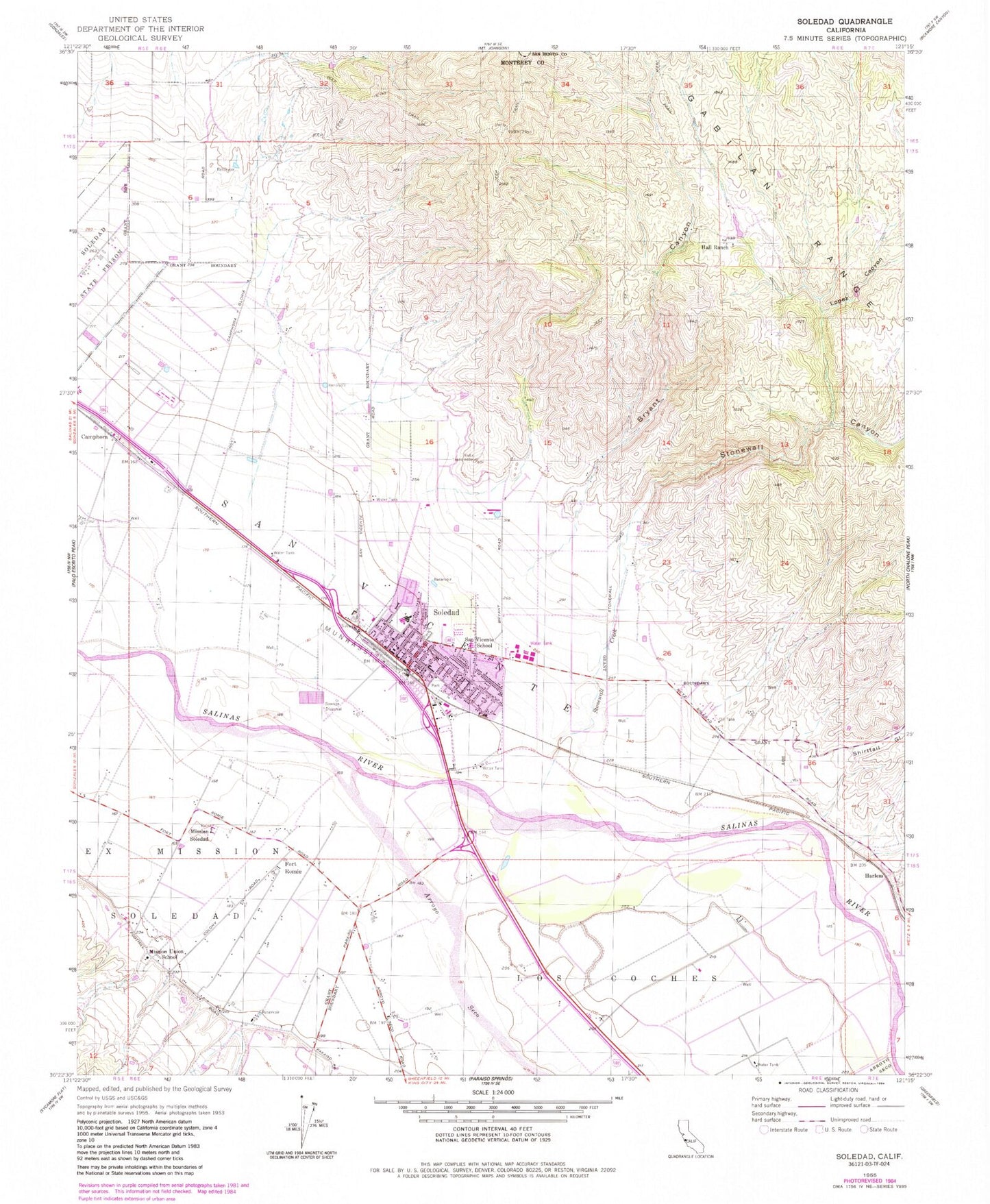
Classic USGS Soledad California 7.5'x7.5' Topo Map
Couldn't load pickup availability
Historical USGS topographic quad map of Soledad in the state of California. Map scale may vary for some years, but is generally around 1:24,000. Print size is approximately 24" x 27"
This quadrangle is in the following counties: Monterey, San Benito.
The map contains contour lines, roads, rivers, towns, and lakes. Printed on high-quality waterproof paper with UV fade-resistant inks, and shipped rolled.
Contains the following named places: American Medical Response Soledad, Arroyo Seco, Bill Ramos Park, Bryant Canyon, Camphora, City of Soledad, Correctional Training Facility Heliport, Fort Romie, Frank Ledesma Elementary School, Gabilan Elementary School, Hall Ranch, Harlem, Jack Franscioni Elementary School, KOJY-AM (Soledad), KSUR-FM (Greenfield), Little League Park, Lopez Canyon, Los Coche Adobe, Los Coches, Main Street Middle School, Mission Elementary School, Mission Soledad, Paul Masson Vineyards, Pinnacles High School, Rose Ferrero Elementary School, San Vicente Elementary School, Shirttail Gulch, Smith and Hook Winery, Soledad, Soledad Branch Monterey County Free Libraries, Soledad Cemetery, Soledad Christian Academy, Soledad Community Education Center, Soledad Fire Department, Soledad High School, Soledad Police Department, Soledad Post Office, Stonewall Canyon, Stonewall Creek, Upper Lateral Number Two and One Half, Vosti Park, ZIP Code: 93960