MyTopo
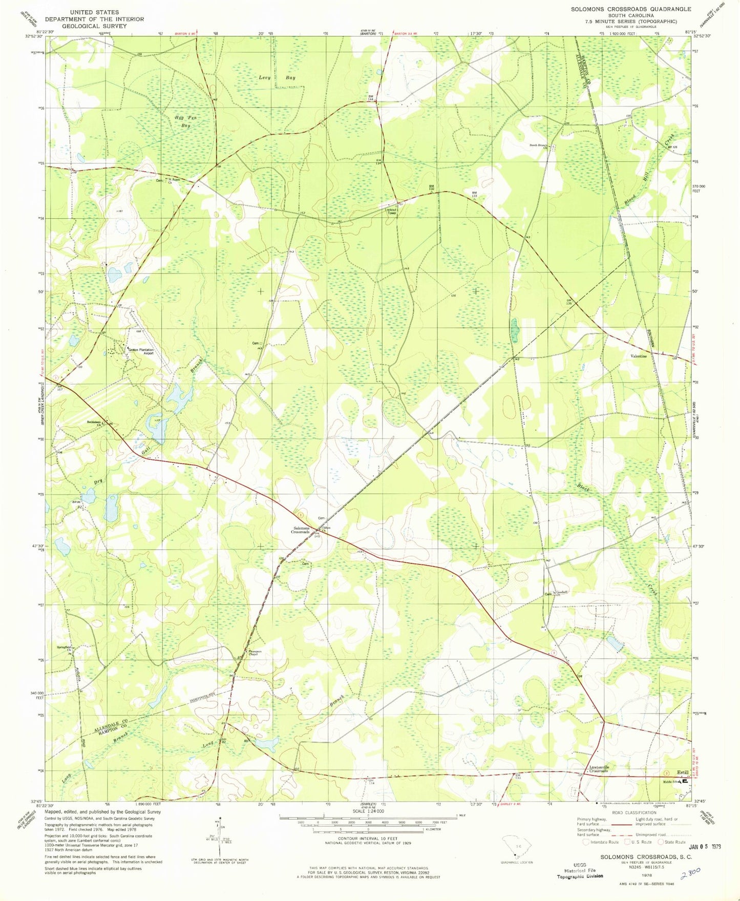
Classic USGS Solomons Crossroads South Carolina 7.5'x7.5' Topo Map
Couldn't load pickup availability
Historical USGS topographic quad map of Solomons Crossroads in the state of South Carolina. Map scale may vary for some years, but is generally around 1:24,000. Print size is approximately 24" x 27"
This quadrangle is in the following counties: Allendale, Hampton.
The map contains contour lines, roads, rivers, towns, and lakes. Printed on high-quality waterproof paper with UV fade-resistant inks, and shipped rolled.
Contains the following named places: Arnes Pond, Badger Pond D-2571 Dam, Beech Branch Church, Bethlehem Church, Cherry Hill School, Clifton Baptist Church, Cypress Pond Church, Estill Middle School, Goodwill Church, Goodwill School, Grotan Plantation, Harpers Pond, Haskel Pond Dam D-2570, Hog Pen Bay, Kenyon Church, King Creek School, Lawtonville Cemetery, Lawtonville Crossroads, Luray Fire Tower, Middle School, Peeples, Saint James Church, Solomons Cross Roads School, Solomons Crossroads, Solomons Store, South Carolina Noname 25009 D-2594 Dam, South Carolina Noname 25010 D-2595 Dam, Springfield Church, Still School, Thompson Chapel, Thompson School, Union Church, Valentine, Valentine Church, Venison Hunt Club, Williams Store, Winthrop Club, ZIP Code: 29932