MyTopo
Classic USGS Solsberry Indiana 7.5'x7.5' Topo Map
Couldn't load pickup availability
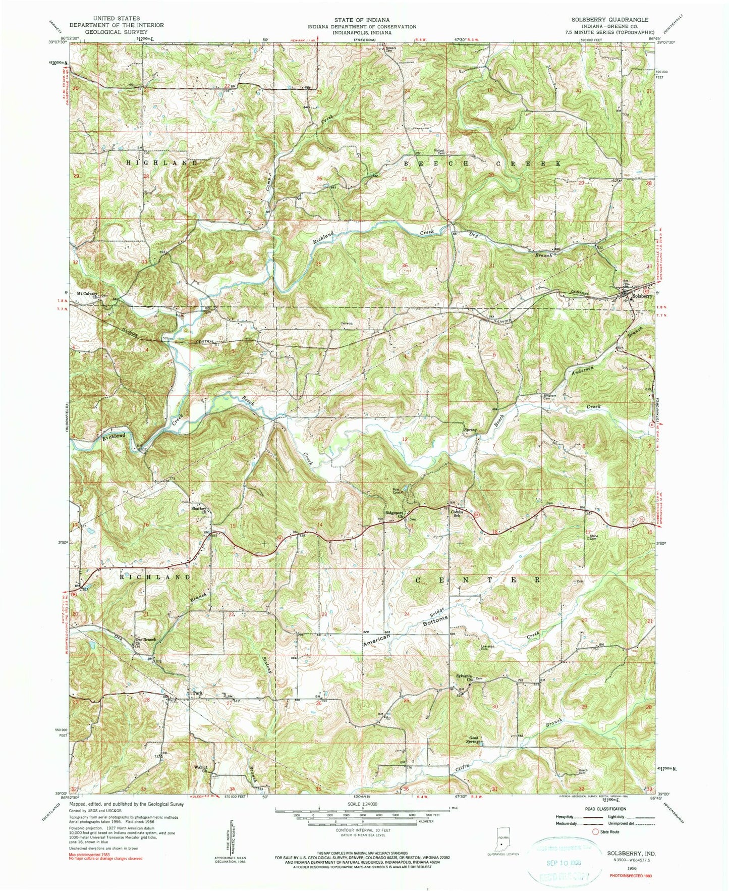
Historical USGS topographic quad map of Solsberry in the state of Indiana. Map scale may vary for some years, but is generally around 1:24,000. Print size is approximately 24" x 27"
This quadrangle is in the following counties: Greene.
The map contains contour lines, roads, rivers, towns, and lakes. Printed on high-quality waterproof paper with UV fade-resistant inks, and shipped rolled.
Contains the following named places: American Bottoms, Anderson Branch, Augustine Burch Cemetery, Beech Creek, Beechwood Lake Dam, Bingham Cemetery, Bridge Creek, Camp Creek, Combs School, Dry Branch, Eastern Volunteer Fire Department, Goad Spring, Lawrence Cemetery, Mount Calvary Church, Newark Cemetery, Ore Branch Church, Park, Philpot Cemetery, Ridgeport, Ridgeport Church, Sharkey Church, Solsberry, Solsberry Post Office, Stone Cemetery, Sylvania Church, Tanner, Township of Beech Creek, Township of Center, Walnut Church