MyTopo
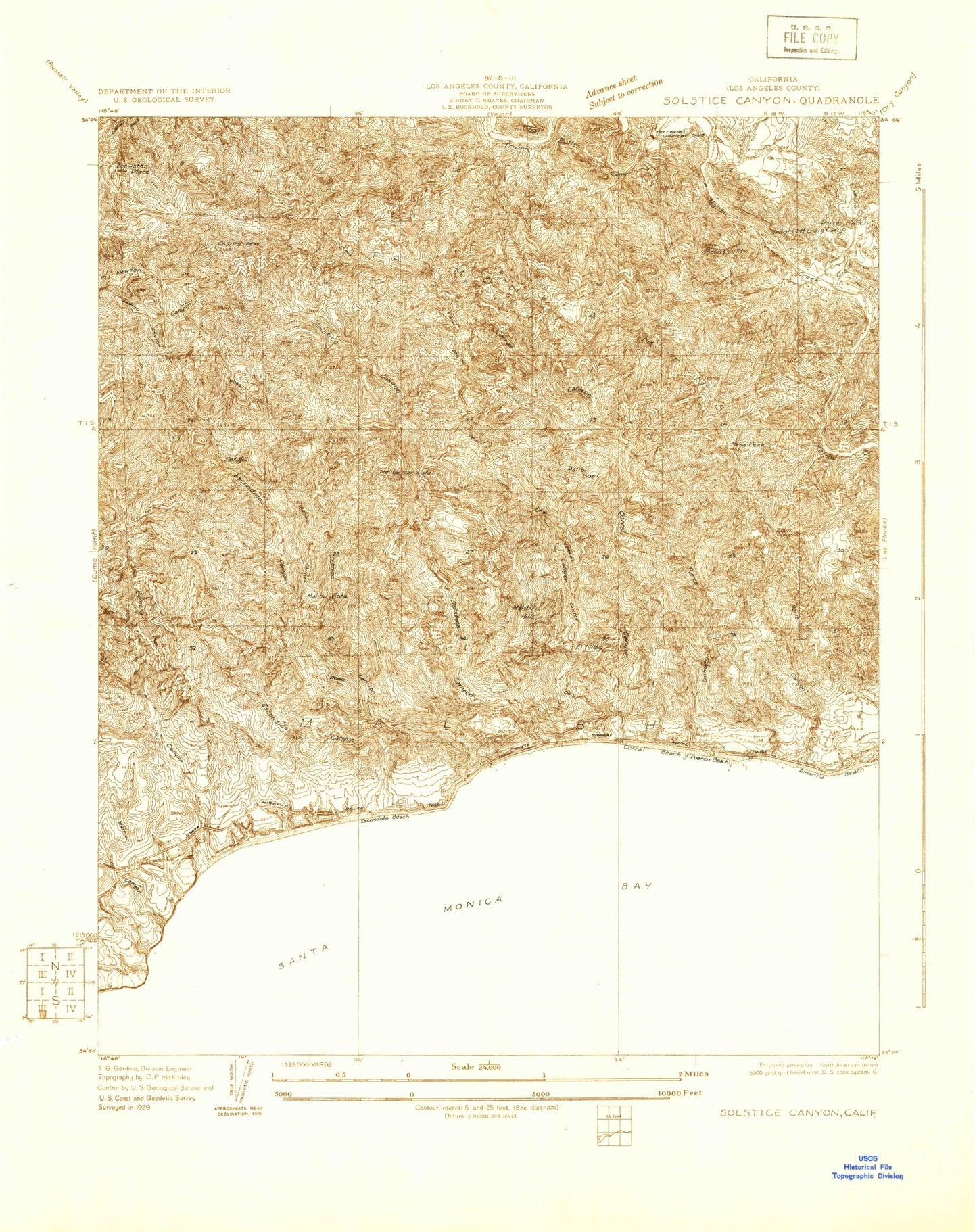
Classic USGS Solstice Canyon California 7.5'x7.5' Topo Map
Couldn't load pickup availability
Historical USGS topographic quad map of Solstice Canyon in the state of California. Typical map scale is 1:24,000, but may vary for certain years, if available. Print size: 24" x 27"
This quadrangle is in the following counties: Los Angeles.
The map contains contour lines, roads, rivers, towns, and lakes. Printed on high-quality waterproof paper with UV fade-resistant inks, and shipped rolled.
Contains the following named places: Castro Peak, Escondido Beach, Escondido Canyon, Latigo Canyon, Ramirez Canyon, Walnut Canyon, Los Angeles County Fire Department Station 71, Paradise Cove, Amarillo Beach, Brents Mountain, Century Ranch, Cold Creek, Century Reservoir, Corral Beach, Corral Canyon, Camp David Gonzales, Dry Canyon, Las Virgenes Creek, Marle Canyon, Mesa Peak, Puerco Beach, Puerco Canyon, Salvation Army Camp, Sleeper Canyon, Solstice Canyon, Tapia Park, Triunfo Canyon, Winter Canyon, Santa Monica Mountains National Recreation Area, Santa Monica Mountains, El Nido, Goat Buttes, Malibu Bowl, Malibu Hills, Malibu Vista, Century 001-071 Dam, Brewster Place, Malibu Mar Vista (historical), Oak Hill, Perral Rancho, The Crags Country Club, Old Hope Ranch, Dan Blocker Beach, Malibu Bluffs, Camp Gilmore, Malibu Bluffs Park, Pepperdine University - Malibu Campus, Old Rex Allen Ranch, Paradise Cove Mobile Home Park, Paradise Cove Pier, Perral Calabasas Ranch, Solstice Hill, Calabasas Division (historical), Agoura Hills-Malibu Division, City of Malibu, Kaslow Natural Preserve, McAuley Peak, Pepperdine University Census Designated Place