MyTopo
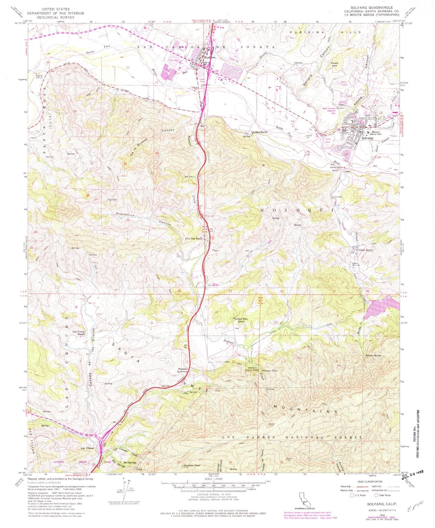
Classic USGS Solvang California 7.5'x7.5' Topo Map
Couldn't load pickup availability
Historical USGS topographic quad map of Solvang in the state of California. Map scale may vary for some years, but is generally around 1:24,000. Print size is approximately 24" x 27"
This quadrangle is in the following counties: Santa Barbara.
The map contains contour lines, roads, rivers, towns, and lakes. Printed on high-quality waterproof paper with UV fade-resistant inks, and shipped rolled.
Contains the following named places: Adobe Canyon, Alamo Pintado Creek, Alisal Creek, Alisal Creek 756 Dam, Alisal Golf Course, Alisal Ranch, Allan Hancock College - Solvang Center, American Medical Response Santa Barbara County, Ballard Canyon, Buellton, Buellton Library, Buellton Park, Buellton Post Office, Calahuasa, California Highway Patrol - Buellton Office, Canada De Las Cruces, Canada De Los Palos Blancos, Canada de Najao-ui, Chalk Hill, City of Buellton, City of Solvang, Copenhagen Cellars, De la Questa Canyon, Folded Hills Ranch, Gardner Ranch, Gaviota Peak, Hans Christian Anderson Museum, Hans Christian Anderson Park, High Sky Farm, Hot Springs, Hot Springs Creek, Jonata Middle School, KSYV-FM (Solvang), Las Canovas Creek, Las Cruces, Las Cruces Ranch, Live Oak Ranch, Mission Santa Ines, Mission Santa Ynez, Monjas Creek, Monjas Spring, Moonshine Canyon, Mosby Winery, Nielsens Shopping Center, Nojoqui, Nojoqui Creek, Nojoqui Falls, Nojoqui Falls Park, Nojoqui Summit, Oak Valley Elementary School, Pollyrich Farms, Santa Barbara County Fire Department Station 30, Santa Barbara County Fire Department Station 31, Santa Barbara County Sheriff's Office Buellton Substation, Santa Barbara County Sheriff's Office Solvang Station, Santa Ynez Valley Cottage Hospital, Solvang, Solvang Branch Santa Barbara Public Library, Solvang Cemetery, Solvang Chamber of Commerce, Solvang Park, Solvang Post Office, Solvang School, Solvang Visitors Center, Veterans Memorial Building, Vista de las Cruces School, Zaca Creek, Zaca Creek Golf Course, ZIP Codes: 93427, 93463


