
MyTopo
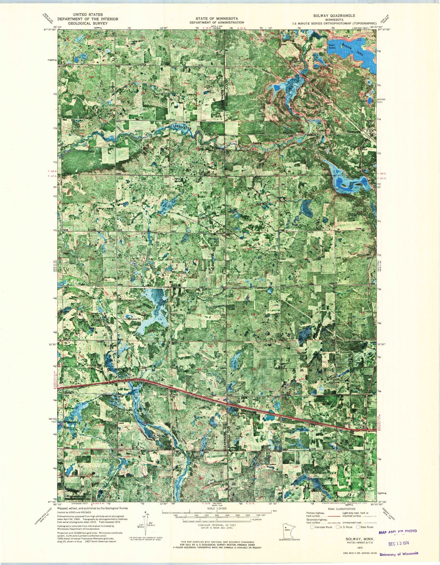
Classic USGS Solway Minnesota 7.5'x7.5' Topo Map
Couldn't load pickup availability
Historical USGS topographic quad map of Solway in the state of Minnesota. Map scale may vary for some years, but is generally around 1:24,000. Print size is approximately 24" x 27"
This quadrangle is in the following counties: Beltrami, Clearwater.
The map contains contour lines, roads, rivers, towns, and lakes. Printed on high-quality waterproof paper with UV fade-resistant inks, and shipped rolled.
Contains the following named places: Blackstar Dairy, Buzzle Lake, Buzzle Post Office, City of Solway, Lanstad Free Lutheran Church, Pinewood, Pinewood Post Office, Pinewood Station, Shevlin-Moose Cemetery, Solway, Solway Bible Chapel, Solway Cemetery, Solway Lutheran Church, Solway Post Office, Solway Rural Volunteer Fire Department, Township of Shevlin, ZIP Code: 56676


