MyTopo
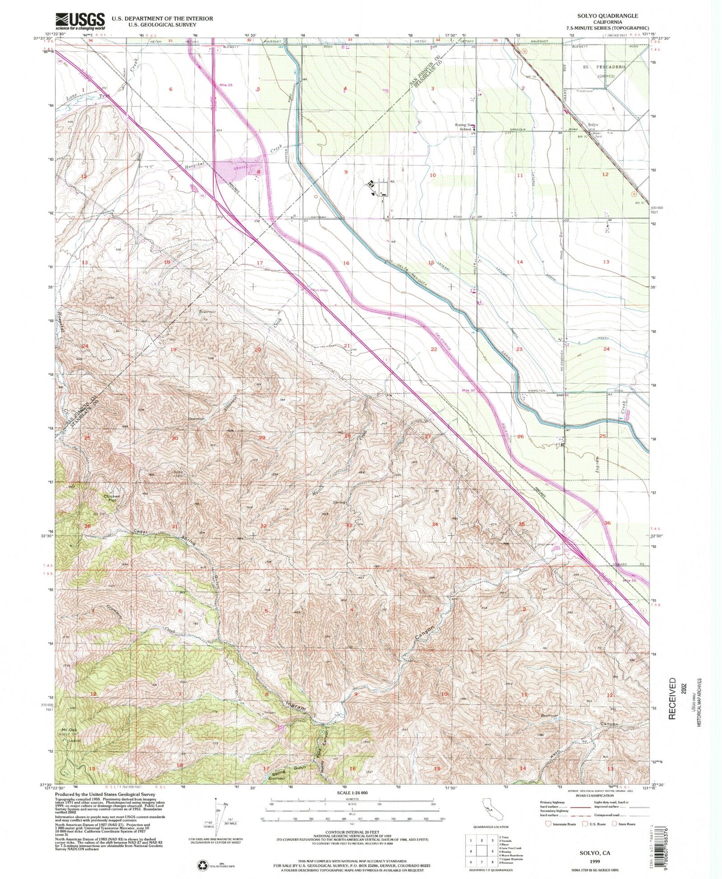
Classic USGS Solyo California 7.5'x7.5' Topo Map
Couldn't load pickup availability
Historical USGS topographic quad map of Solyo in the state of California. Map scale may vary for some years, but is generally around 1:24,000. Print size is approximately 24" x 27"
This quadrangle is in the following counties: San Joaquin, Stanislaus.
The map contains contour lines, roads, rivers, towns, and lakes. Printed on high-quality waterproof paper with UV fade-resistant inks, and shipped rolled.
Contains the following named places: Arkansas Creek, Bird Road Quarry, Cedar Spring Gulch, Chicken Flat, Grummett Creek, Ingram Canyon, KBEE-FM (Modesto), KOSO-FM (Patterson), Lateral Five North, Lateral Four North, Lateral Six North, Martin Creek, Mount Oso, Naval Auxiliary Air Station Vernalis, Rocky Ford Canyon, Solyo, Spring Gulch, Transition To Success - Rising Sun Campus, ZIP Code: 95387