MyTopo
Classic USGS Sombrero Peak California 7.5'x7.5' Topo Map
Regular price
$16.95
Regular price
Sale price
$16.95
Unit price
per
Couldn't load pickup availability
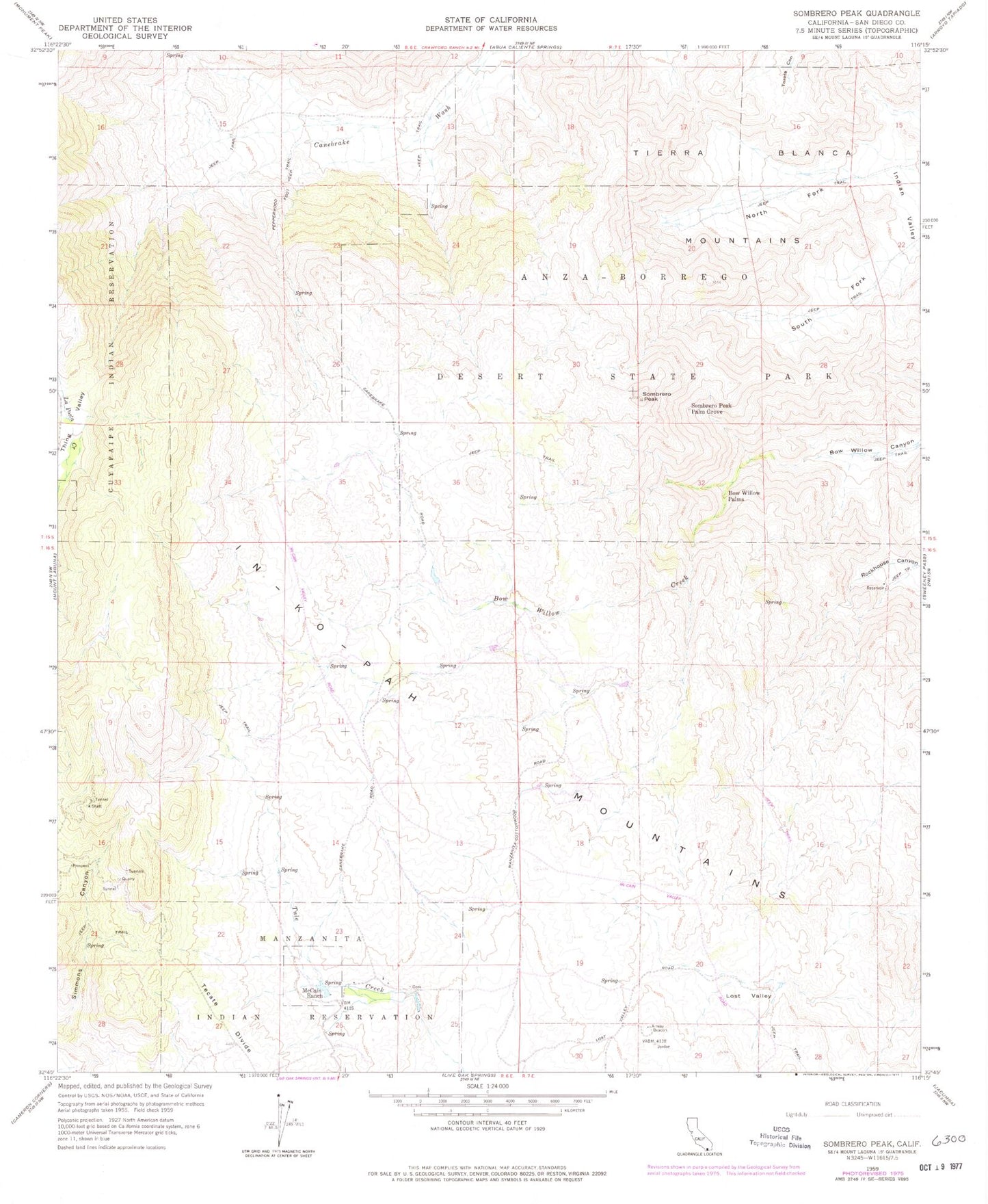
Historical USGS topographic quad map of Sombrero Peak in the state of California. Map scale may vary for some years, but is generally around 1:24,000. Print size is approximately 24" x 27"
This quadrangle is in the following counties: San Diego.
The map contains contour lines, roads, rivers, towns, and lakes. Printed on high-quality waterproof paper with UV fade-resistant inks, and shipped rolled.
Contains the following named places: Bow Willow Palms, Cottonwood Campground, In-Ko-Pah Mountains, Lost Valley, Manzanita Cemetery, Manzanita Reservation, McCain Ranch, North Fork Indian Valley, Pepperwood Trail, Sombrero Peak, Sombrero Peak Palm Grove, South Fork Indian Valley, Tierra Blanca Mountains