MyTopo
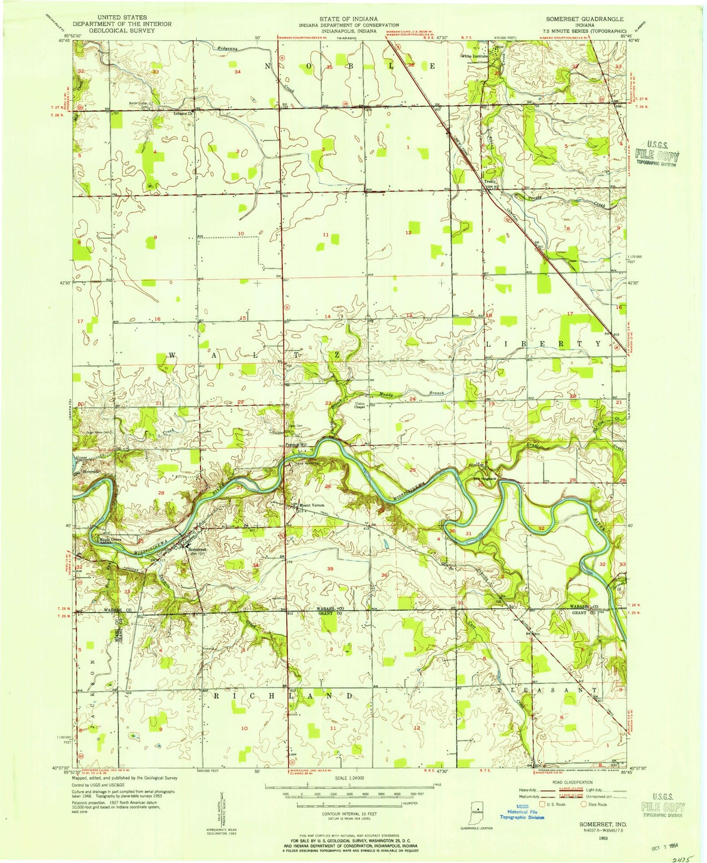
Classic USGS Somerset Indiana 7.5'x7.5' Topo Map
Couldn't load pickup availability
Historical USGS topographic quad map of Somerset in the state of Indiana. Map scale may vary for some years, but is generally around 1:24,000. Print size is approximately 24" x 27"
This quadrangle is in the following counties: Grant, Miami, Wabash.
The map contains contour lines, roads, rivers, towns, and lakes. Printed on high-quality waterproof paper with UV fade-resistant inks, and shipped rolled.
Contains the following named places: Cart Creek, Converse - Somerset Fire Department, Forked Branch, Goose Creek, Grant Creek, Hogback Ridge State Recreation Area, Latchum School, Lebanon Church, Metocinah Creek, Mississinewa Memorial Cemetery, Mount Vernon, Muddy Branch, Murphy Cemetery, Pearson Mill State Recreation Area, Pee Dee Creek, Reserve Number Four, Reserve Number Three, Reserve Number Two, Rock Run, Somerset, Somerset Census Designated Place, Somerset Post Office, Southwood Elementary School, Southwood Junior-Senior High School, Tenmile Creek, The Hogback, Township of Waltz, Treaty, White Institute, ZIP Code: 46984