MyTopo
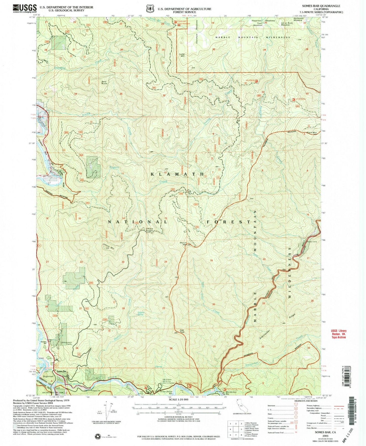
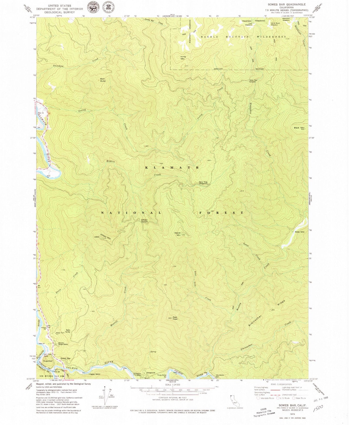
Classic USGS Somes Bar California 7.5'x7.5' Topo Map
Couldn't load pickup availability
Historical USGS topographic quad map of Somes Bar in the state of California. Map scale may vary for some years, but is generally around 1:24,000. Print size is approximately 24" x 27"
This quadrangle is in the following counties: Humboldt, Siskiyou.
The map contains contour lines, roads, rivers, towns, and lakes. Printed on high-quality waterproof paper with UV fade-resistant inks, and shipped rolled.
Contains the following named places: Bald Butte, Black Mountain, Camp Four Campsite, Camp Three Campground, Deer Lick Creek, East Peak, Edie Ranch, Gates Creek, Halfmoon Meadow, Haypress Creek, Irving Creek Ranch, Irving Creek School, Irving Mountain, Ishi Pishi Falls, Junction Elementary School, Kworatem, Let-Er Buck Meadow, Merrill Creek, Merrill Mountain, Murderers Bar, Oak Bottom Campground, Oak Bottom Forest Service Station, Offield Mountain, Offield Mountain Lookout, Offield Saddle, Rogers Creek, Salmon River, Somes Bar, Somes Bar School, Somes Bar Work Center, Stanshaw Meadows, Steinacher Creek, Sugarloaf, Sulphur Spring, Trail Meadow, Ukonom Ranger Station, Wooley Camp, Wooley Creek, ZIP Code: 95568