MyTopo
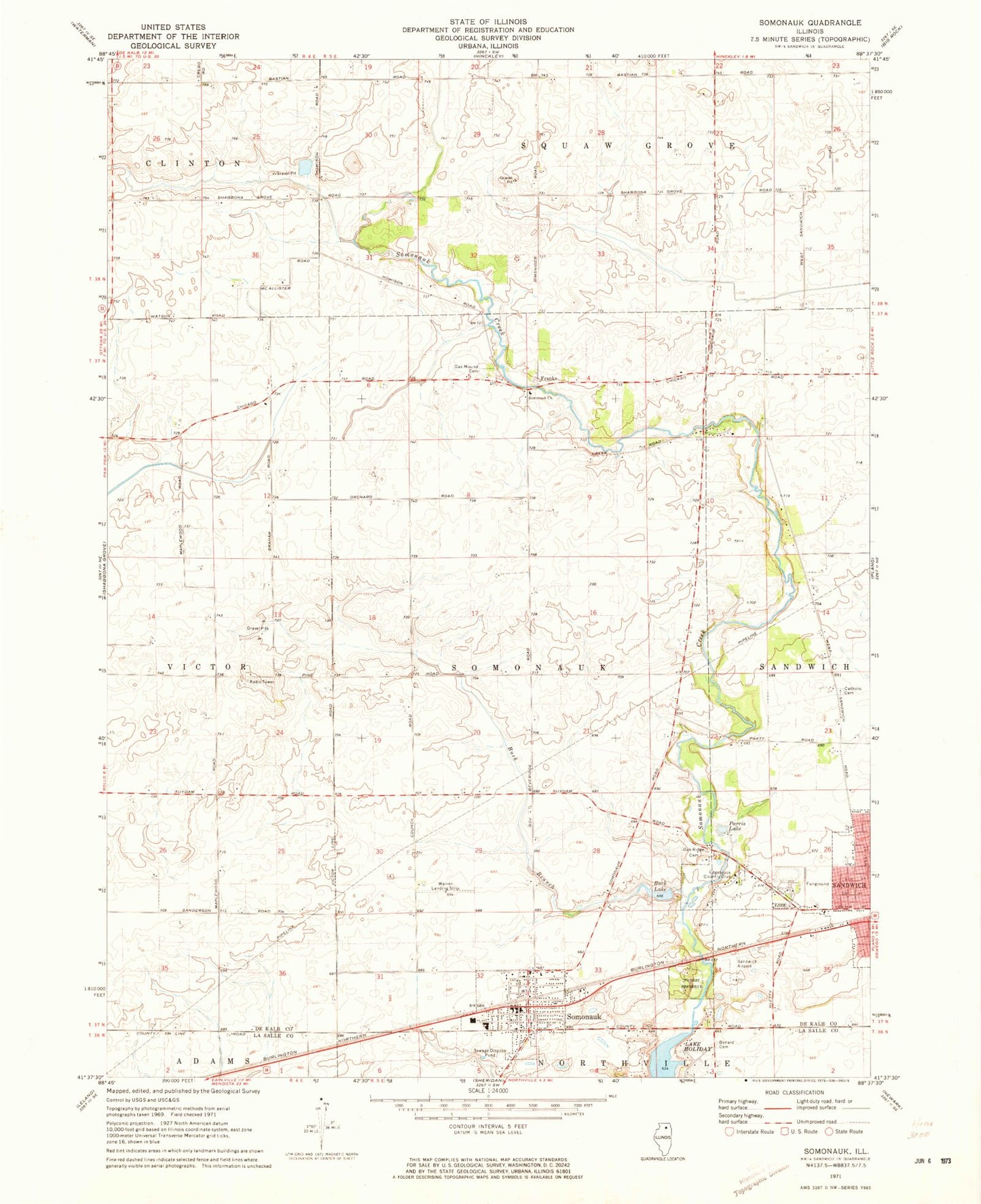
Classic USGS Somonauk Illinois 7.5'x7.5' Topo Map
Couldn't load pickup availability
Historical USGS topographic quad map of Somonauk in the state of Illinois. Map scale may vary for some years, but is generally around 1:24,000. Print size is approximately 24" x 27"
This quadrangle is in the following counties: DeKalb, LaSalle.
The map contains contour lines, roads, rivers, towns, and lakes. Printed on high-quality waterproof paper with UV fade-resistant inks, and shipped rolled.
Contains the following named places: Binder School, Brookside School, Buck Branch, Buck Lake, Buck Lake Dam, Coleman School, Culver Cemetery, Edgebrook Country Club, Fay School, Franks, Freeland School, George Airport, Hays School, Oak Mound Cemetery, Oak Ridge Cemetery, Parris Lake, Prairie View Elementary School, Saint Paul Catholic Cemetery, Sandwich Airport, Sandwich Memorial Park, Saunnak Forest Preserve, Somonauk, Somonauk Church, Somonauk Community Fire Protection District, Somonauk Grade School, Somonauk Junior-Senior High School, Somonauk Police Department, Somonauk Post Office, Somonauk School, Sononauk Lake, Township of Sandwich, Township of Somonauk, Van Olindas Cemetery, Village of Somonauk, Warren Airport, Warren Landing Strip, Woodlake Landing, ZIP Codes: 60548, 60552