MyTopo
Classic USGS Sonnette Montana 7.5'x7.5' Topo Map
Couldn't load pickup availability
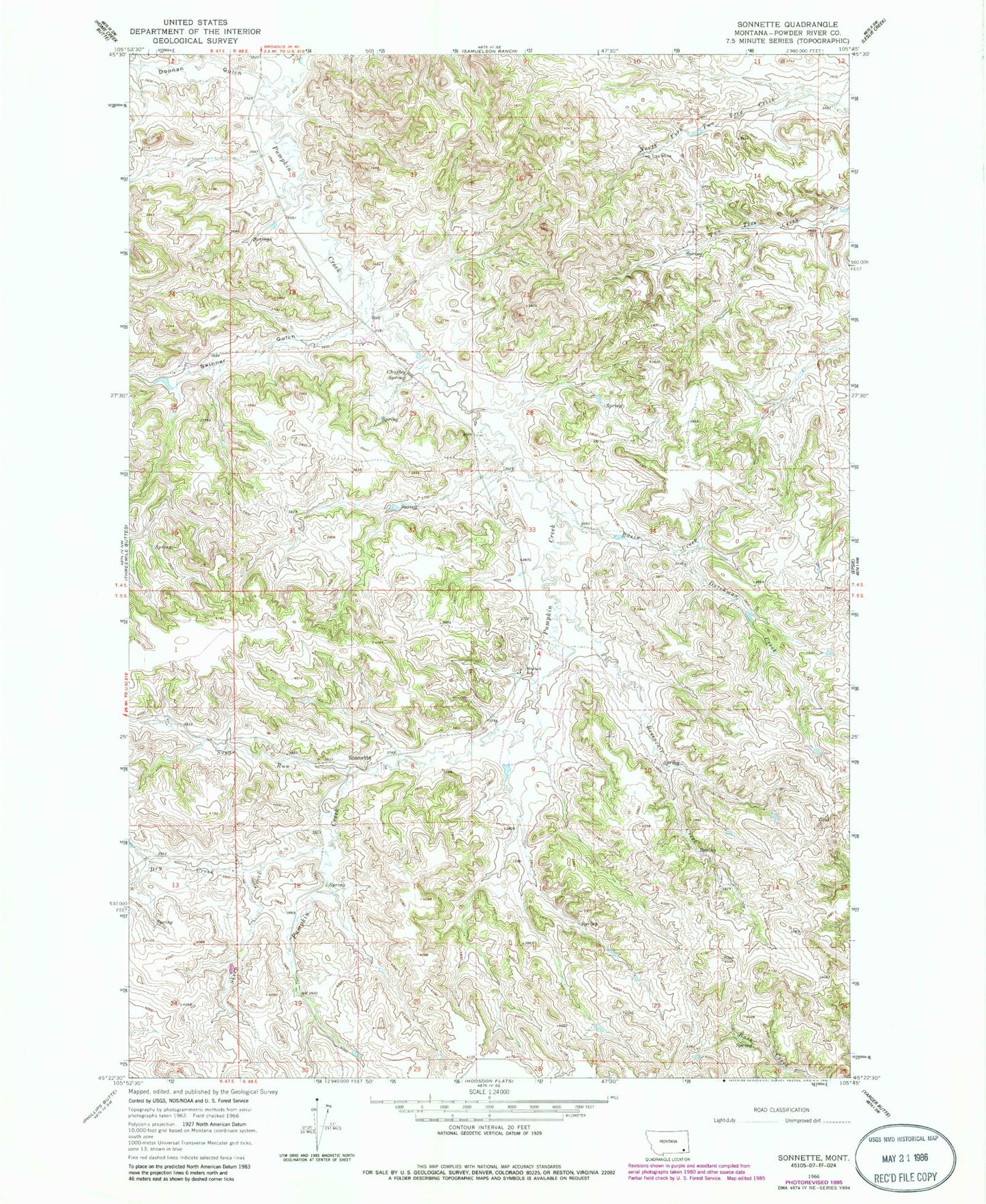
Historical USGS topographic quad map of Sonnette in the state of Montana. Map scale may vary for some years, but is generally around 1:24,000. Print size is approximately 24" x 27"
This quadrangle is in the following counties: Powder River.
The map contains contour lines, roads, rivers, towns, and lakes. Printed on high-quality waterproof paper with UV fade-resistant inks, and shipped rolled.
Contains the following named places: 04S48E18BACD01 Well, 04S48E20CBDC01 Well, 04S48E20CC__01 Well, 04S48E26ACAC01 Well, 04S48E26BDBD01 Spring, 04S48E28CBCC01 Well, 04S48E34DDBB01 Well, 05S48E04CADC01 Well, 05S48E16BDAB01 Well, Basin Creek, Chuffey Spring, Doonan Gulch, Dry Creek, Dutchman Creek, Mitchell School, Reservoir Creek, Sheep Creek, Skinner Gulch, Sonnette, Sugar Run, Two Tree Mine