MyTopo
Classic USGS Sonny Boy Lakes Washington 7.5'x7.5' Topo Map
Couldn't load pickup availability
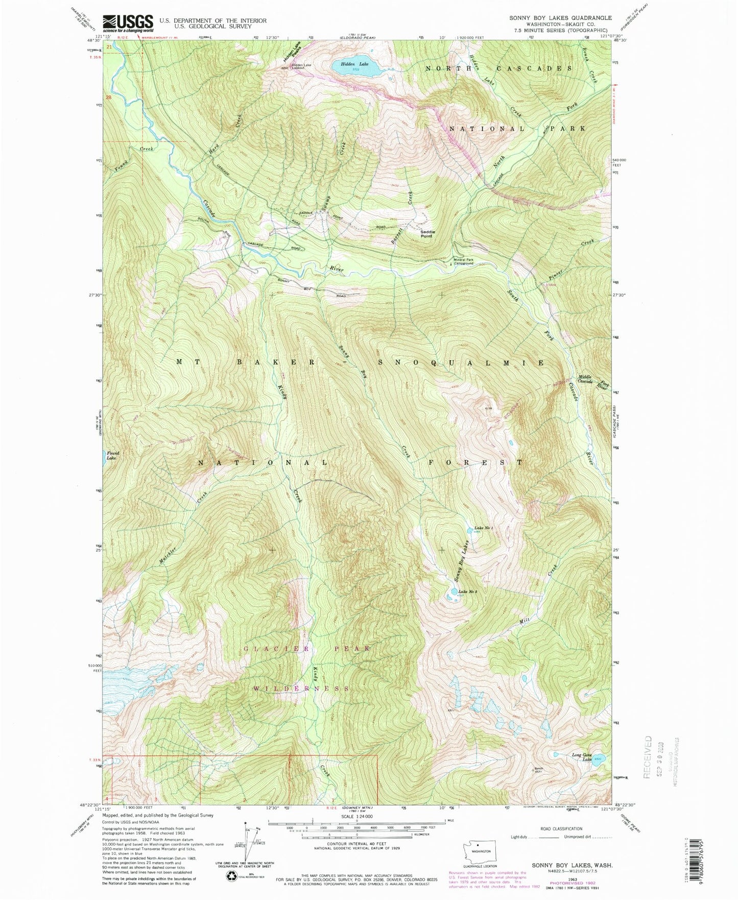
Historical USGS topographic quad map of Sonny Boy Lakes in the state of Washington. Typical map scale is 1:24,000, but may vary for certain years, if available. Print size: 24" x 27"
This quadrangle is in the following counties: Skagit.
The map contains contour lines, roads, rivers, towns, and lakes. Printed on high-quality waterproof paper with UV fade-resistant inks, and shipped rolled.
Contains the following named places: Barrett Creek, Found Creek, Hard Creek, Hidden Lake, Hidden Lake Creek, Hidden Lake Lookout, Kindy Creek, Long Gone Lake, Middle Fork Cascade River, Mineral Park Campground, Mutchler Creek, North Fork Cascade River, Pincer Creek, Roush Creek, Saddle Point, Sonny Bay Creek, Sonny Boy Lakes, South Fork Cascade River, Swamp Creek, Mineral Park, Vee Creek, Lake Number 1, Lake Number 2, Mineral Park Guard Station