MyTopo
Classic USGS Sonora SE Texas 7.5'x7.5' Topo Map
Regular price
$16.95
Regular price
Sale price
$16.95
Unit price
per
Couldn't load pickup availability
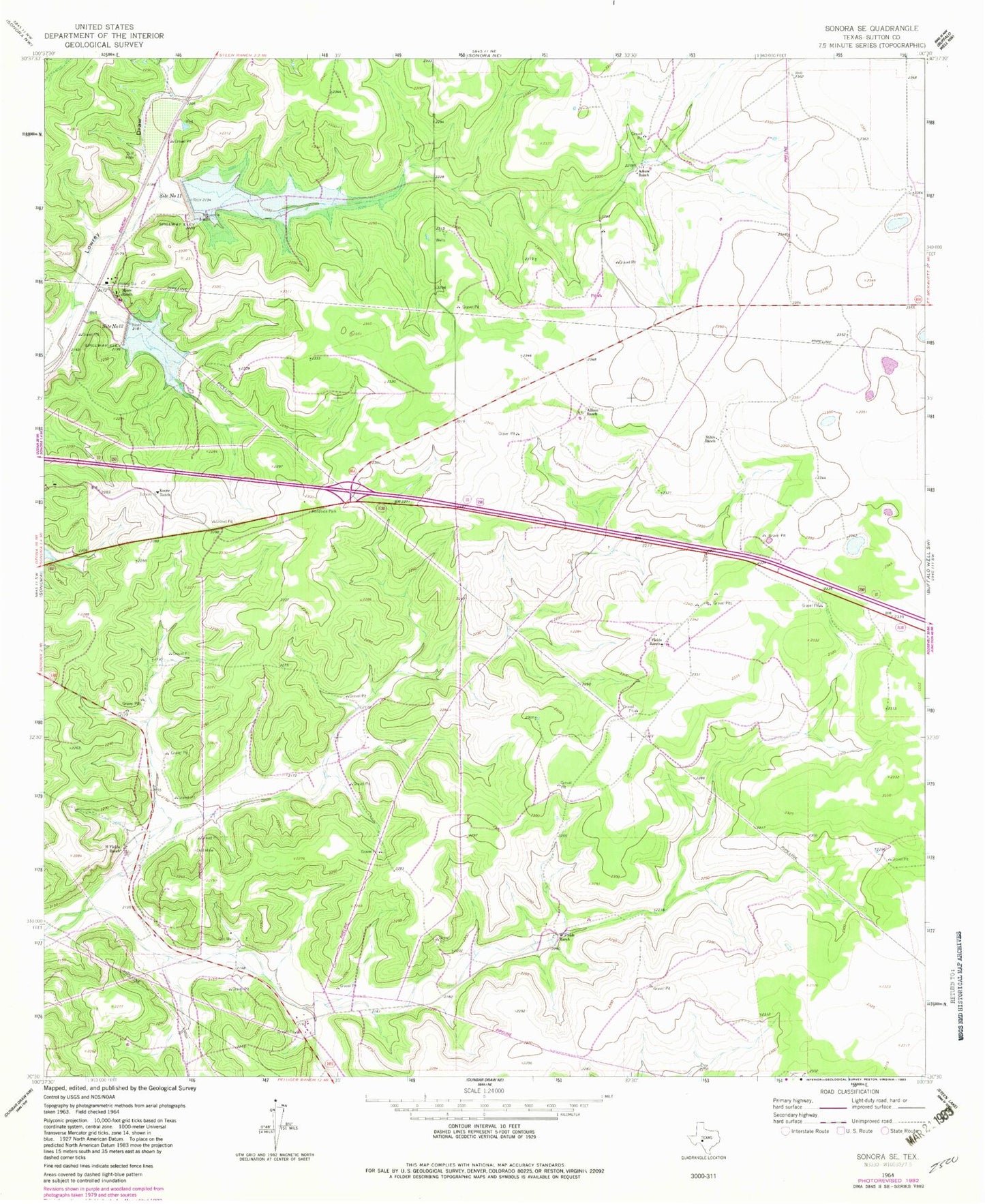
Historical USGS topographic quad map of Sonora SE in the state of Texas. Map scale may vary for some years, but is generally around 1:24,000. Print size is approximately 24" x 27"
This quadrangle is in the following counties: Sutton.
The map contains contour lines, roads, rivers, towns, and lakes. Printed on high-quality waterproof paper with UV fade-resistant inks, and shipped rolled.
Contains the following named places: Allison Ranch, Askey Ranch, H Fields Ranch, J Fields Ranch, John Fields Ranch Airport, Keene Ranch, Miers Ranch, Site Number Eleven, Site Number Twelve, Soil Conservation Service Site 11 Dam, Soil Conservation Service Site 12 Dam, Stites Ranch, Threemile Well, W Fields Ranch