MyTopo
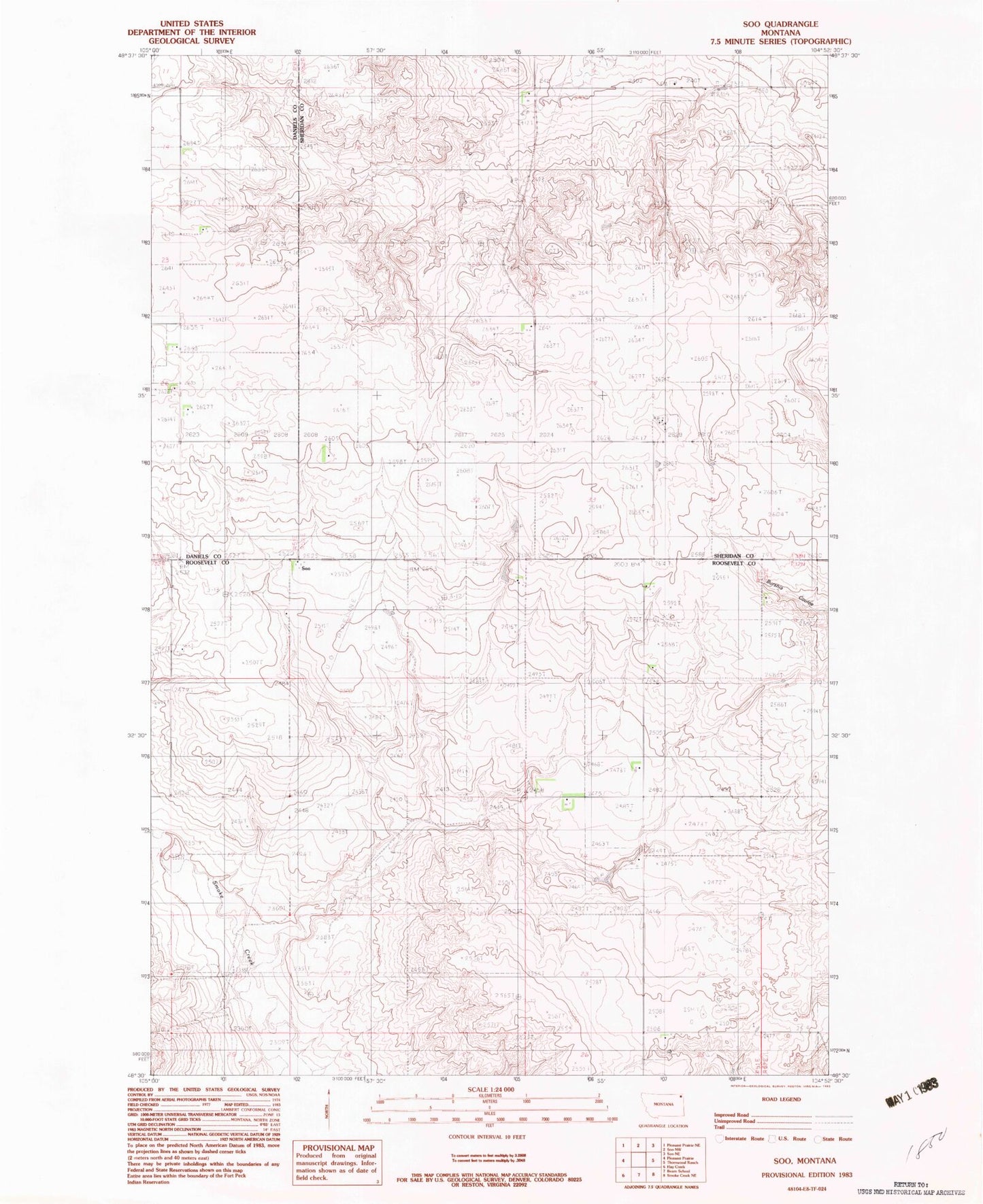
Classic USGS Soo Montana 7.5'x7.5' Topo Map
Couldn't load pickup availability
Historical USGS topographic quad map of Soo in the state of Montana. Map scale may vary for some years, but is generally around 1:24,000. Print size is approximately 24" x 27"
This quadrangle is in the following counties: Daniels, Roosevelt, Sheridan.
The map contains contour lines, roads, rivers, towns, and lakes. Printed on high-quality waterproof paper with UV fade-resistant inks, and shipped rolled.
Contains the following named places: 32N52E03AADC01 Well, 32N52E04BBBB01 Well, 32N52E04BBBB02 Well, 33N49E09BB__10 Well, 33N52E17AAAB01 Well, 33N52E17DDDC01 Well, 33N52E27CCBD01 Well, 33N52E27CCBD02 Well, 33N52E29AAAA01 Well, Bummer Dam, Faith Lutheran Cemetery, Faith Lutheran Church, Soo, Soo School, Wanso School