MyTopo
Classic USGS Soosap Peak Oregon 7.5'x7.5' Topo Map
Regular price
$16.95
Regular price
Sale price
$16.95
Unit price
per
Couldn't load pickup availability
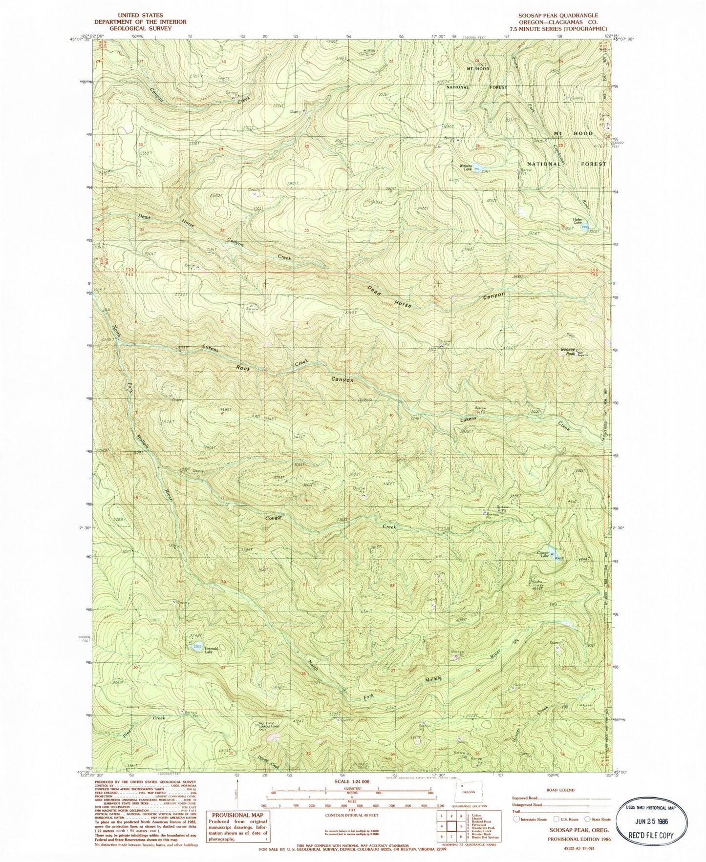
Historical USGS topographic quad map of Soosap Peak in the state of Oregon. Map scale may vary for some years, but is generally around 1:24,000. Print size is approximately 24" x 27"
This quadrangle is in the following counties: Clackamas.
The map contains contour lines, roads, rivers, towns, and lakes. Printed on high-quality waterproof paper with UV fade-resistant inks, and shipped rolled.
Contains the following named places: Cougar Creek, Cougar Lake, Dead Horse Canyon, Emerald Lake, High Camp, High Camp Lookout, High Camp Trail, Hunters Camp, Lukens Creek, Rock Canyon, Soosap Peak, Timothy Patch, Williams Lake