
MyTopo
Classic USGS Sopchoppy Florida 7.5'x7.5' Topo Map
Couldn't load pickup availability
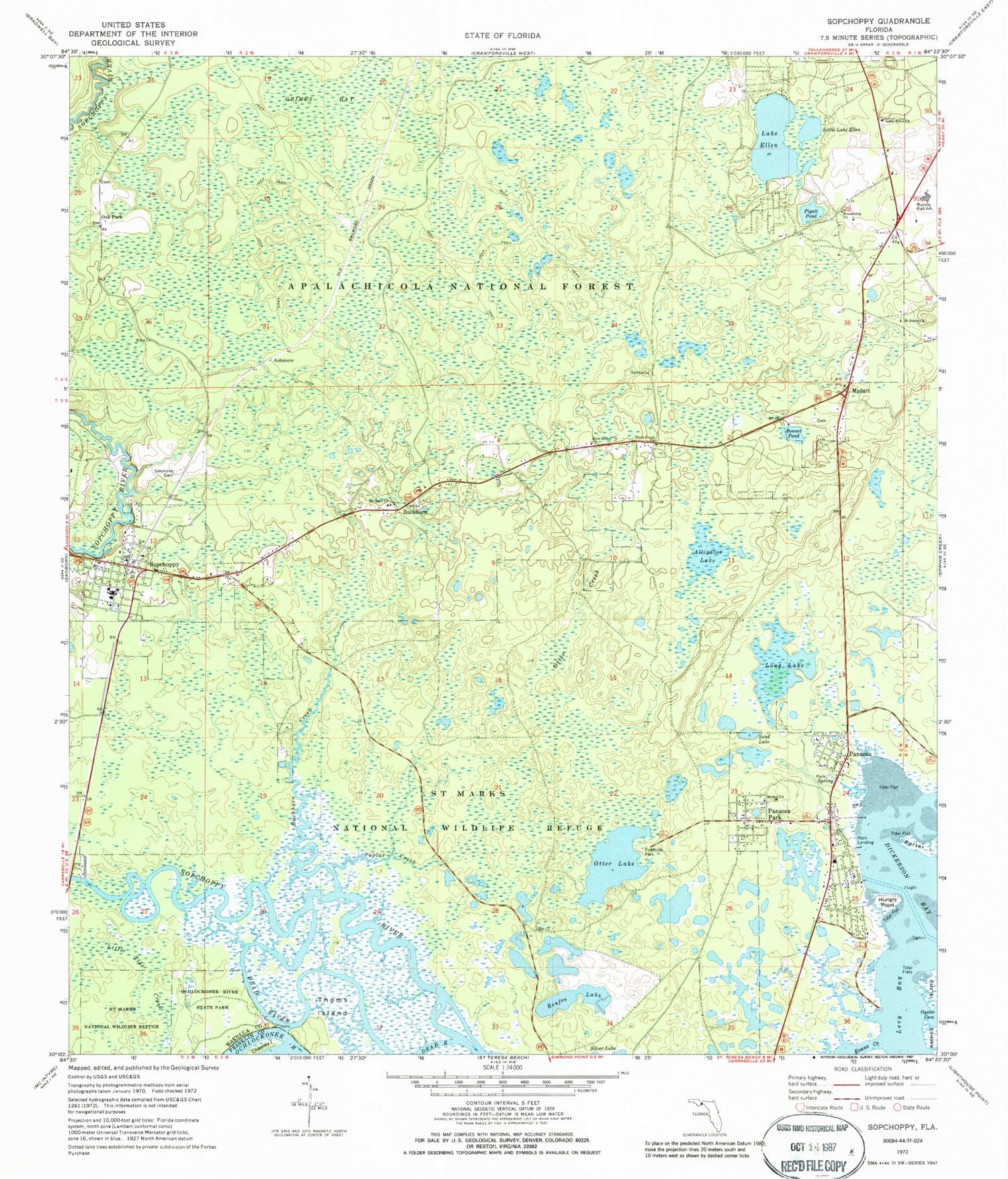
Historical USGS topographic quad map of Sopchoppy in the state of Florida. Map scale may vary for some years, but is generally around 1:24,000. Print size is approximately 24" x 27"
This quadrangle is in the following counties: Franklin, Wakulla.
The map contains contour lines, roads, rivers, towns, and lakes. Printed on high-quality waterproof paper with UV fade-resistant inks, and shipped rolled.
Contains the following named places: Alligator Lake, Ashmore, Bethel Church, Bonnet Pond, Buckhorn, Buckhorn Creek, Chesley Island, City of Sopchoppy, Dead River, Dickerson Bay, Evans Creek, First Baptist Church of Panacea, Fox Lake, Friendship Church, Grimes Bay, Grimes Cemetery, Hungry Point, Lake Ellen, Lake Ellen Church, Levy Bay, Little Ellen Lake, Long Lake, Medart, Medart Volunteer Fire Department Station 5, Mount Trail Church, Mount Trial Primitive Baptist Church, New Home Church, Oak Park, Ochlockonee River State Park, Otter Creek, Otter Creek Church, Otter Lake, Panacea, Panacea Census Designated Place, Panacea Park, Panacea Post Office, Panacea Volunteer Fire Department Station 6, Pigott Pond, Poplar Creek, Renfro Lake, Riverside Baptist Church, Rock Landing, Saint Johns Church, Saint Marks Precinct, Sand Lake, Simmons Cemetery, Simmons Point, Sopchoppy, Sopchoppy Elementary School, Sopchoppy Fire Department, Sopchoppy Post Office, Sopchoppy-Panacea United Methodist Church, Thoms Island, Tully, Wakulla High School, West Wakulla Division


