MyTopo
Classic USGS Sorrento Florida 7.5'x7.5' Topo Map
Couldn't load pickup availability
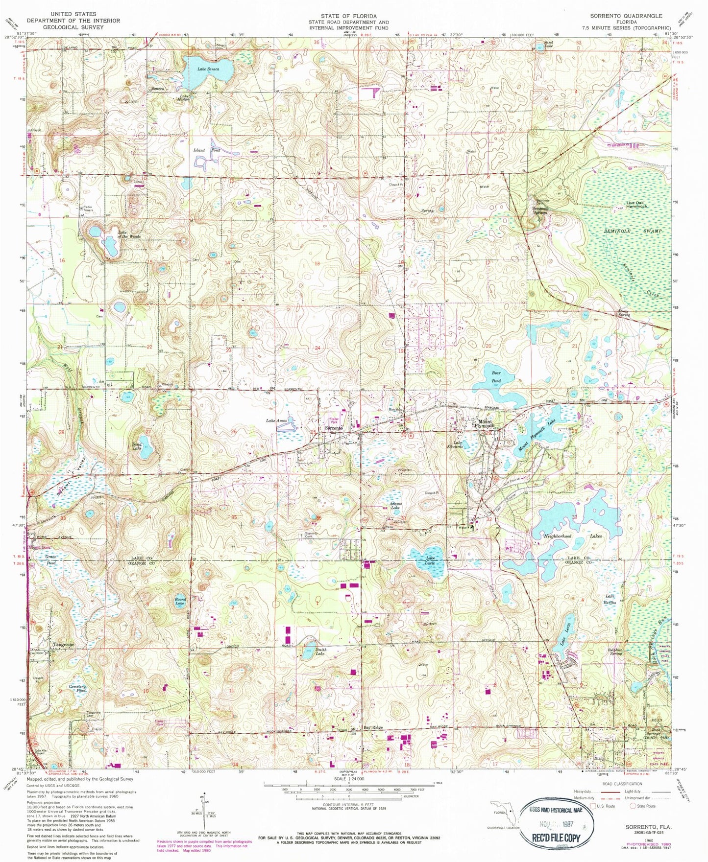
Historical USGS topographic quad map of Sorrento in the state of Florida. Map scale may vary for some years, but is generally around 1:24,000. Print size is approximately 24" x 27"
This quadrangle is in the following counties: Lake, Orange.
The map contains contour lines, roads, rivers, towns, and lakes. Printed on high-quality waterproof paper with UV fade-resistant inks, and shipped rolled.
Contains the following named places: Adams Lake, Bay Ridge, Bear Pond, Brightwood Manor Trailer Park, Cemetery Pond, Droty Spring, Grass Pond, Island Pond, Kelly Park, Lake Amos, Lake Bartho, Lake Bundy, Lake County Fire Rescue Station 39, Lake Edwards, Lake Emergency Medical Services Station 131, Lake Kitty, Lake Lerla, Lake Lucie, Lake Madge, Lake of the Woods, Lake Ola Chapel, Lake Seneca, Live Oak Hammock, Metrowest Country Club, Mount Dora Division, Mount Plymouth, Mount Plymouth Census Designated Place, Mount Plymouth Lake, Mount Plymouth Lakes, Mount Post Office Plymouth, Neighborhood Lakes, New Hope Church, New Hope Missionary Baptist Church, Oak Tree Park, Orange County Fire Rescue Station 29, Prays Pond, Refuge Church of Our Lord Jesus Christ, Rock Springs, Round Lake, Round Lake Christian Church, Sand Lake, Seminole Cemetery, Seminole Springs, Seneca, Seneca Cemetery, Smith Lake, Sorrento, Sorrento Cemetery, Sorrento Census Designated Place, Sorrento Christian Center, Sorrento Church of God, Sorrento Post Office, Sorrento Presbyterian Church, Sulphur Spring, Sunset Valley, Tangerine Airport, Tangerine Cemetery, The President Country Club, Valley Mobile Home Park, Wekiwa Springs State Park, Wolf Branch, ZIP Code: 32776