MyTopo
Classic USGS Sorrento Louisiana 7.5'x7.5' Topo Map
Couldn't load pickup availability
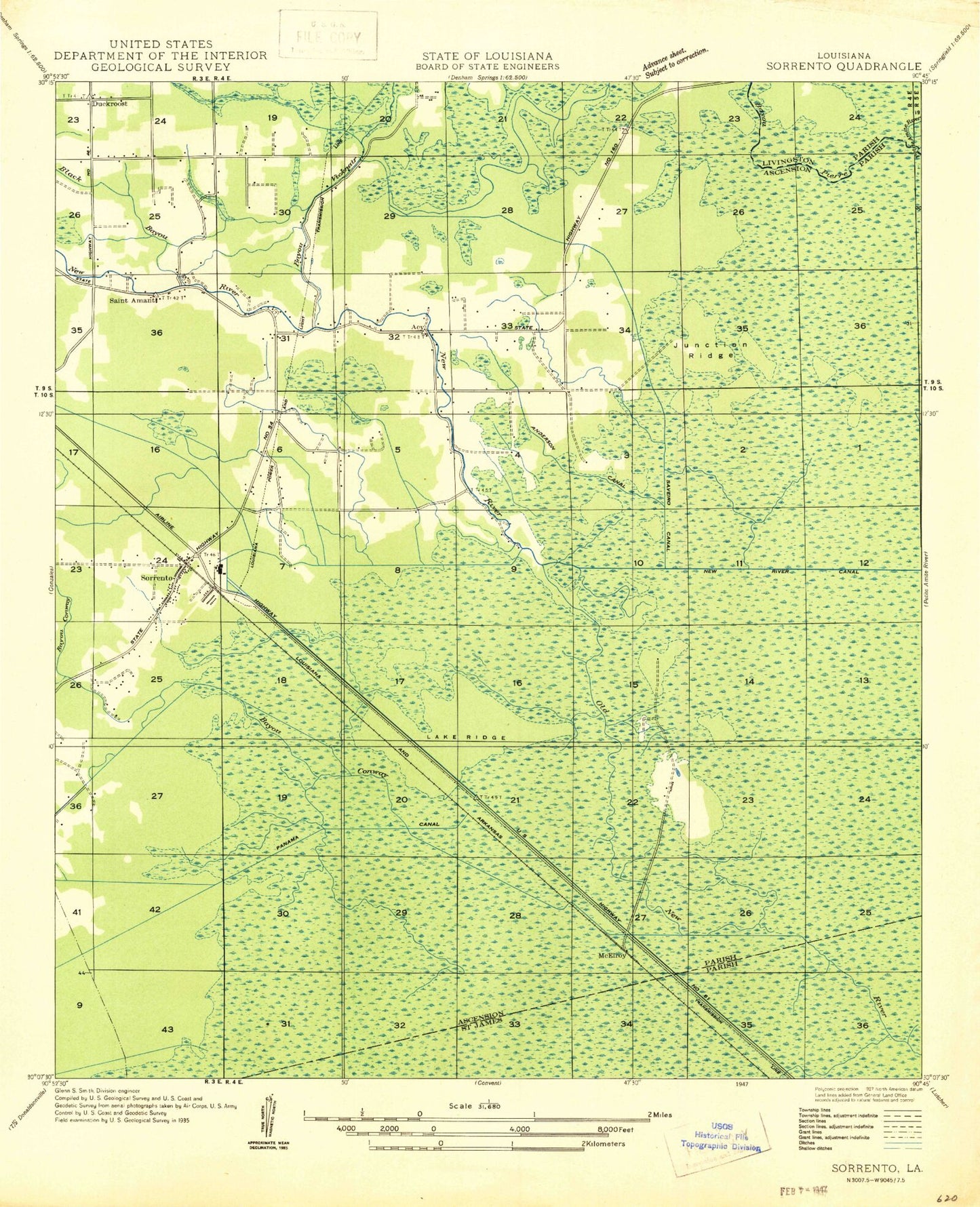
Historical USGS topographic quad map of Sorrento in the state of Louisiana. Map scale may vary for some years, but is generally around 1:24,000. Print size is approximately 24" x 27"
This quadrangle is in the following counties: Ascension, Livingston, St. James.
The map contains contour lines, roads, rivers, towns, and lakes. Printed on high-quality waterproof paper with UV fade-resistant inks, and shipped rolled.
Contains the following named places: Acy, Acy Fire Station, Amite River Diversion Canal, Anderson Canal, Babin Canal, Barmen, Bayou Conway, Bayou Francois, Bayou Pierre, Bayou Vicknair, BFI Colonial Landfill, Black Bayou, Duckroost, Duckroost Bayou, Heath Bayou, Holy Rosary Catholic Church, Junction Ridge, Lake Ridge, Louisiana Technical College Ascension Campus, McElroy, McElroy Ridge, New River, New River Canal, New River Church, Parish Governing Authority District 6, Richardson Cemetery, River Parishes Community College, Saint Amant, Saint Amant Baptist Church, Saint Amant Fire Department Station 60, Saint Amant Head Start Number 4, Saint Amant High School, Saint Amant Middle School, Saint Amant Post Office, Saint Amant Primary School, Saint Ann Chapel, Saveiro Canal, Second Mount Carmel Missionary Baptist Church, Sorrento, Sorrento Baptist Church, Sorrento Gas and Oil Field, Sorrento Police Department, Sorrento Post Office, Sorrento Town Hall, Sorrento Volunteer Fire Department Station 20, Town of Sorrento, Ward Ten, ZIP Codes: 70774, 70778