MyTopo
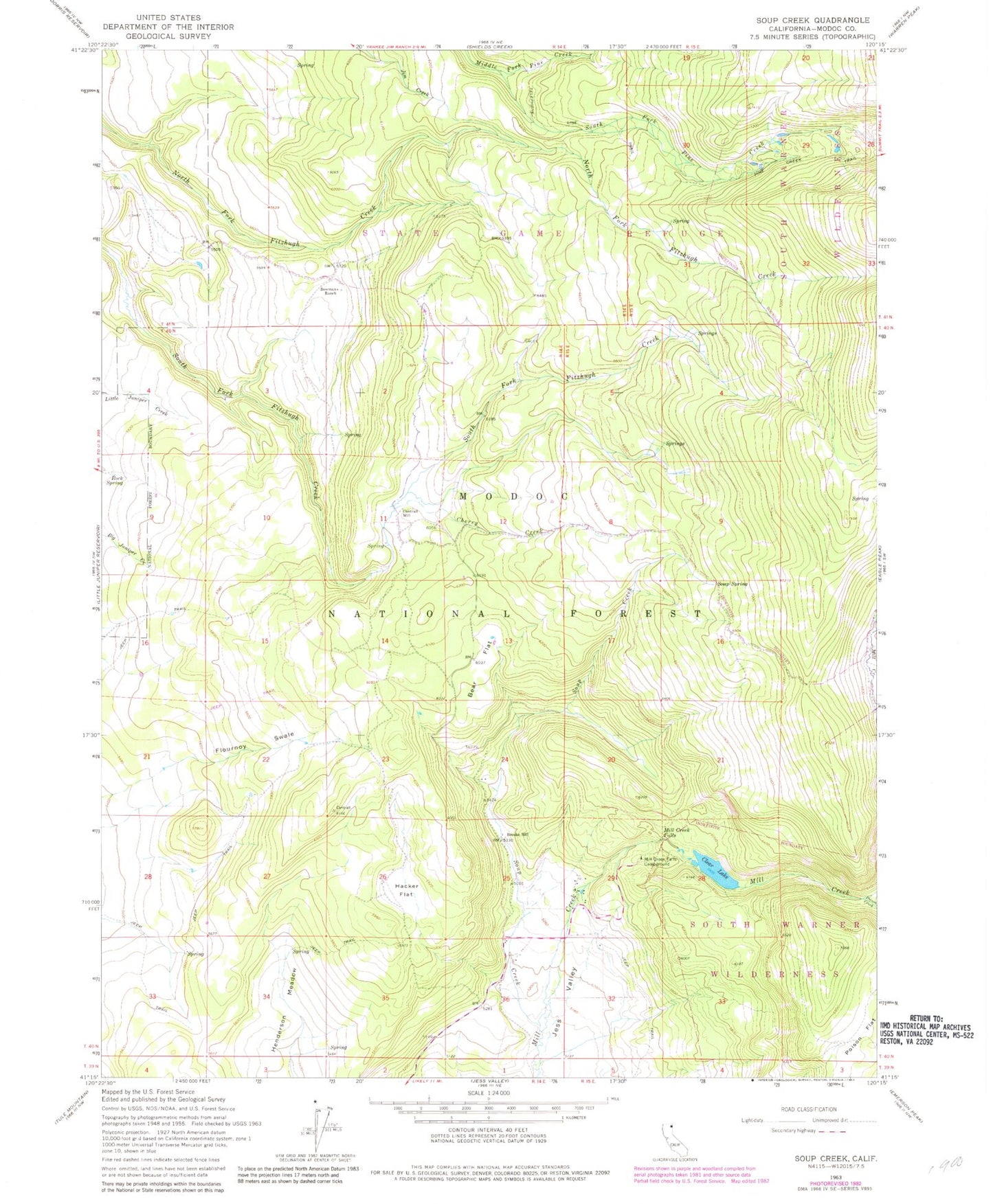
Classic USGS Soup Creek California 7.5'x7.5' Topo Map
Couldn't load pickup availability
Historical USGS topographic quad map of Soup Creek in the state of California. Map scale may vary for some years, but is generally around 1:24,000. Print size is approximately 24" x 27"
This quadrangle is in the following counties: Modoc.
The map contains contour lines, roads, rivers, towns, and lakes. Printed on high-quality waterproof paper with UV fade-resistant inks, and shipped rolled.
Contains the following named places: Bear Flat, Bowman Ranch, Brooks Mill, Cantrall Mill, Cherry Creek, Clear Lake, Flournoy Swale, Hacker Flat, Henderson Meadow, Mill Creek, Mill Creek Falls, Mill Creek Falls Campground, Poison Creek, Poison Flat, Rock Spring, Slide Creek, Soup Creek, Soup Spring, Soup Spring Campground, South Fork Pine Creek, ZIP Code: 96116