MyTopo
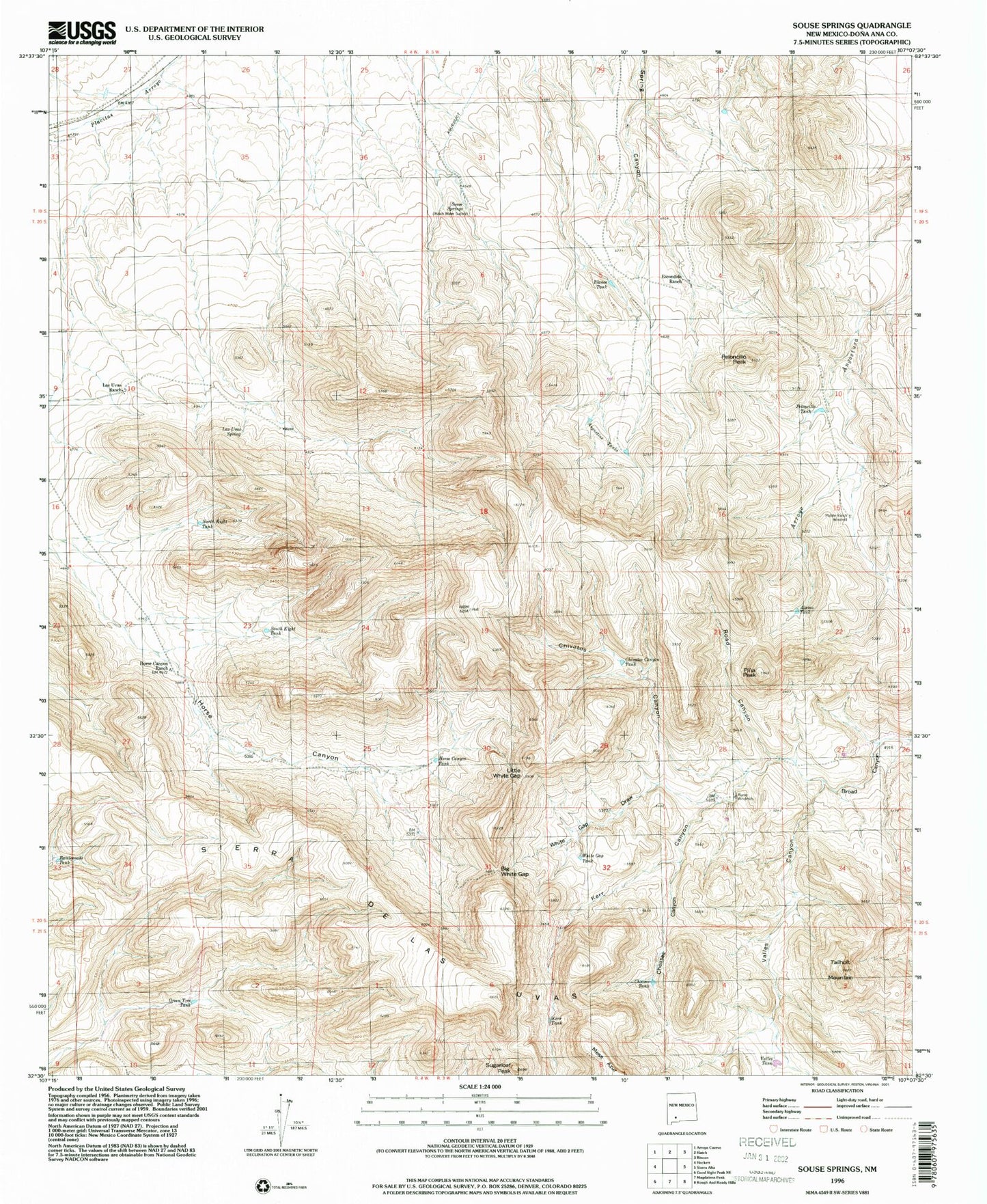
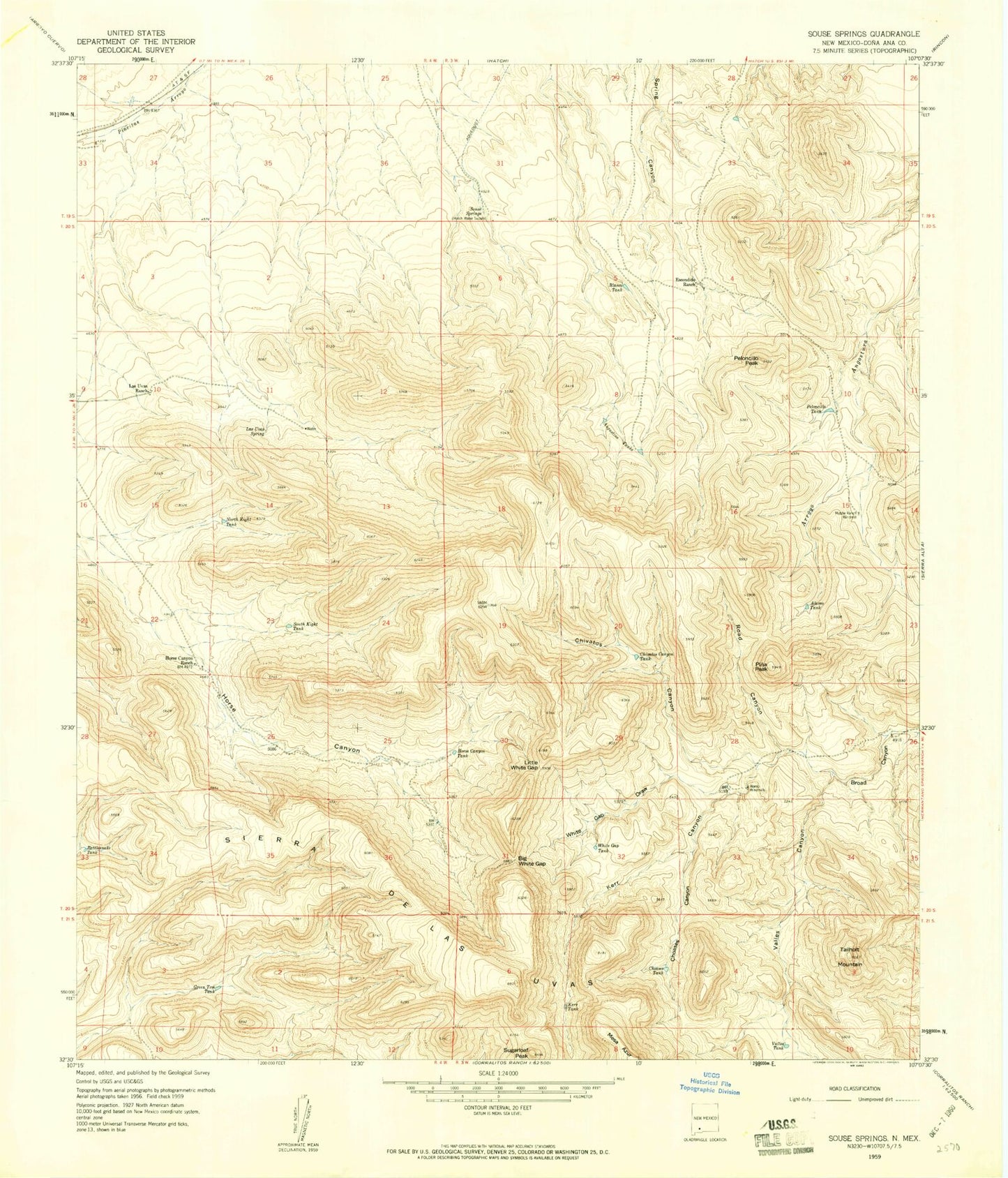
Classic USGS Souse Springs New Mexico 7.5'x7.5' Topo Map
Couldn't load pickup availability
Historical USGS topographic quad map of Souse Springs in the state of New Mexico. Map scale may vary for some years, but is generally around 1:24,000. Print size is approximately 24" x 27"
This quadrangle is in the following counties: Do��a Ana.
The map contains contour lines, roads, rivers, towns, and lakes. Printed on high-quality waterproof paper with UV fade-resistant inks, and shipped rolled.
Contains the following named places: Alamo Tank, Alamo Windmills, Augustine Tank, Big White Gap, Blanco Tank, Chivatos Canyon, Chivatos Canyon Tank, Choases Canyon, Choases Tank, Escondido Ranch, Green Tree Tank, Horse Canyon Ranch, Horse Canyon Tank, Kerr Canyon, Kerr Tank, Las Uvas Mountains Wilderness Study Area, Las Uvas Ranch, Las Uvas Spring, Little White Gap, Middle Ranch Windmill, North Kight Tank, Peloncillo Peak, Peloncillo Tank, Pina Peak, Rattlesnake Tank, Road Canyon, Souse Springs, South Kight Tank, Sugarloaf Peak, Tailholt Mountain, Valles Canyon, Valles Tank, White Gap Draw, White Gap Tank, ZIP Code: 87937