MyTopo
Classic USGS South Bastian Spring Nevada 7.5'x7.5' Topo Map
Regular price
$16.95
Regular price
Sale price
$16.95
Unit price
per
Couldn't load pickup availability
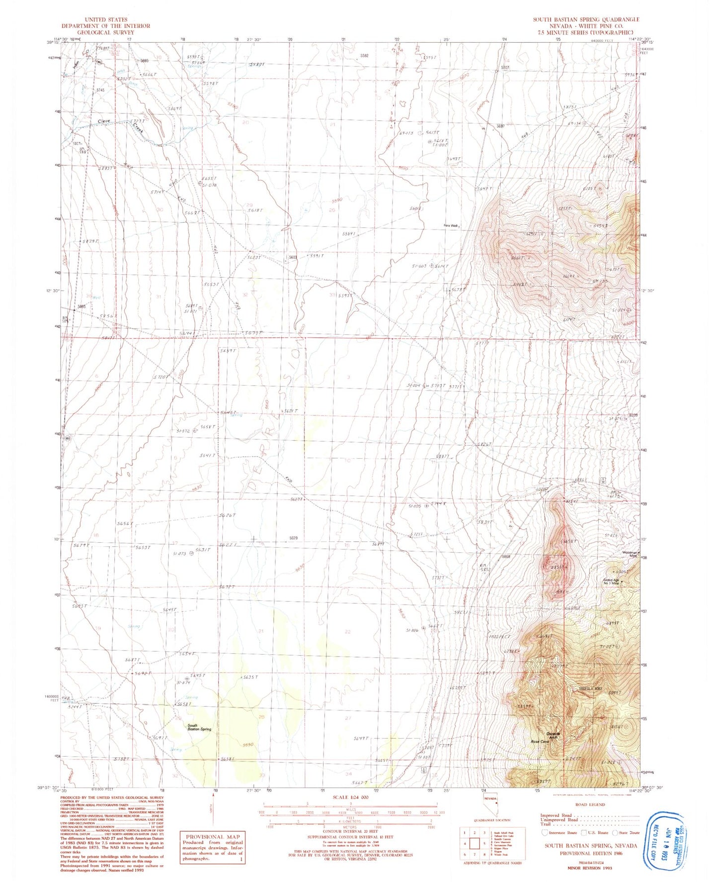
Historical USGS topographic quad map of South Bastian Spring in the state of Nevada. Map scale may vary for some years, but is generally around 1:24,000. Print size is approximately 24" x 27"
This quadrangle is in the following counties: White Pine.
The map contains contour lines, roads, rivers, towns, and lakes. Printed on high-quality waterproof paper with UV fade-resistant inks, and shipped rolled.
Contains the following named places: Cleve Creek, Fera Well, Gilded Age Number 1 Mine, Indian Creek, Osceola Arch, Rose Cave Guano Mine, South Bastian Spring, Swamp Cedar Natural Area, Woodman Mine