

MyTopo
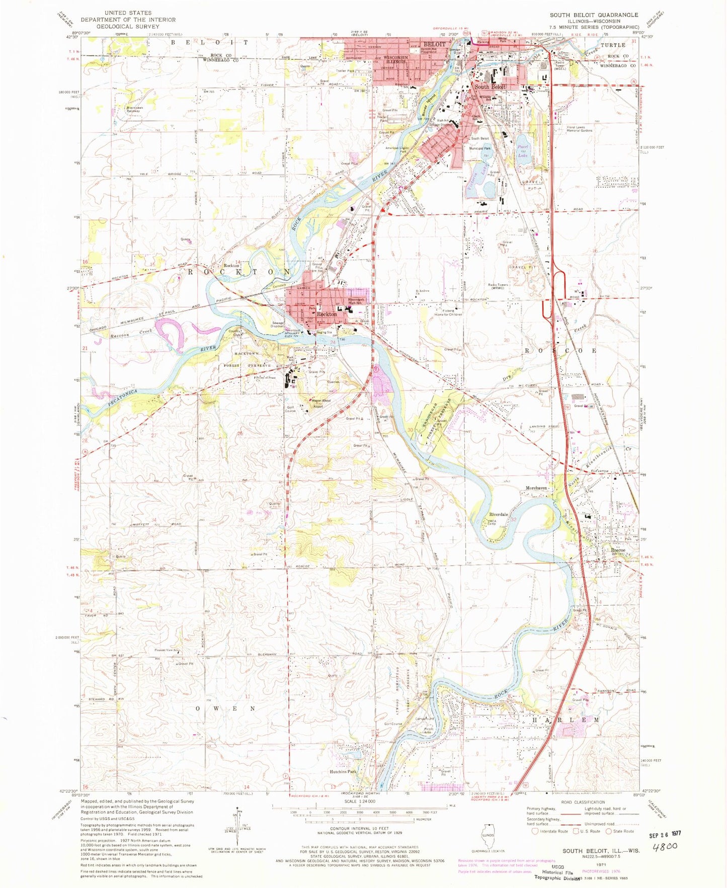
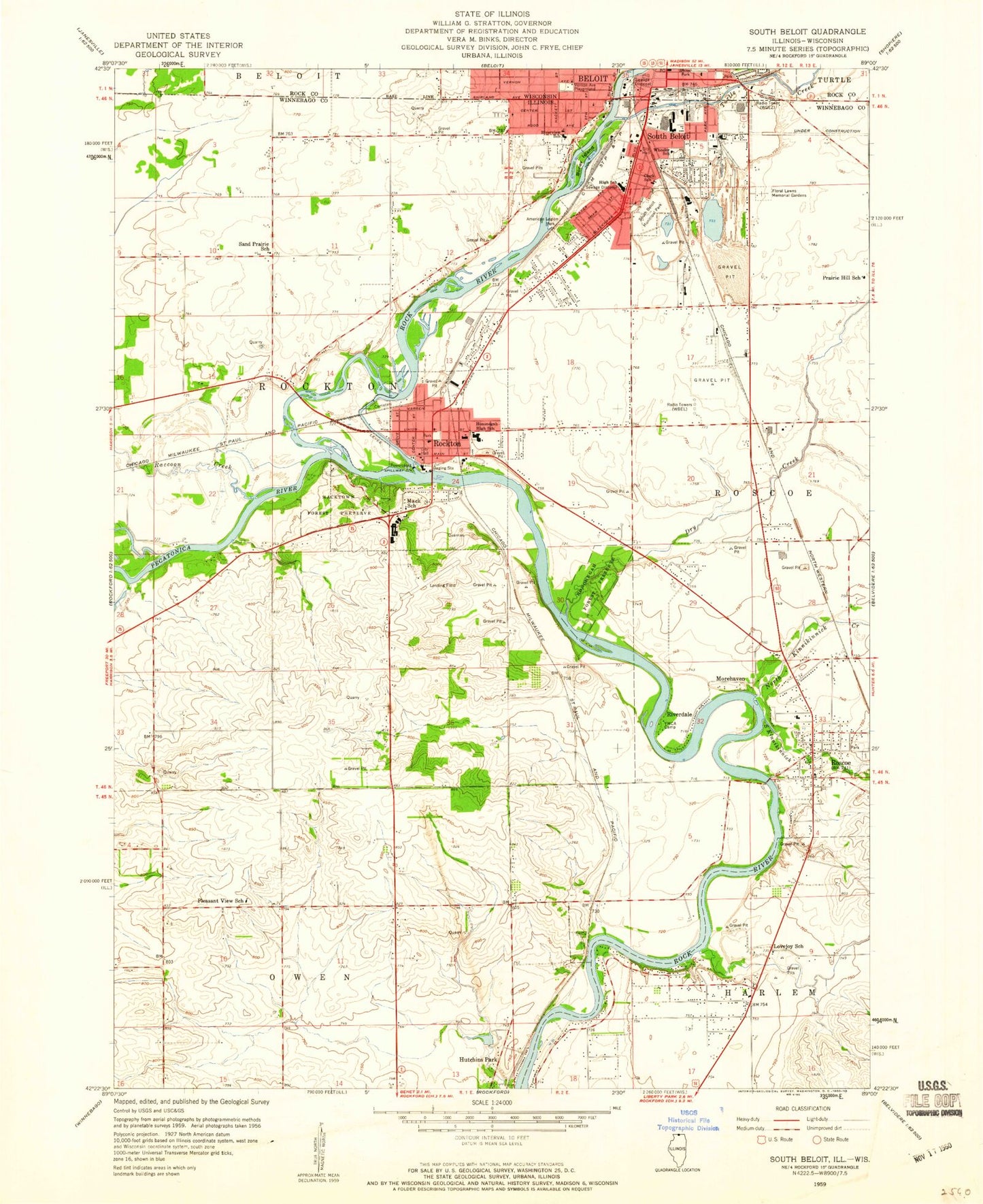
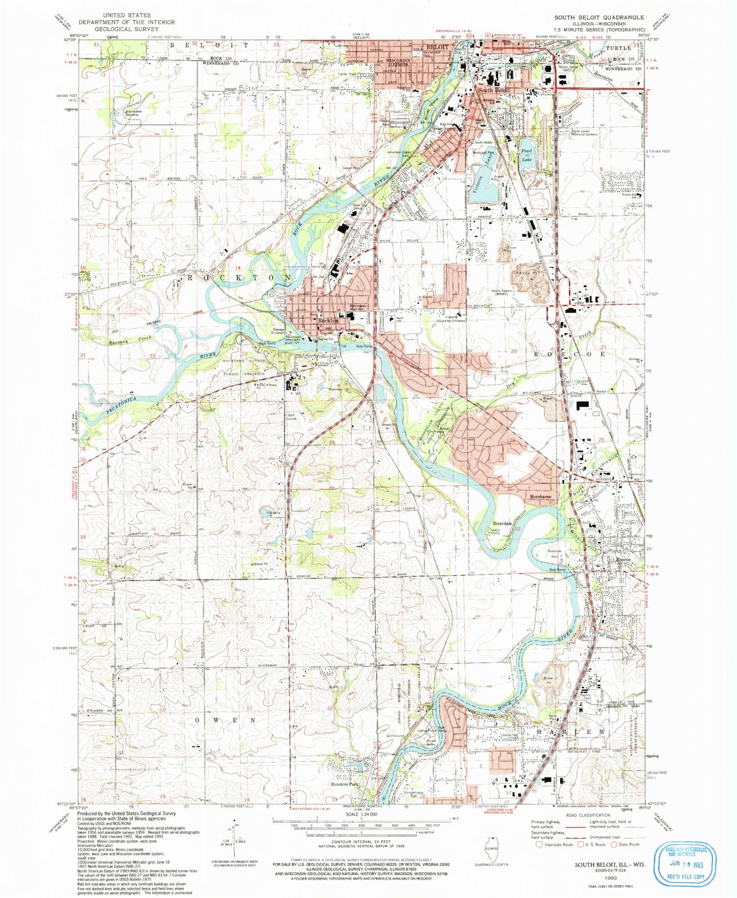
Classic USGS South Beloit Illinois 7.5'x7.5' Topo Map
Couldn't load pickup availability
Historical USGS topographic quad map of South Beloit in the states of Illinois, Wisconsin. Map scale may vary for some years, but is generally around 1:24,000. Print size is approximately 24" x 27"
This quadrangle is in the following counties: Rock, Winnebago.
The map contains contour lines, roads, rivers, towns, and lakes. Printed on high-quality waterproof paper with UV fade-resistant inks, and shipped rolled.
Contains the following named places: American Legion Park, Atwood Homestead County Forest Preserve, Beloit Police Department, Beloit Post Office, Bethel African Methodist Episcopal Church, Blackhawk Farms Raceway Ambulance Service, Blackhawk Farms Raceway LLC Airport, Blackhawk Prairie Park, Blackhawk Raceway, Blacks Quarry Number 127, Boney Island, Canada School, Church of Christ, Church of Saint Thomas the Apostle, City of South Beloit, Clark Elementary School, Dry Creek, Ed Truman Quarry, Eicher Airport, Emmanuel Baptist Church, Faith Lutheran Church, First Congregational Church, First Pentecostal Church, Floberg Home for Children, Floral Lawn Cemetery, Harlem - Roscoe Fire Protection District Station 1, Harlem - Roscoe Fire Protection District Station 3, Harry D Fenton Airport, Heritage Church, Hononegah Community High School, Hononegah County Forest Preserve, Hulland Spring, Hutchins Park, Kieselburg County Forest Preserve, Kinnikinnick School, Latham Park Aero Estates Airport, Leanna Lakeside Park, Mack School, Macktown County Forest Preserve, Mc Curdy Airport, Mechanics Green, Miller Airport, Morehaven, North Kinnikinnick Creek, North Shore Sand and Gravel Pit, Northgate Estates, Old Stone Congregational Church, Pearl Lake, Pecatonica River, Pentecostal Tabernacle Church of God in Christ, Phil-Aire Estates, Players Park, Pleasant View School, Prairie Hill Elementary School, Prince of Peace Lutheran Church, Raccoon Creek, Riverdale, Riverside Park, Riverview Elementary School, Rock River, Rockton, Rockton Bog Nature Preserve, Rockton Dam, Rockton Fire Protection District Station 1, Rockton Grade School, Rockton Historic District, Rockton Post Office, Rockton Township Cemetery, Rockton United Methodist Church, Rockton Village Police Department, Roscoe, Roscoe Police Department, Roscoe Post Office, Roscoe Siding, Saint Andrew Church, Saint Peter Catholic School, Saint Peters Roman Catholic Church, Sand Prairie School, South Beloit, South Beloit Fire Department, South Beloit High School, South Beloit Municipal Park, South Beloit Police Department, South Beloit Post Office, South Bluff Homes, South Kinnikinnick Creek, Stephen Mack Middle School, Taft School, Talcott Free Public Library, Township of Rockton, Turtle Creek, Turtle Creek Park, Vernon Avenue Park, Victoria Lake, Village of Rockton, Village of Roscoe, Walt Williamson Park, WBEL-AM (Beloit), WBEL-AM (South Beloit), WGEZ-AM (Beloit), Wheeler School