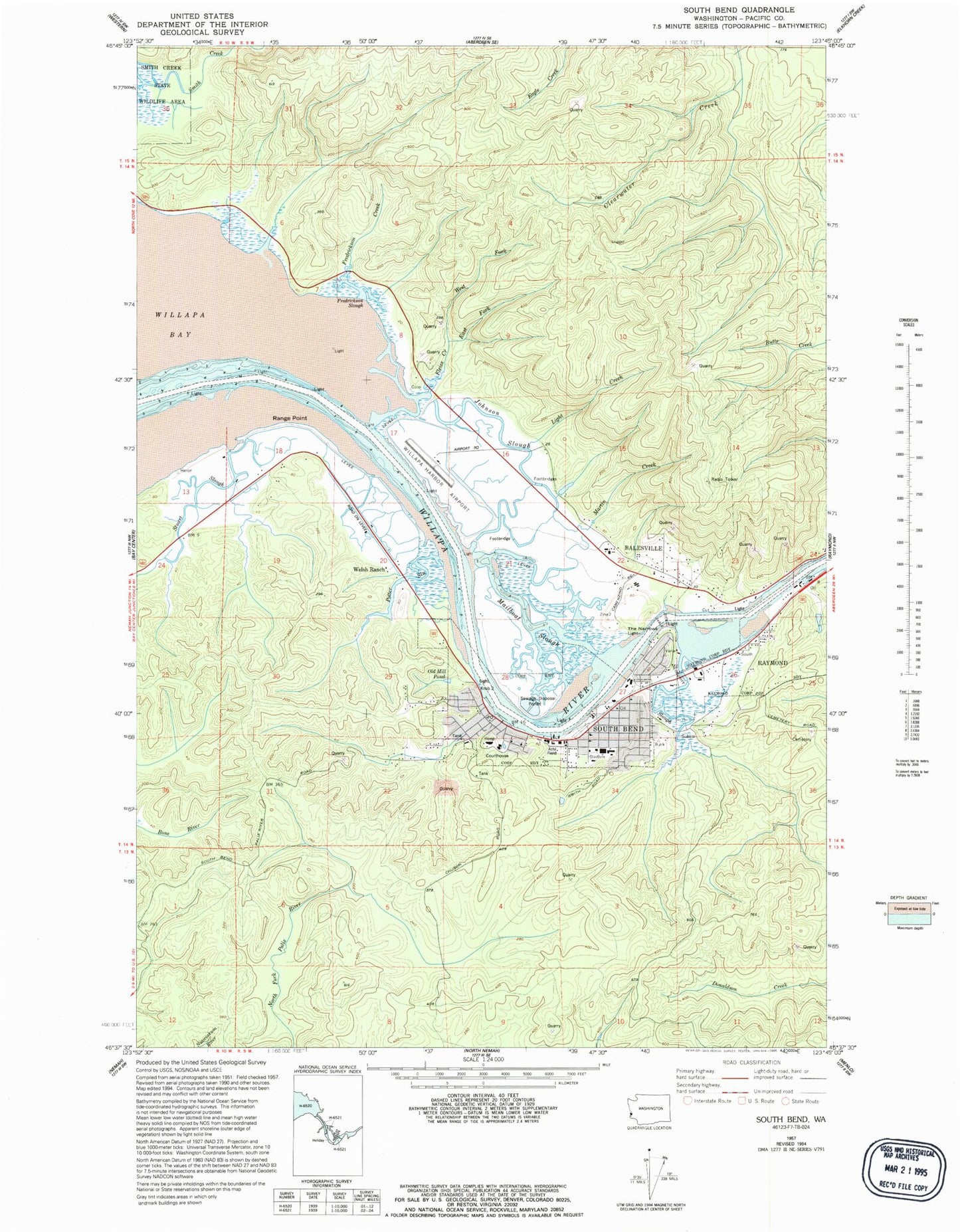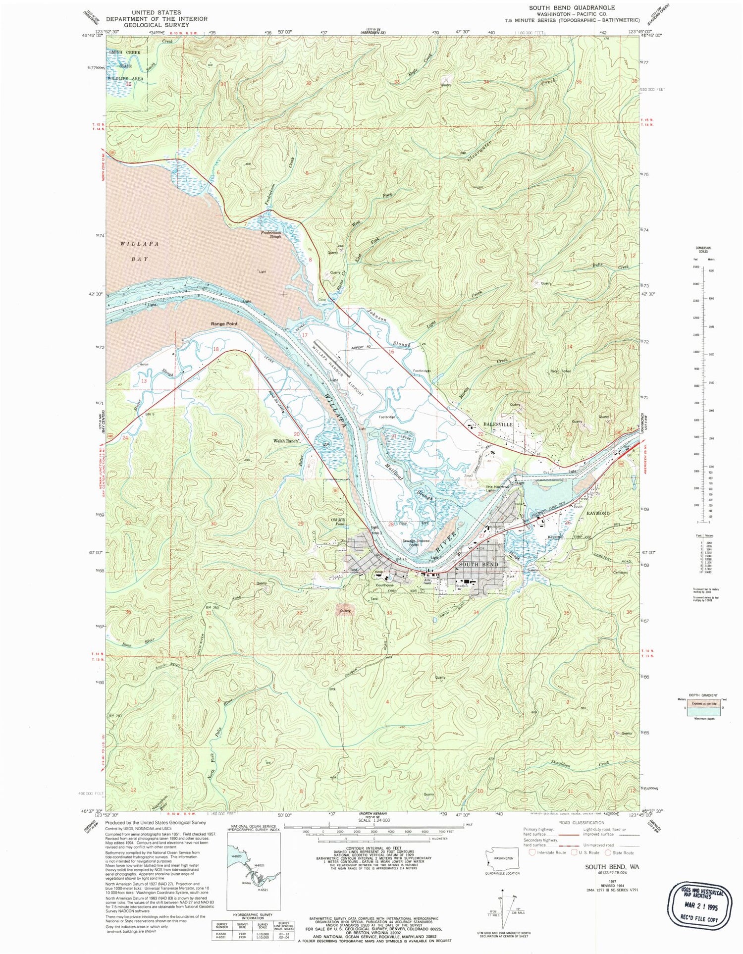
MyTopo
Classic USGS South Bend Washington 7.5'x7.5' Topo Map
Couldn't load pickup availability
Historical USGS topographic quad map of South Bend in the state of Washington. Map scale may vary for some years, but is generally around 1:24,000. Print size is approximately 24" x 27"
This quadrangle is in the following counties: Pacific.
The map contains contour lines, roads, rivers, towns, and lakes. Printed on high-quality waterproof paper with UV fade-resistant inks, and shipped rolled.
Contains the following named places: Alder House Assisted Living Facility, Bale Dam Number One, Bale Dam Number Two, Chauncey Davis Elementary School, City of South Bend, Electric Creek Dam, First Baptist Church, First Lutheran Church, Fredrickson Slough, Grace Community Church, I I Slough, Johnson Slough, KAPA-AM (Raymond), Kellogg Slough, KSWW-FM (Raymond), Mailboat Slough, Martin Creek Dam, Milne Quarry, Old Mill Pond, Old Mill Pond Dam, Pacific County Courthouse, Pacific County Courthouse Annex, Pacific County Museum, Pacific County Sheriff's Office South Bend, Potter Slough, Range Point, Raymond Division, Seahaven, Skidmore Slough, Smith Creek State Wildlife Recreation Area, South Bend, South Bend City Reservoir, South Bend City Reservoir Dam, South Bend Early Learning Center, South Bend High School, South Bend Police Department, South Bend Post Office, South Bend School District Office, South Bend Sewage Treatment Plant, South Bend Timberland Library, South Bend United Methodist Church, South Bend Volunteer Fire Department, Stuart Slough, The Narrows, Welsh Ranch, Willapa Harbor Airport, Willapa Harbor Heliport, Willapa Harbor Hospital, Willapa River