MyTopo
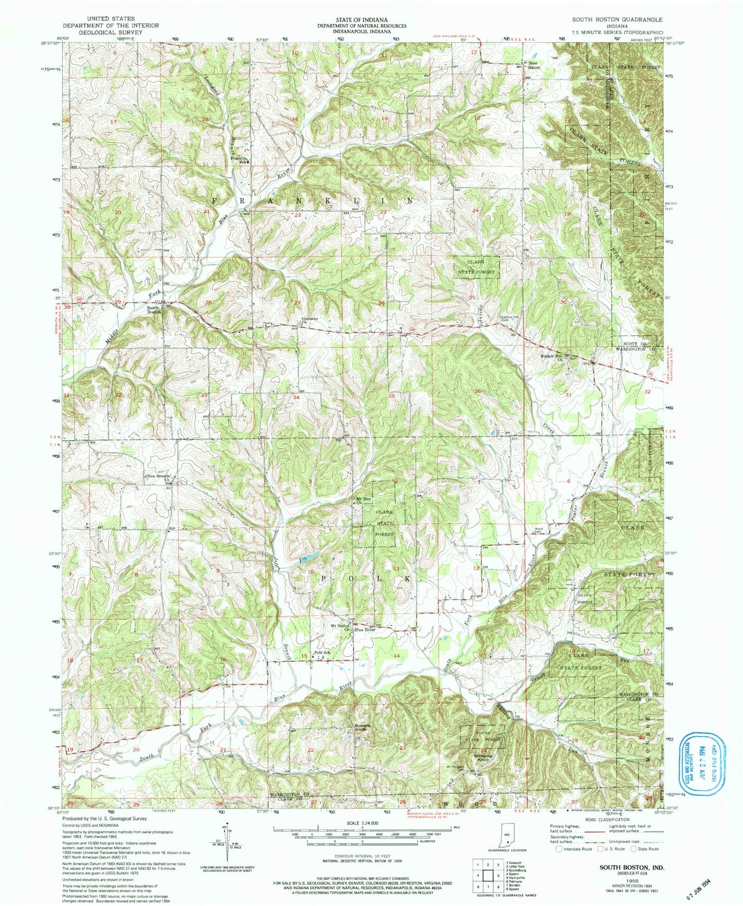
Classic USGS South Boston Indiana 7.5'x7.5' Topo Map
Couldn't load pickup availability
Historical USGS topographic quad map of South Boston in the state of Indiana. Map scale may vary for some years, but is generally around 1:24,000. Print size is approximately 24" x 27"
This quadrangle is in the following counties: Clark, Scott, Washington.
The map contains contour lines, roads, rivers, towns, and lakes. Printed on high-quality waterproof paper with UV fade-resistant inks, and shipped rolled.
Contains the following named places: Bartle, Blue River, Bowers Knob, Bunker Hill, Bunker Hill Church, Chestnut Hill Cemetery, Chestnut Hill Post Office, Clark State Forest, Conoway Church, Daisy Hill, Franklin School, Honey Run, Jeff Branch, Lockwood Branch, Mead Cemetery, Mount Bethel Church, Mount Zion Church, New Salem, North Honey Run, Olive Branch Church, Peek-A-Boo Lake, Peek-A-Boo Lake Dam, Polk School, South Boston, South Poplar Branch, Springle Creek, Swayback Cemetery, Township of Franklin, Township of Polk, Whiskey Run, Williams Knob