MyTopo
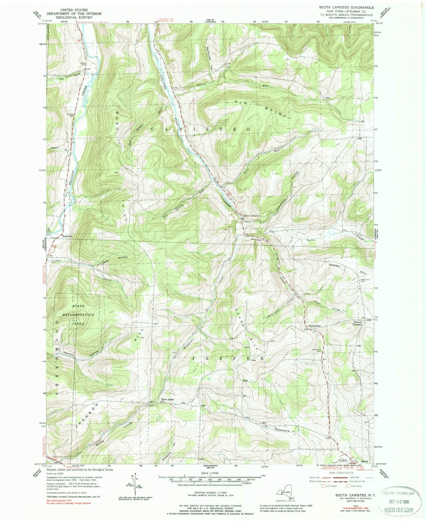
Classic USGS South Canisteo New York 7.5'x7.5' Topo Map
Couldn't load pickup availability
Historical USGS topographic quad map of South Canisteo in the state of New York. Map scale may vary for some years, but is generally around 1:24,000. Print size is approximately 24" x 27"
This quadrangle is in the following counties: Steuben.
The map contains contour lines, roads, rivers, towns, and lakes. Printed on high-quality waterproof paper with UV fade-resistant inks, and shipped rolled.
Contains the following named places: Banks Hollow, Barkalow Hollow, Bennetts, Bennetts Cemetery, Bennetts Creek Bible Church, Brickyard Creek, Bush Hill, Bush Hill School, Carter Cemetery, Carter School, Dennis Corners, Dennis Creek, Drake School, Fall Creek, Grass Hill, Gravel Run, Gravel Run Hill School, Gravel Run School, Gully Cemetery, Gully School, Hampshire, Hampshire Cemetery, Jackson Hill, Jasper Cemetery, Klein School, Leahy Hollow, Marsh Hill, Marsh Hill Cemetery, Milwaukee Creek, Norton Hollow School, Old Blady, Peak Creek, Putman School, Red Spring Run, Rock Run, Slate Creek, South Canisteo, Spaulding Hollow, Spring Brook Church, State Road School, Sugar Creek, Thomas Cemetery, Town of Canisteo, Town of Jasper, Two Bridge Run, West Jasper Wesleyan Church, Woodward School, ZIP Code: 14823