MyTopo
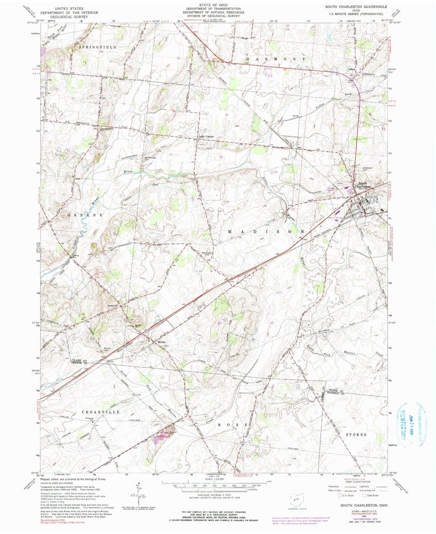
Classic USGS South Charleston Ohio 7.5'x7.5' Topo Map
Couldn't load pickup availability
Historical USGS topographic quad map of South Charleston in the state of Ohio. Map scale may vary for some years, but is generally around 1:24,000. Print size is approximately 24" x 27"
This quadrangle is in the following counties: Clark, Greene, Madison.
The map contains contour lines, roads, rivers, towns, and lakes. Printed on high-quality waterproof paper with UV fade-resistant inks, and shipped rolled.
Contains the following named places: Bloxom Cemetery, Briggs School, Buffenbarger Cemetery, Cortsville, Dolly Varden, Dublin School, First Presbyterian Church of South Charleston, Green Plain Monthly Meetinghouse, Greenlawn Cemetery, Lisbon, Lisbon Airfield, Lisbon Cemetery, Lisbon Fork, Locust Hills Golf Course, Madison Township Fire Department and Emergency Medical Services, Methodist Cemetery, Miami View Elementary School, Old Quaker Cemetery, Pleasant Grove Cemetery, Pleasant Grove Church, Selma, Selma Church, Selma Methodist Episcopal Cemetery, Selma Post Office, South Charleston, South Charleston Historic District, South Charleston Police Department, South Charleston Post Office, South Charleston United Methodist Church, Southeastern High School, Township of Madison, Village of South Charleston, ZIP Code: 45368