MyTopo
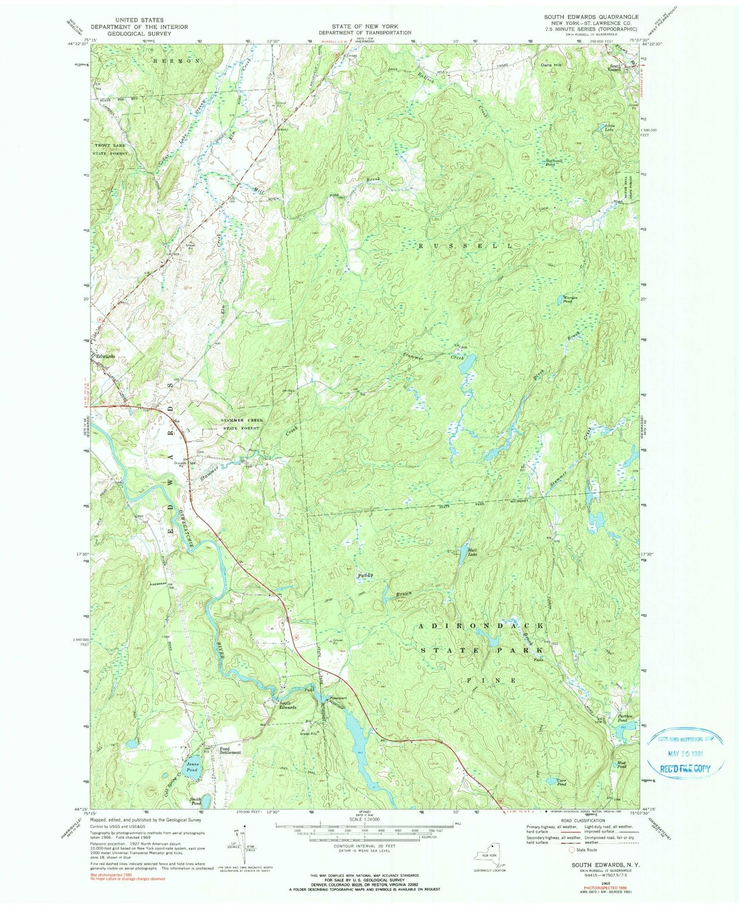
Classic USGS South Edwards New York 7.5'x7.5' Topo Map
Couldn't load pickup availability
Historical USGS topographic quad map of South Edwards in the state of New York. Map scale may vary for some years, but is generally around 1:24,000. Print size is approximately 24" x 27"
This quadrangle is in the following counties: St. Lawrence.
The map contains contour lines, roads, rivers, towns, and lakes. Printed on high-quality waterproof paper with UV fade-resistant inks, and shipped rolled.
Contains the following named places: Birch Brook, Carr Pond, Cedar Lake Stream, Dana Hill, Edwards - Knox Elementary School, Edwards - Knox Junior - Senior High School, Edwards Post Office, Gotham Family Farm, Hall Lake, Hepburn Library of Edwards, Jones Pond, Little Lake, Mill Brook, Mud Pond, New Beginnings Assembly of God, Paddy Brown Brook, Partlow Pond, Pond Settlement, Smith Pond, South Edwards, South Russell, Stammer Creek, Stammer Creek State Forest, Stockwell Pond, Trout Lake State Forest, Warden Pond, ZIP Code: 13639