MyTopo
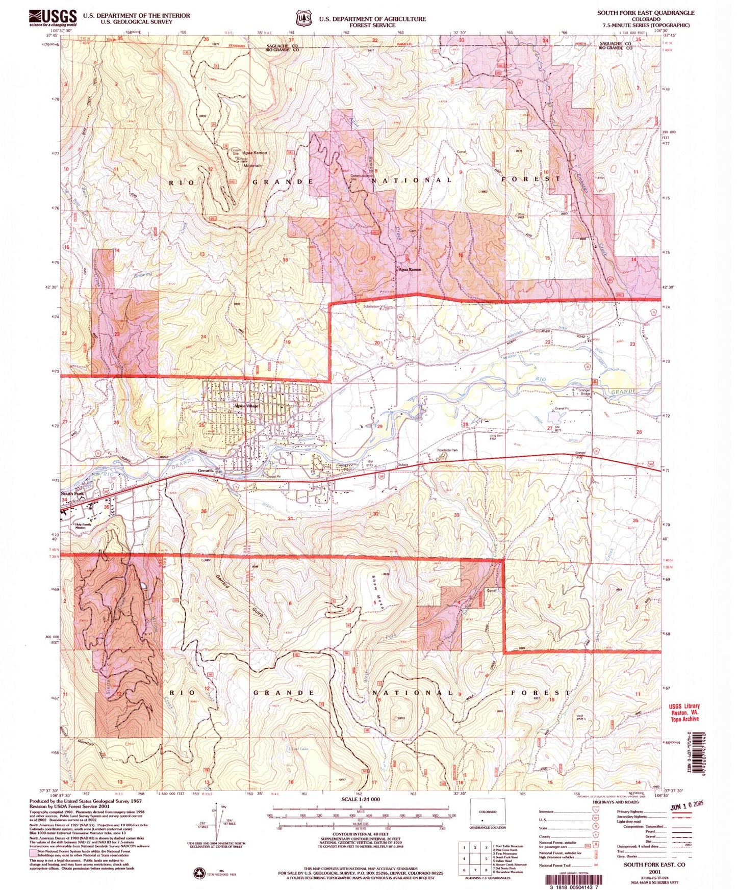
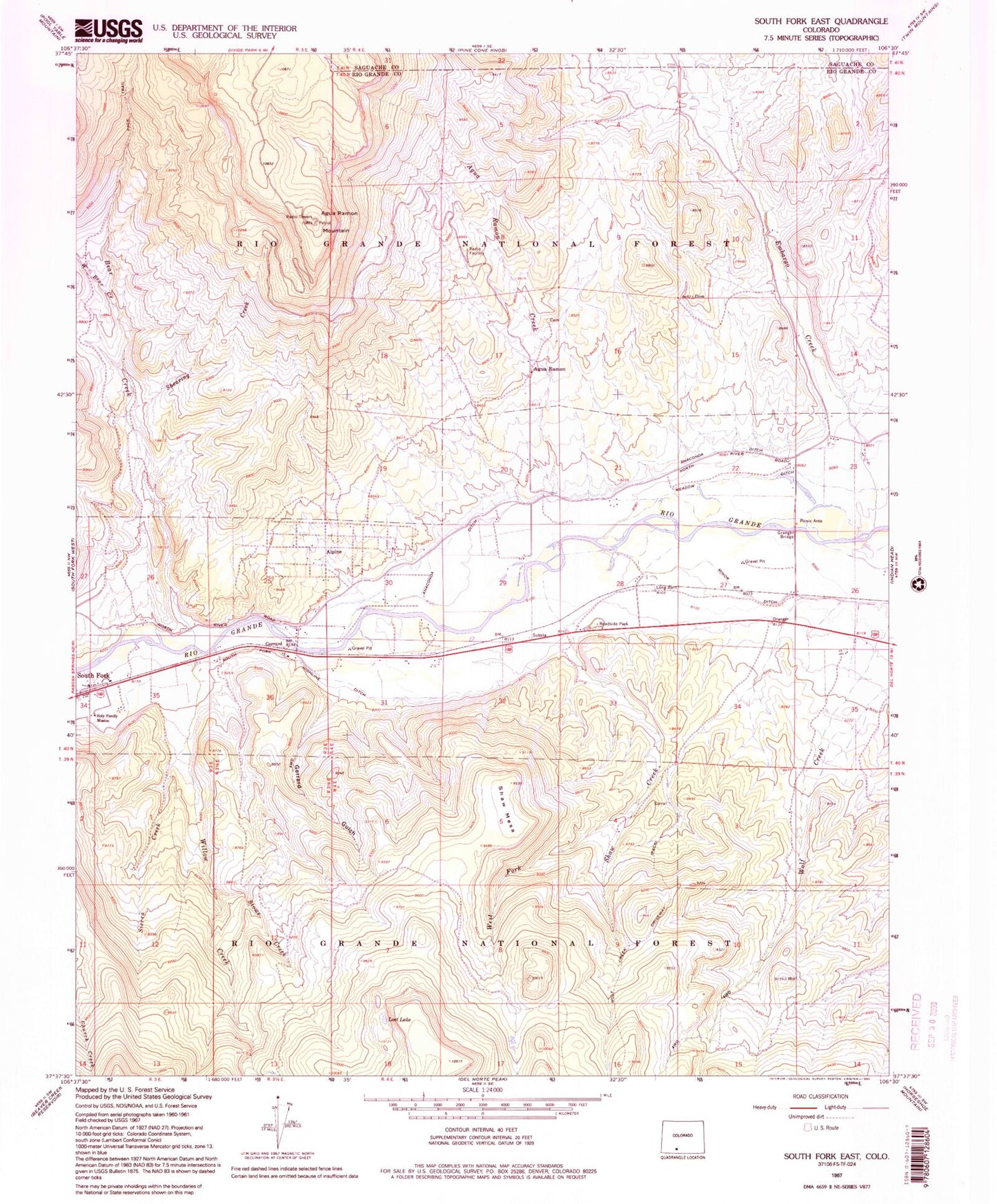
Classic USGS South Fork East Colorado 7.5'x7.5' Topo Map
Couldn't load pickup availability
Historical USGS topographic quad map of South Fork East in the state of Colorado. Map scale may vary for some years, but is generally around 1:24,000. Print size is approximately 24" x 27"
This quadrangle is in the following counties: Rio Grande, Saguache.
The map contains contour lines, roads, rivers, towns, and lakes. Printed on high-quality waterproof paper with UV fade-resistant inks, and shipped rolled.
Contains the following named places: Agua Ramon, Agua Ramon Creek, Agua Ramon Mountain, Alpine, Alpine Census Designated Place, Anaconda Ditch, Aqua Ramon Creek, Baughman Creek, Bear Creek, Beaver Park Dam, Beaver Park Reservoir, Chapman Field Airport, Embargo Creek, Gerrard, Gerrard Census Designated Place, Gerrard Gulch, Granger Bridge, Holy Family Mission, Lost Lake, Meadow Ditch, Minor Ditch, Morning Shadows Ranch Airport, New Hope Community Church, Poage Dam, Poage Reservoir, Rio Grande National Forest, Shaw Creek, Shaw Mesa, Shearing Creek, Sierra Creek, South Fork Highline Ditch, Stowe Creek, West Bear Creek, West Fork Shaw Creek, Willow Creek, Wolf Creek