MyTopo
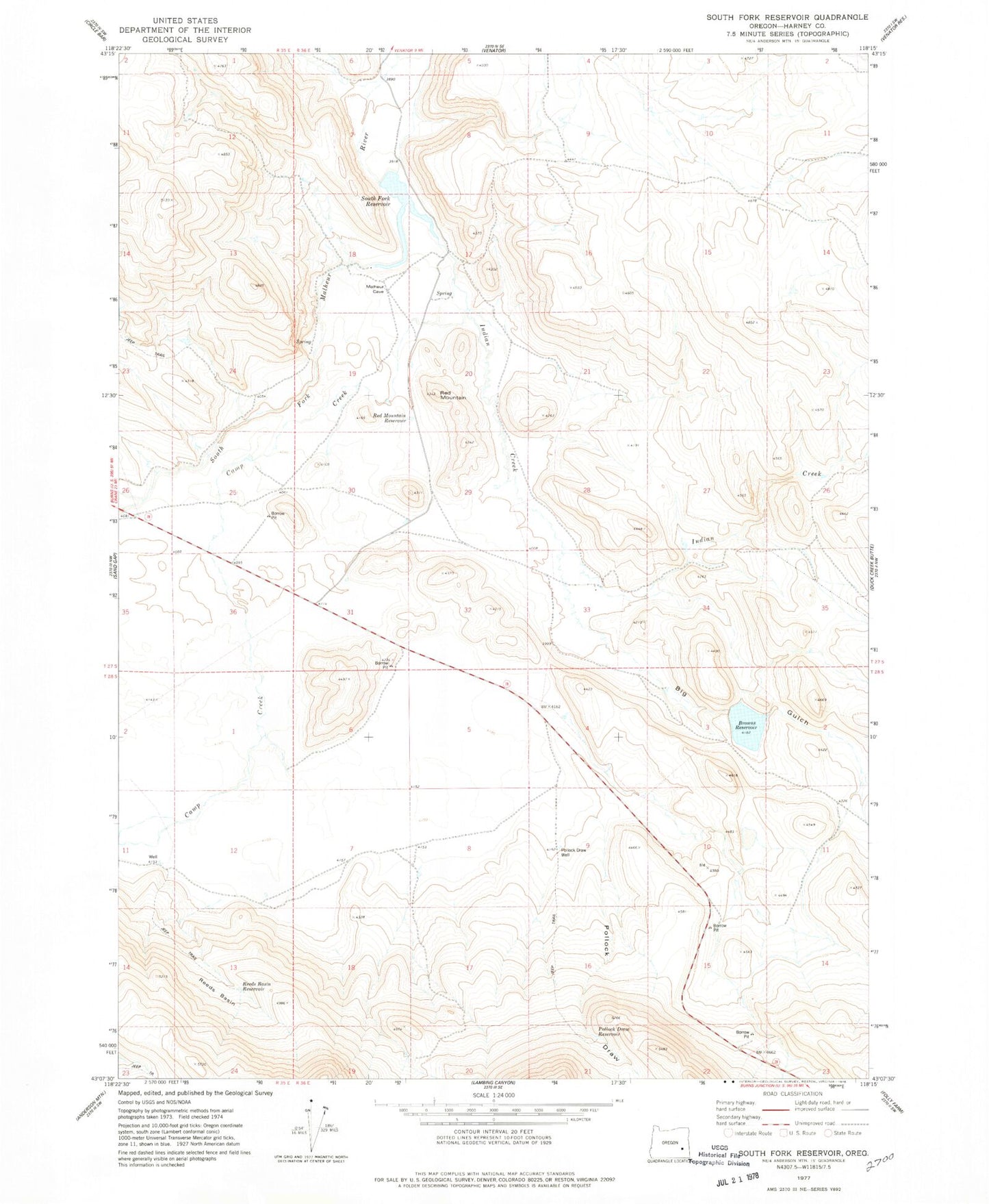
Classic USGS South Fork Reservoir Oregon 7.5'x7.5' Topo Map
Couldn't load pickup availability
Historical USGS topographic quad map of South Fork Reservoir in the state of Oregon. Map scale may vary for some years, but is generally around 1:24,000. Print size is approximately 24" x 27"
This quadrangle is in the following counties: Harney.
The map contains contour lines, roads, rivers, towns, and lakes. Printed on high-quality waterproof paper with UV fade-resistant inks, and shipped rolled.
Contains the following named places: A E Brown Dam, Barren Valley, Barren Valley Reservoir, Basin Reservoir, Big Gulch, Browns Feed Canal, Browns Reservoir, Camp Creek, Carry Reservoir, Dewdrop Reservoir, Dry Creek, Green Reservoir, Halfway Reservoir, Indian Creek, Indian Reservoir, Jewell Reservoir, Johnson Reservoir, Lost Reservoir, Pollock Draw, Pollock Draw Reservoir, Pollock Draw Well, Red Hen Reservoir, Red Mountain, Red Mountain Reservoir, Reeds Basin, Reeds Basin Reservoir, South Fork Reservoir, South Fork Waterhole