MyTopo
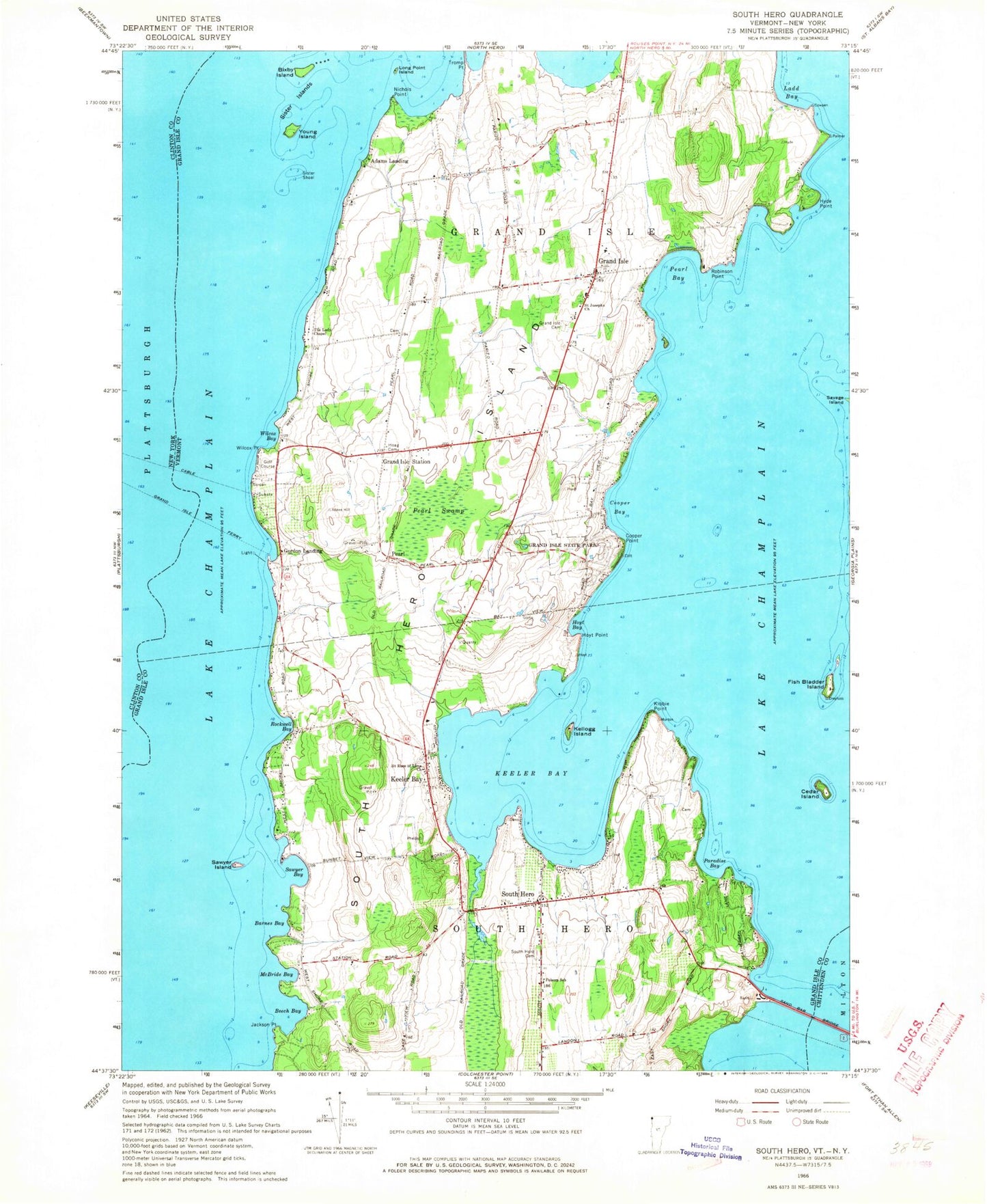
Classic USGS South Hero Vermont 7.5'x7.5' Topo Map
Couldn't load pickup availability
Historical USGS topographic quad map of South Hero in the states of Vermont, New York. Typical map scale is 1:24,000, but may vary for certain years, if available. Print size: 24" x 27"
This quadrangle is in the following counties: Chittenden, Clinton, Grand Isle.
The map contains contour lines, roads, rivers, towns, and lakes. Printed on high-quality waterproof paper with UV fade-resistant inks, and shipped rolled.
Contains the following named places: Barnes Bay, Beech Bay, Bixby Island, Cedar Island, Cooper Bay, Cooper Point, Fish Bladder Island, Folsom Educational and Community Center, Grand Isle, Grand Isle Cemetery, Grand Isle Ferry, Grand Isle State Park, Grand Isle Station, Hoag Cemetery, Hoyt Bay, Hoyt Point, Hyde Point, Keeler Bay, Keeler Bay, Kellogg Island, Ladd Bay, Long Point Island, McBride Bay, Nichols Point, Paradise Bay, Pearl, Pearl Bay, Pearl Swamp, Robinson Point, Rockwell Bay, Saint Josephs Church, Saint Rose of Lima Church, Sand Bar Bridge, Sawyer Bay, Sawyer Island, Sister Islands, Sister Shoal, South Hero, South Hero Cemetery, South Hero Island, The Lady Chapel, Wilcox Bay, Wilcox Point, Young Island, Gordon Landing, Adams Landing, Maycrest Camp, Apple Island Campground and Marina, Kibbe Point, Jackson Point, Town of Grand Isle, Town of South Hero, Camp Merrycrest, Grand Isle School, Grand Isle Library, Grand Isle Post Office, Old Stone Inn (historical), Quaker and Macomber Cemetery, South Hero Bicentennial Museum, South Hero Community Library, South Hero Post Office, Wilcox Cove Golf Course, Appletree Bay Campground, Grand Isle Fire Department, South Hero Volunteer Fire Department, Grand Isle Rescue Squad, South Hero Rescue Squad, South Hero Census Designated Place, Grand Isle Ferry


