MyTopo
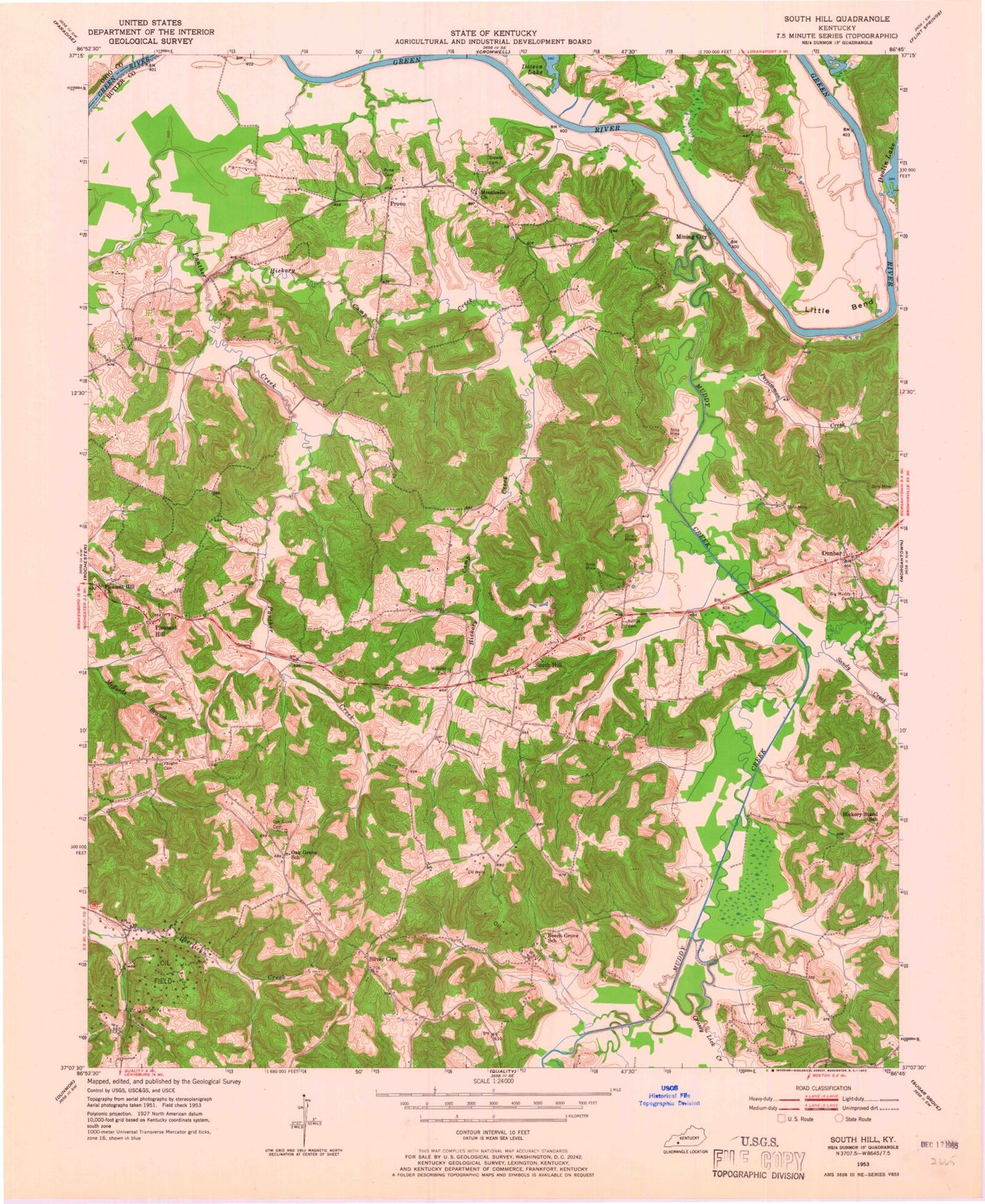
Classic USGS South Hill Kentucky 7.5'x7.5' Topo Map
Couldn't load pickup availability
Historical USGS topographic quad map of South Hill in the state of Kentucky. Map scale may vary for some years, but is generally around 1:24,000. Print size is approximately 24" x 27"
This quadrangle is in the following counties: Butler, Ohio.
The map contains contour lines, roads, rivers, towns, and lakes. Printed on high-quality waterproof paper with UV fade-resistant inks, and shipped rolled.
Contains the following named places: Beech Grove School, Bethel Cemetery, Big Muddy Cemetery, Doolin - Rone Cemetery, Doolin Lake, Dunbar, Grassy Lick Creek, Hickory Camp Creek, Hickory Stand, Hickory Stand School, Hope, Little Bend, McCoytown, Mining City, Monticello Church, Monticello Church Cemetery, Muddy Creek, Oak Grove Cemetery, Oak Grove School, Persimmon Creek, Pleasant Hill, Pleasant Hill Church, Provo, Rochester Division, Sandy Creek, Silver City, South Hill, Stringtown, Vaughn Cemetery, Webster Cemetery, ZIP Code: 42273