MyTopo
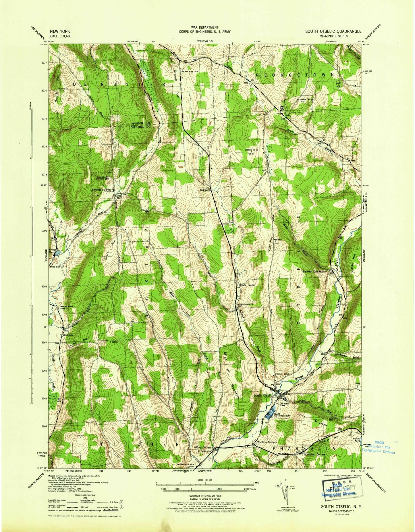
Classic USGS South Otselic New York 7.5'x7.5' Topo Map
Couldn't load pickup availability
Historical USGS topographic quad map of South Otselic in the state of New York. Map scale may vary for some years, but is generally around 1:24,000. Print size is approximately 24" x 27"
This quadrangle is in the following counties: Chenango, Madison.
The map contains contour lines, roads, rivers, towns, and lakes. Printed on high-quality waterproof paper with UV fade-resistant inks, and shipped rolled.
Contains the following named places: Ashbell Brook, Bucks Brook, Camp Georgetown, Cary Hill, Crumb Hill, Crumb Hill Cemetery, First Baptist Church, Glading Brook, Knapp Pond, Lane Hill, Lane School, Lincklaen Center, Lincklaen Center Cemetery, Mariposa, Marstan Farms, North West Corners Cemetery, Northwest Corners, Otselic Valley Junior - Senior High School, Parce Mountain, Pond School, Rhode Island, Rhode Island Cemetery, Seventh Day Hollow, Seventh Day Hollow Cemetery, Silas Hill Mountain, South Hill, South Otselic, South Otselic Post Office, South Otselic Volunteer Fire Department, Thompson Brook, Town of Lincklaen, Truman Hill, Ufford Cemetery, Ufford Corners, Valley View Cemetery, Waldron Corners, Woodlawn Cemetery, ZIP Codes: 13052, 13124, 13155