
MyTopo
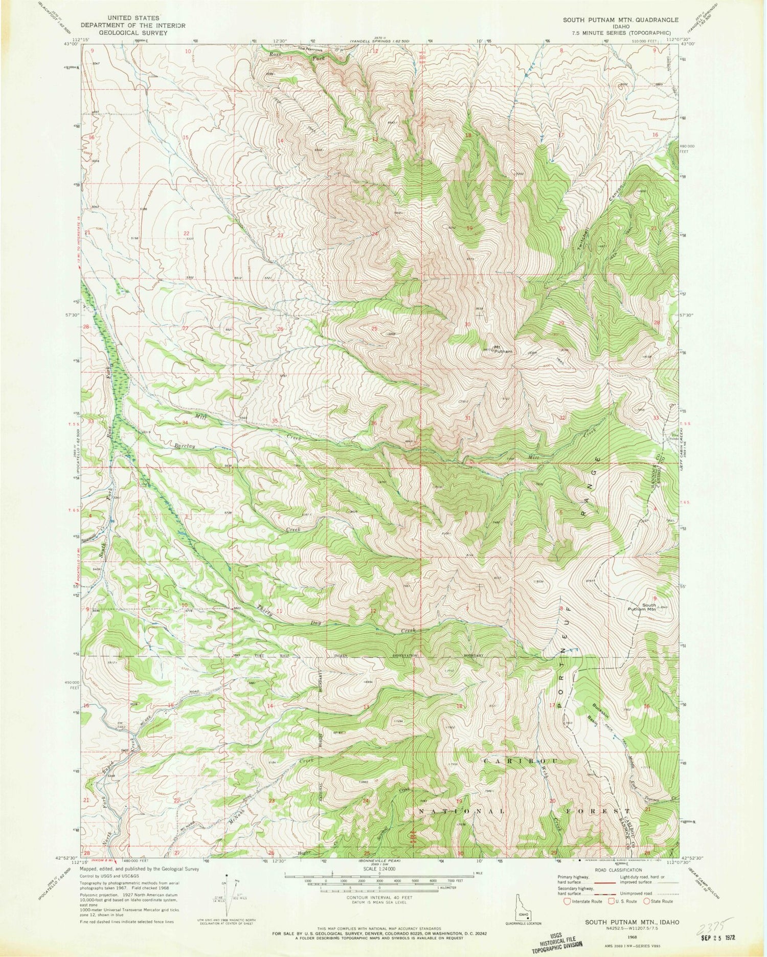
Classic USGS South Putnam Mountain Idaho 7.5'x7.5' Topo Map
Regular price
$16.95
Regular price
Sale price
$16.95
Unit price
per
Couldn't load pickup availability
Historical USGS topographic quad map of South Putnam Mountain in the state of Idaho. Map scale may vary for some years, but is generally around 1:24,000. Print size is approximately 24" x 27"
This quadrangle is in the following counties: Bannock, Caribou.
The map contains contour lines, roads, rivers, towns, and lakes. Printed on high-quality waterproof paper with UV fade-resistant inks, and shipped rolled.
Contains the following named places: Barclay Creek, Buckskin Basin, Five Points, Mill Creek, Mount Putnam, Sawmill Creek, South Putnam Mountain, The Narrows, Thirty Day Creek, Twitchell Canyon, ZIP Code: 83202


