MyTopo
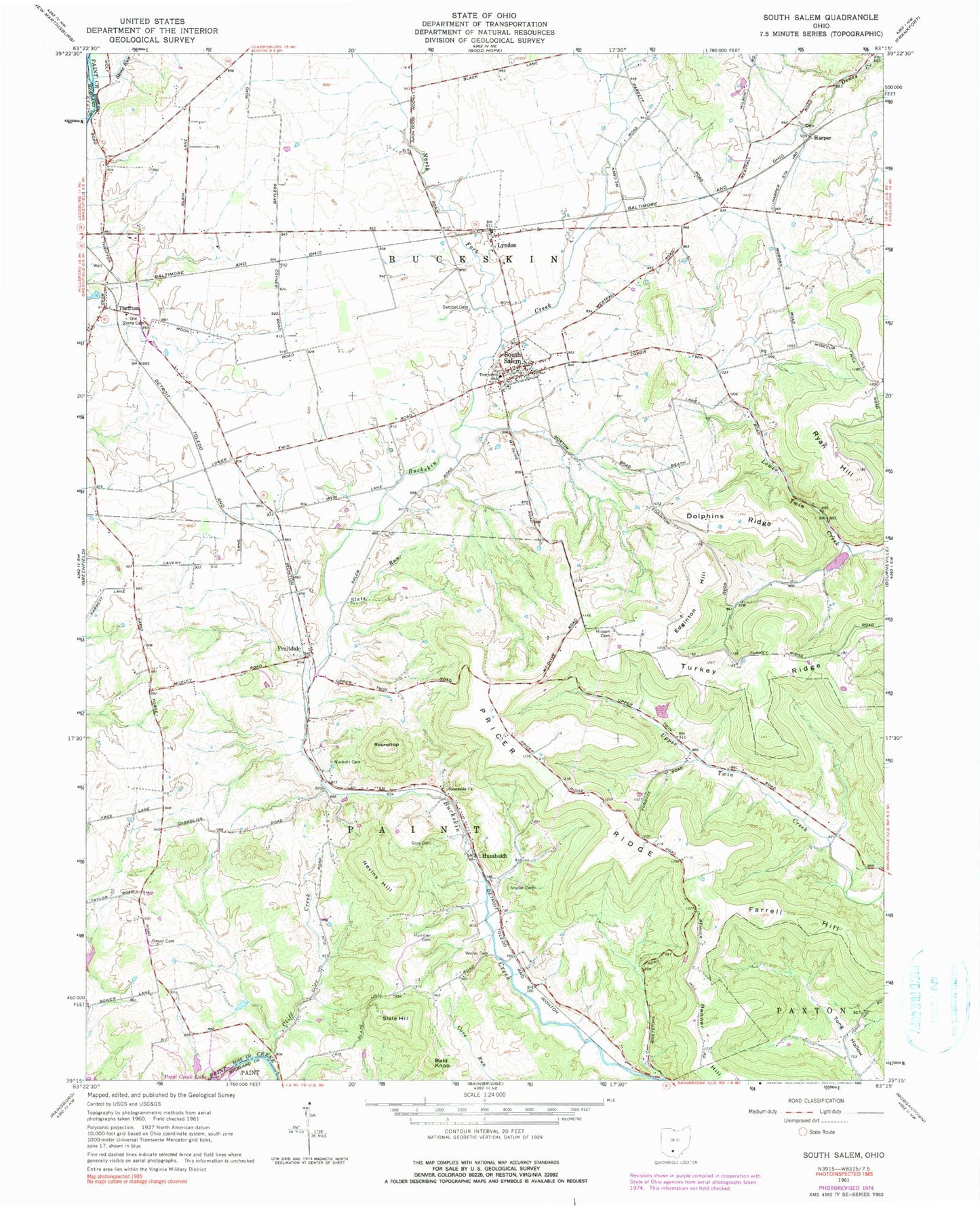
Classic USGS South Salem Ohio 7.5'x7.5' Topo Map
Couldn't load pickup availability
Historical USGS topographic quad map of South Salem in the state of Ohio. Typical map scale is 1:24,000, but may vary for certain years, if available. Print size: 24" x 27"
This quadrangle is in the following counties: Highland, Ross.
The map contains contour lines, roads, rivers, towns, and lakes. Printed on high-quality waterproof paper with UV fade-resistant inks, and shipped rolled.
Contains the following named places: Dolphins Ridge, Dwyer Cemetery, Grey Cemetery, Hixson Cemetery, Hymiller Cemetery, Nevins Hill, North Fork Buckskin Creek, Nuckols Cemetery, Old Stone Cemetery, Roundtop, Ryan Hill, Satchel Cemetery, Slate Run, Snyder Cemetery, Stone Run, Sunnyside Church, Weller Cemetery, Bald Knob, Slate Hill, Buckskin Elementary School, Harper School (historical), Dhume School (historical), Morton School (historical), Brown School (historical), Beech Glen School (historical), Mount Olive School (historical), Sunnyside School (historical), Valley School (historical), Blain School (historical), Middleton School (historical), Dwyer School (historical), Pricer Ridge, Turkey Ridge, Lyndon, Fruitdale, Thrifton, Harper, Humboldt, South Salem, Benner Hill, Cliff Creek, New Salem (historical), Buckskin Bridge, Edginton Hill, Paint Creek Dam, Paint Creek Lake, Crawley Lake Dam, Crawley Lake, Ross Field, Township of Buckskin, Township of Paint, Harper Cemetery, South Salem Cemetery, Fruitdale Post Office (historical), Lyndon Post Office, Humboldt Post Office (historical), Thrifton Post Office (historical), South Salem Post Office, Village of South Salem, Caldwell Farm, Barton Farms, Turtlerock Farm, Shoemaker Farm, Blueberry Hill Farm