MyTopo
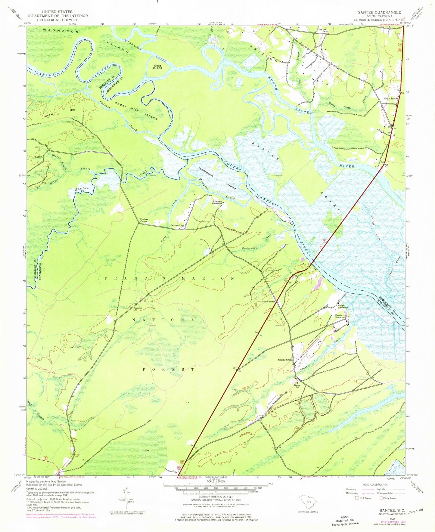
Classic USGS South Santee South Carolina 7.5'x7.5' Topo Map
Couldn't load pickup availability
Historical USGS topographic quad map of South Santee in the state of South Carolina. Map scale may vary for some years, but is generally around 1:24,000. Print size is approximately 24" x 27"
This quadrangle is in the following counties: Berkeley, Charleston, Georgetown.
The map contains contour lines, roads, rivers, towns, and lakes. Printed on high-quality waterproof paper with UV fade-resistant inks, and shipped rolled.
Contains the following named places: Awendaw Fire District Station 6, Big Morgan Branch, Bonny Clabber Creek, Bouman Branch, Cedar Creek, Cedar Hill, Cedar Hill Island, Chicken Creek, Collins Creek, Crow Hill, Daniels Island, Elmwood Hunt Camp, Fairfield Plantation, Fawn Hill School, Garfish Creek, Georgetown Fire Department Station 2, Germantown, Germantown Church, Germanville School, Goat Island, Hampton Creek, Hampton Island, Hampton Plantation, Hampton Plantation State Park, Harrietta Plantation, Hopsewee Plantation, John T Stevens Memorial Bridge, Little Morgan Branch, Lynches Ferry, Mazycks Ferry, Montgomery Creek, Moss Swamp School, Mount Zion Cemetery, Mount Zion Church, Mount Zion School, North Santee, Pole Branch, Push and Go Creek, Saint James Church, Sampit-North Santee Division, Santee Park, Santee River, Santee School, Singleton African Methodist Episcopal Church, South Santee, Wadmacon Creek, Wambaw Corner, Wambaw Creek, Washo Reserve, Water Horn Ferry, Waterhorn Historical Area, Wedge Plantation