MyTopo
USGS Classic South Sister Oregon 7.5'x7.5' Topo Map
Couldn't load pickup availability
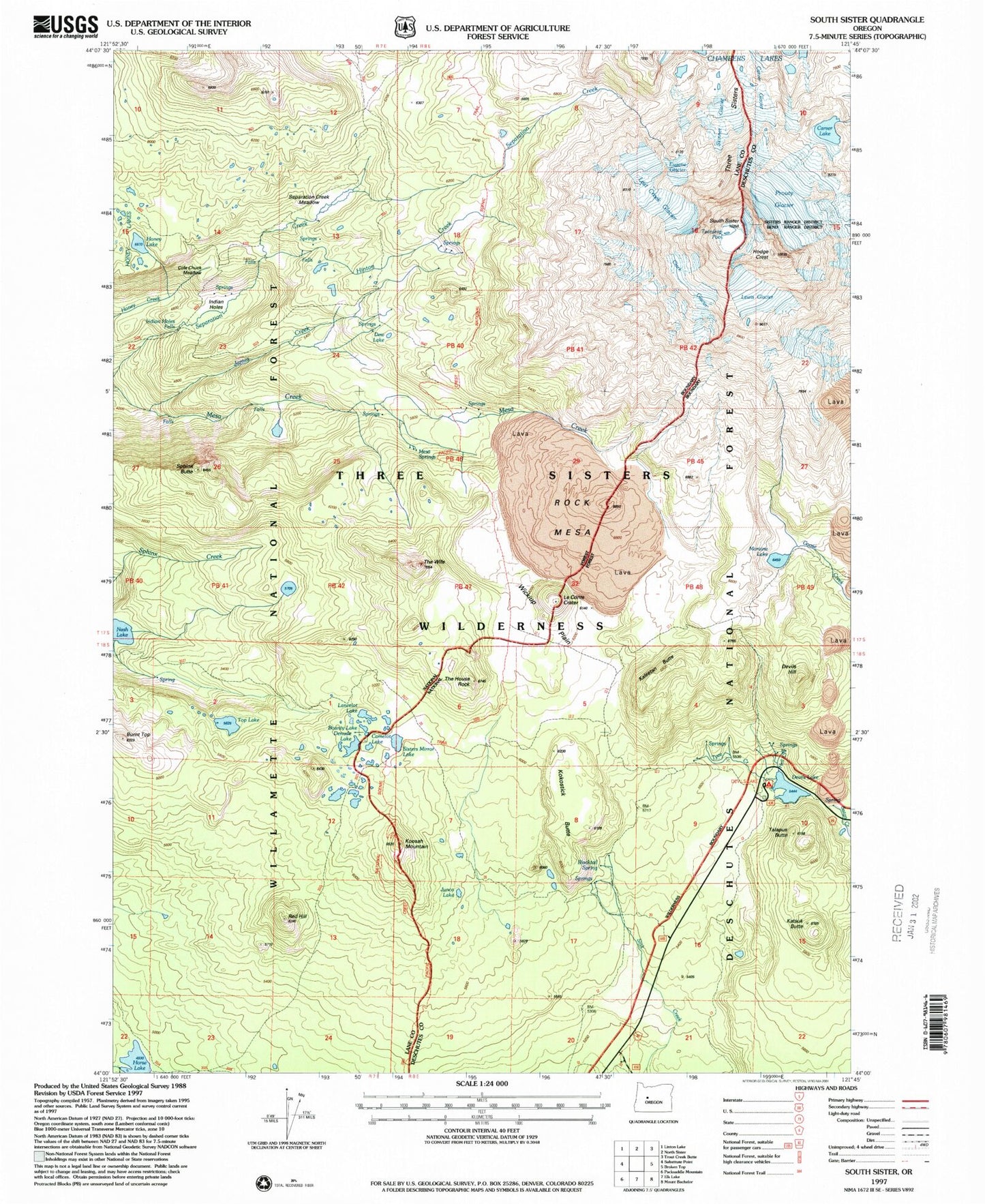
Historical USGS topographic quad map of South Sister in the state of Oregon. Scale: 1:24000. Print size: 24" x 27"
This quadrangle is in the following counties: Deschutes, Lane.
The map contains contour lines, roads, rivers, towns, lakes, and grids including latitude / longitude and UTM / MGRS. Printed on high-quality waterproof paper with UV fade-resistant inks.
Contains the following named places: Hell Creek, Satan Creek, Blacktail Spring, Bounty Lake, Burnt Top, Camelot Lake, Carver Lake, Clark Glacier, Cole Chuck Meadow, Denude Lake, Devils Garden Forest Camp (historical), Devils Hill, Devils Lake, Dew Lake, Eugene Glacier, Hinton Creek, Honey Lake, Indian Holes, James Creek, James Creek Shelter, Junco Lake, Kaleetan Butte, Katsuk Butte, Koosah Mountain, Lancelot Lake, Le Conte Crater, Lewis Glacier, Lost Creek Glacier, Mirror Lake Trail, Moraine Lake, Moraine Lake Trail, Prouty Glacier, Red Hill, Rock Mesa, Satan Creek Forest Camp, Separation Creek Meadow, Sisters Mirror Lake, Skinner Glacier, South Sister, Sphinx Butte, Talapus Butte, The House Rock, The Wife, Three Sisters, Top Lake, Tyee Creek, Wickiup Plain, Wickiup Plain Trail, Indian Hole Falls, Mesa Springs, Hodge Crest, Teardrop Pool, Frazier Upland, Reese Lake, Devils Lake Recreation Site, Kokostick Butte, Horse Lake