MyTopo
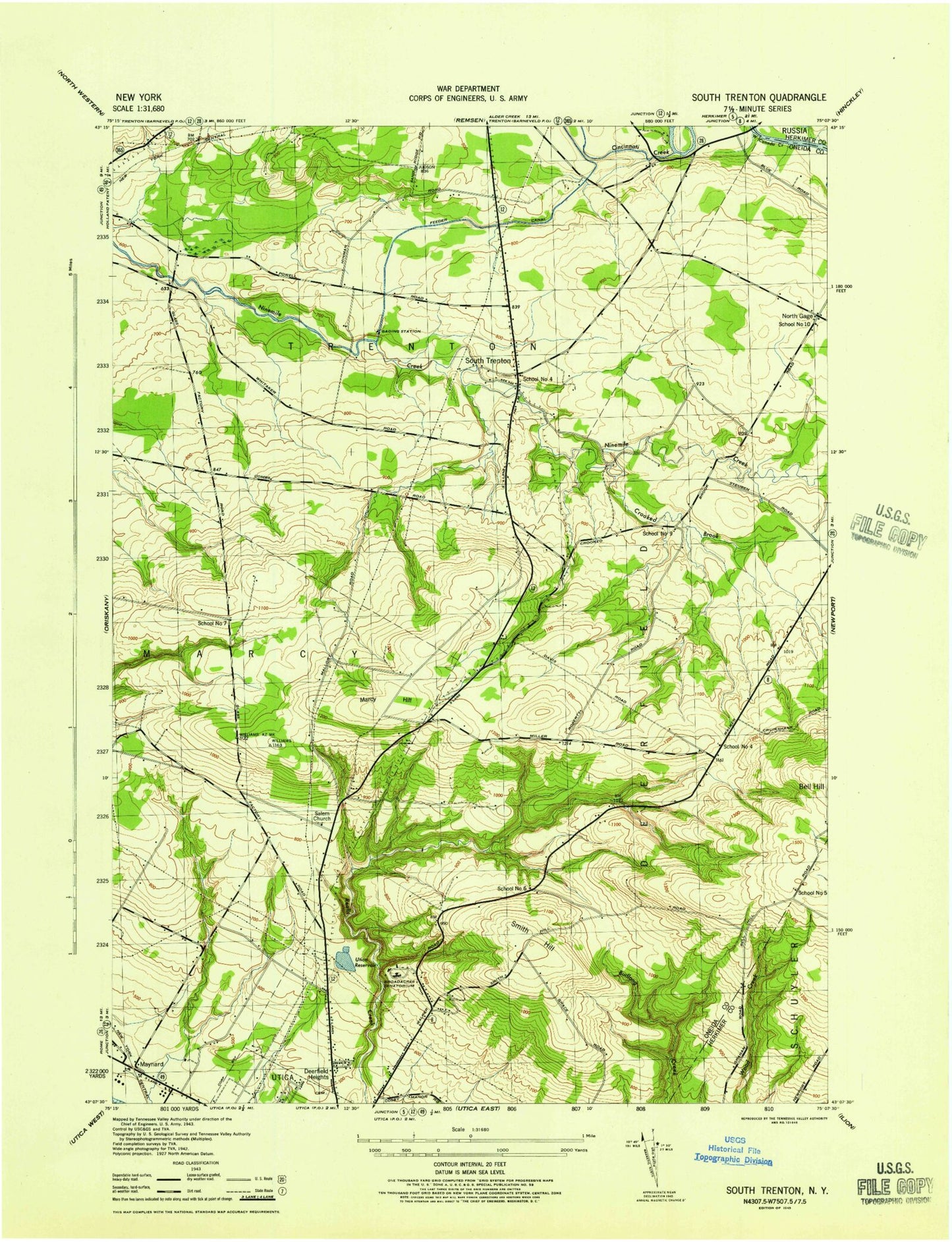
Classic USGS South Trenton New York 7.5'x7.5' Topo Map
Couldn't load pickup availability
Historical USGS topographic quad map of South Trenton in the state of New York. Map scale may vary for some years, but is generally around 1:24,000. Print size is approximately 24" x 27"
This quadrangle is in the following counties: Herkimer, Oneida.
The map contains contour lines, roads, rivers, towns, and lakes. Printed on high-quality waterproof paper with UV fade-resistant inks, and shipped rolled.
Contains the following named places: Atanasoffs Tree Farm, Broadacres Nursing Home, Cameron Hill, Cincinnati Creek, Crooked Brook, Deerfield Elementary School, Deerfield Heights, Deerfield Volunteer Fire Company 1 Station 1, Deerfield Volunteer Fire Company 1 Station 2, Green Acres, Horatio Mall Shopping Center, Marcy Hill, Maynard Fire Department Station 2, North Gage, Riverside Mall Shopping Center, Saint Vincent Mission, Salem Cemetery, Salem Church, School Number 10, School Number 4, School Number 5, School Number 7, School Number 9, Smith Hill, South Trenton, South Trenton Presbyterian Church, State University of New York Institue of Technology, Town of Deerfield, Utica Reservoir, WEIF-FM (Utica), WLZW-FM (Utica), Wood Point, WOUR-FM (Utica), WRCK-FM (Utica), WUNY-FM (Utica), WUTR-TV (Utica), ZIP Codes: 13304, 13502