MyTopo
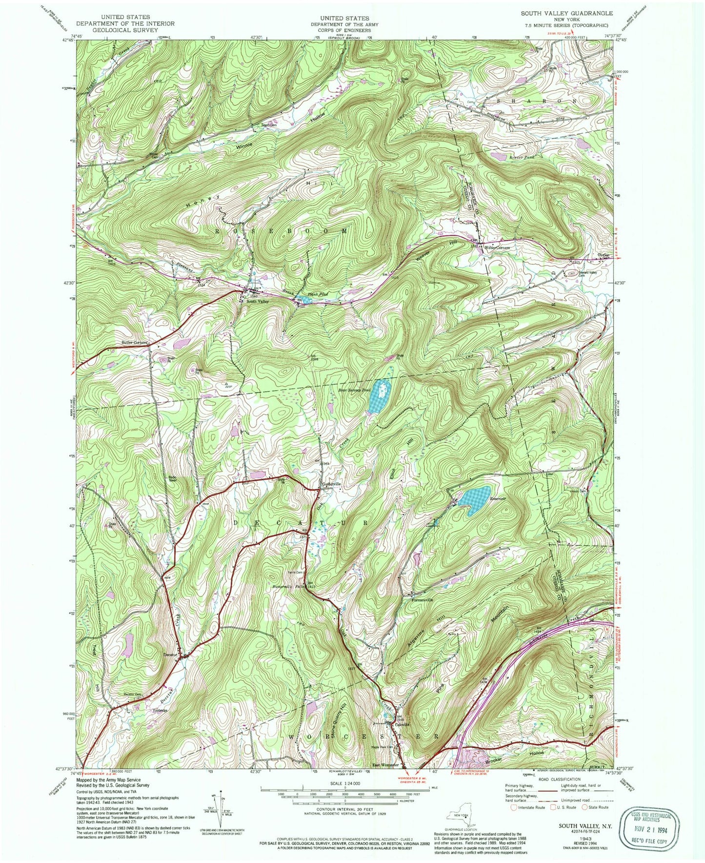
Classic USGS South Valley New York 7.5'x7.5' Topo Map
Couldn't load pickup availability
Historical USGS topographic quad map of South Valley in the state of New York. Map scale may vary for some years, but is generally around 1:24,000. Print size is approximately 24" x 27"
This quadrangle is in the following counties: Otsego, Schoharie.
The map contains contour lines, roads, rivers, towns, and lakes. Printed on high-quality waterproof paper with UV fade-resistant inks, and shipped rolled.
Contains the following named places: Algerine Hill, Bear Swamp Pond, Brooker Hollow, Butler Corners, Buttermilk Falls, Calcutta, Decatur, Decatur Cemetery, East Worcester Census Designated Place, Elliot Hill, Ferris Cemetery, Furnaceville, Gothicville, Honey Hill, Houck Cemetery, Maple View Cemetery, Pine Mountain, Plank Pond, School Number 1, School Number 19, School Number 2, School Number 4, School Number 6, School Number 9, Seward Valley Cemetery, Sissum Cemetery, South Valley, South Valley Pleasant Brook Cemetery, Stone Quarry Hill, Town of Decatur, Town of Roseboom, Treet Hill, Weaver Hill, Weber Corners, Winnie Cemetery