MyTopo
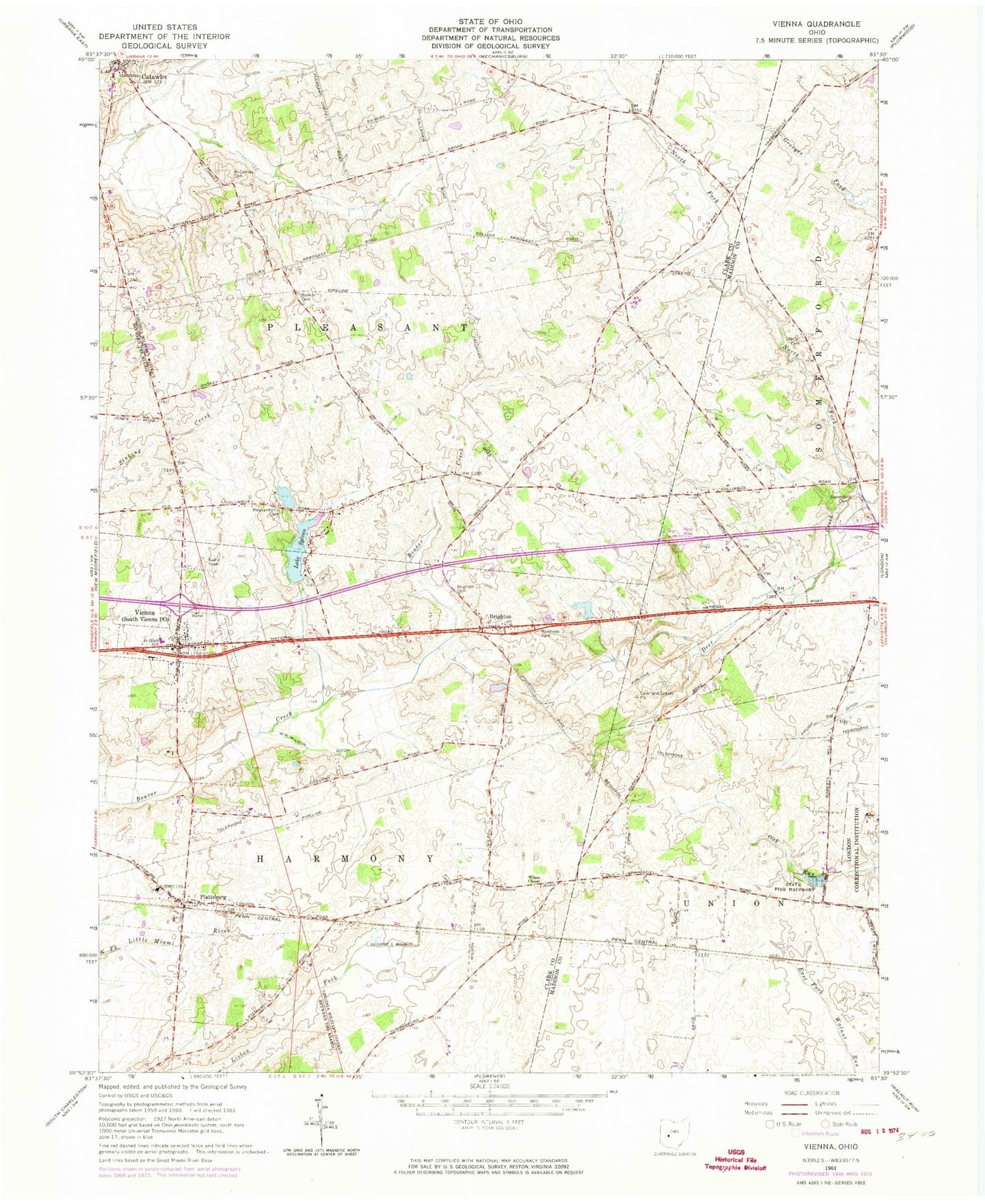
Classic USGS South Vienna Ohio 7.5'x7.5' Topo Map
Couldn't load pickup availability
Historical USGS topographic quad map of South Vienna in the state of Ohio. Map scale may vary for some years, but is generally around 1:24,000. Print size is approximately 24" x 27"
This quadrangle is in the following counties: Clark, Madison.
The map contains contour lines, roads, rivers, towns, and lakes. Printed on high-quality waterproof paper with UV fade-resistant inks, and shipped rolled.
Contains the following named places: Baker Farms, Bar Farms, Bodkin Cemetery, Brighton, Brighton Cemetery, Catawba, Catawba Post Office, Catawba School, George C Wilson Ditch, Gill Livestock and Land Farms, Harmony Township Fire Department, Lake Sylvan, Lake Sylvan Dam, London Fish Hatchery, Markley, McConkey Cemetery, Myers, North Fork Deer Creek, Oakgrove School, Pelz Field Airport, Plattsburg, Plattsburg Cemetery, Plattsburg Post Office, Pleasant Hill Cemetery, Pleasant Township Fire Department, Reaver Farms Orchard, Sanford Farm, Somerford Cemetery, South Vienna, South Vienna Elementary School, South Vienna Post Office, Statler Cemetery, Sylvan Shores, Township of Pleasant, Village of Catawba, Village of South Vienna, W G Wilson Ditch, Wilson Chapel, Wilson Chapel Cemetery, ZIP Codes: 43010, 45369