MyTopo
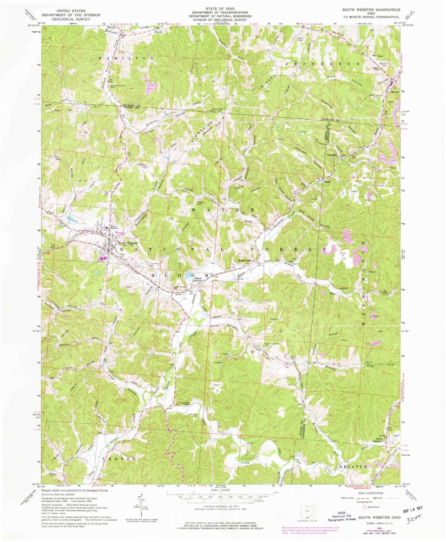
Classic USGS South Webster Ohio 7.5'x7.5' Topo Map
Couldn't load pickup availability
Historical USGS topographic quad map of South Webster in the state of Ohio. Map scale may vary for some years, but is generally around 1:24,000. Print size is approximately 24" x 27"
This quadrangle is in the following counties: Jackson, Lawrence, Scioto.
The map contains contour lines, roads, rivers, towns, and lakes. Printed on high-quality waterproof paper with UV fade-resistant inks, and shipped rolled.
Contains the following named places: Barnhart Hollow, Bloom Furnace, Bloom Furnace Cemetery, Bloom Furnace Creek, Bloom High School, Bloom Junction, Bloom Switch Cemetery, Brady Cemetery, Brady Run, Brant Cemetery, Brushy Fork, Diamond Hollow, Dutch Hollow, Eifort, Eifort Church, Eifort Post Office, Firebrick, Firebrick Post Office, Fisher School, Globe Switch, Hales Creek, Hales Creek Post Office, Harrison Hollow, Hawkins Hollow, Hope Hollow, Hope School, Jackson Fork, Jackson Furnace Cemetery, Jackson Furnace Creek, Jackson Furnace School, Johnson Cemetery, Madland, Madland Post Office, Monroe, Monroe Cemetery, Monroe Chapel, Monroe Hollow, Mount Olive Church, New Globe Hollow, Old Globe Hollow, Olive Creek, Olive Furnace, Olive Furnace Post Office, Pine Creek Chapel, Rayburn Hollow, Rhoden Hollow, Scioto Ambulance District Squad 7, Simmering Lookout Tower, Simmering Ridge, Slab Hollow, Slab Hollow Cemetery, South Webster, South Webster Bloom Township Fire Department, South Webster Cemetery, South Webster Elementary School, South Webster Post Office, South Webster Reservoir, South Webster Reservoir Dam, Stidham Cemetery, Sugar Camp Hollow, Township of Bloom, Village of South Webster, White Bear School, Youngs Branch, ZIP Code: 45682