MyTopo
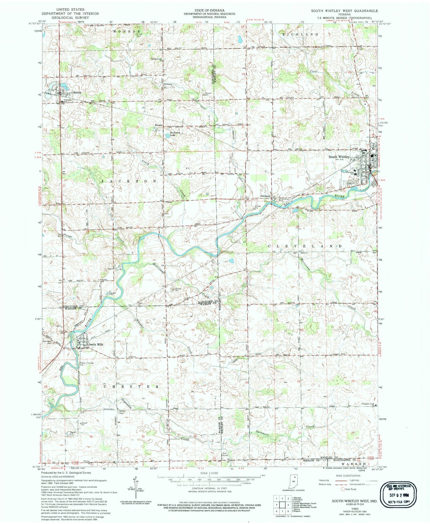
Classic USGS South Whitley West Indiana 7.5'x7.5' Topo Map
Couldn't load pickup availability
Historical USGS topographic quad map of South Whitley West in the state of Indiana. Map scale may vary for some years, but is generally around 1:24,000. Print size is approximately 24" x 27"
This quadrangle is in the following counties: Huntington, Kosciusko, Wabash, Whitley.
The map contains contour lines, roads, rivers, towns, and lakes. Printed on high-quality waterproof paper with UV fade-resistant inks, and shipped rolled.
Contains the following named places: Chester Township Fire Department, Circle Cemetery, Cleveland Township Volunteer Fire Department, Collamer, Cook Ditch, Crazy Creek, Glenwood Cemetery, Heckman Lake, Hurricane Creek, Kinsey, Koontz Ditch, Liberty Mills, Liberty Mills Post Office, Mishler Ditch, Mishler Landing Strip, Pleasant View Church, Plunge Creek, Sidney, Sidney - Jackson Township Volunteer Fire Department, Sidney Elementary School, Simonton Creek, South Whitley, South Whitley Elementary School, South Whitley Middle School, South Whitley Police Department, South Whitley Post Office, South Whitley Wastewater Plant, Sycamore Creek, T Lake, Town of Sidney, Town of South Whitley, Township of Cleveland, Township of Jackson, Union Cemetery, Westrick Airport, Wheeler Creek, ZIP Code: 46946