MyTopo
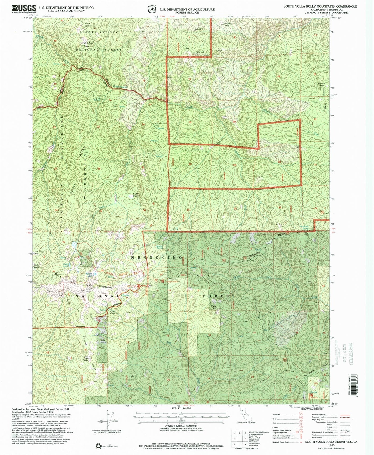
Classic USGS South Yolla Bolly Mountains California 7.5'x7.5' Topo Map
Couldn't load pickup availability
Historical USGS topographic quad map of South Yolla Bolly Mountains in the state of California. Map scale may vary for some years, but is generally around 1:24,000. Print size is approximately 24" x 27"
This quadrangle is in the following counties: Tehama.
The map contains contour lines, roads, rivers, towns, and lakes. Printed on high-quality waterproof paper with UV fade-resistant inks, and shipped rolled.
Contains the following named places: Boswell Ridge, Browns Camp, Browns Camp Trailhead, Buck Creek, Burnt Camp, Cedar Basin Camp, Elkhorn Creek, Elkhorn Peak, Fish Ridge, Hamilton Glade, Hamilton Gulch, Harding Spring, Harvey Creek, Horsepacker Trailhead, Ideas Cove Traihead, Ides Cove, Long Lake, Mount Linn, Oven Lid, Plum Garden, Pole Corral, Prine Cabin, Raglin Ridge, Slides Creek, Slides Glade, Slides Ridge, South Yolla Bolly Mountains, Square Lake, Sulphur Creek, Syd Cabin Glade, Thunder Camp, Toomes Camp, Trough Spring Ridge, Twin Peaks, Valentine Ridge, Valentine Spring