MyTopo
Classic USGS Southeast Pontotoc Mississippi 7.5'x7.5' Topo Map
Couldn't load pickup availability
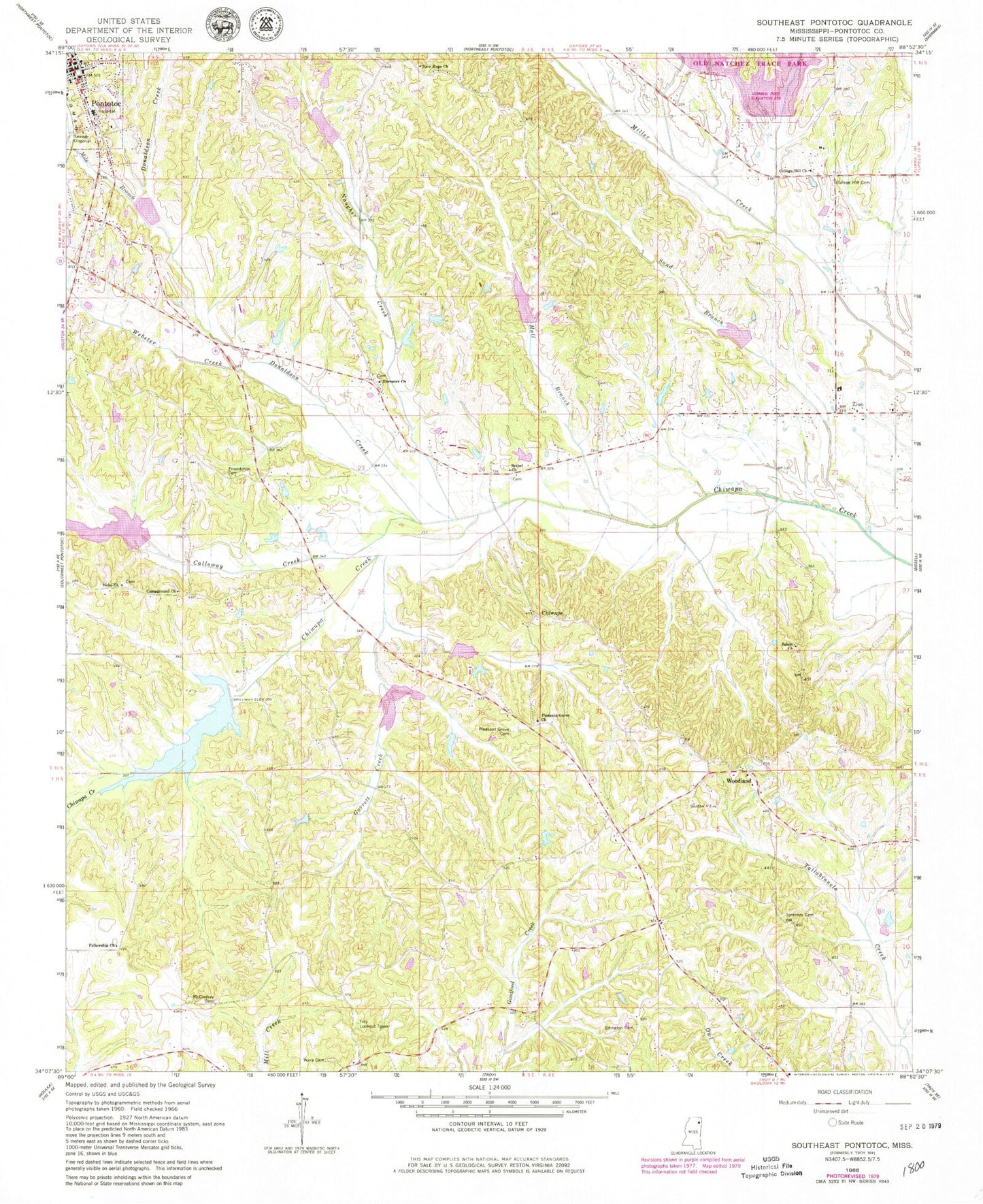
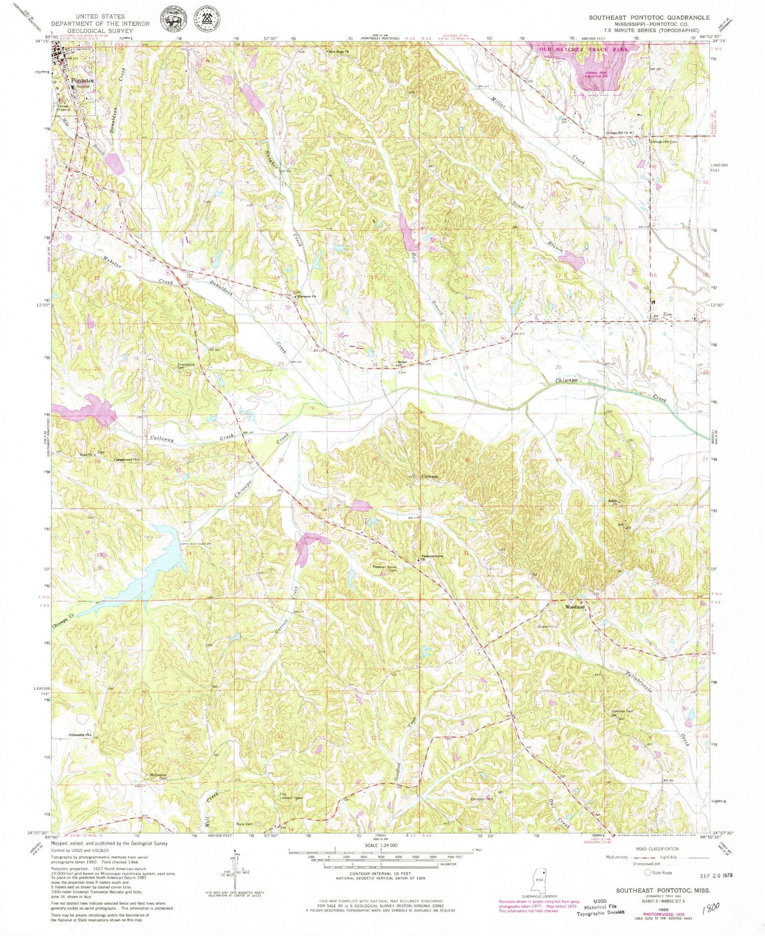
Historical USGS topographic quad map of Southeast Pontotoc in the state of Mississippi. Map scale may vary for some years, but is generally around 1:24,000. Print size is approximately 24" x 27"
This quadrangle is in the following counties: Pontotoc.
The map contains contour lines, roads, rivers, towns, and lakes. Printed on high-quality waterproof paper with UV fade-resistant inks, and shipped rolled.
Contains the following named places: Allens Subagency, Bethel Church, Brame, Calloway Creek, Camp Ground, Camp Ground School, Campground Church, Chickasaw College, Chickasaw Council House, Chiwapa, Chiwapa Creek Structure 1 Dam, Chiwapa Structure 13 Dam, Chiwapa Structure 2 Dam, Chiwapa Structure 24 Dam, Chiwapa Structure 49 Dam, Chiwapa Structure 6 Dam, Chiwapa Structure 7 Dam, Clark Lake Dam, College Hill Cemetery, College Hill Church, College Hill School, Community Bible Church, D'Artaguette Battlefield, Donaldson Creek, Ebenezer Cemetery, Ebenezer Church, Edington Cemetery, Fellowship Church, First Baptist Church, Friendship Cemetery, Garrett Creek, Hall Branch, McCleskey Cemetery, Mile Branch, Monroe Mission, Mount Nebo School, Natchez Trace Lake Dam, Naugher Creek, Nebo Church, New Hope Baptist Church, North Mississippi Medical Center - Pontotoc, Pleasant Grove, Pleasant Grove Baptist Church, Pleasant Grove Cemetery, Pleasant Grove School, Plymouth, Pontotoc, Pontotoc Church of Christ, Primrose, Salem Church, Sand Branch, Smerney Cemetery, Smyrna Primitive Baptist Church, Supervisor District 4, Supervisor District 5, Tockshish, Troy Lookout Tower, Ware Cemetery, Webster Creek, Woodland, Woodland Baptist Church, Zion, Zion Baptist Church