MyTopo
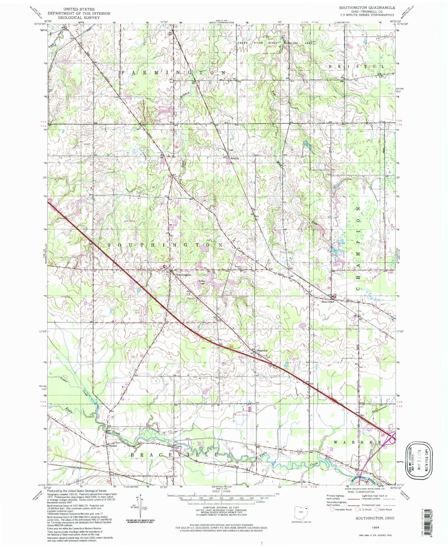
Classic USGS Southington Ohio 7.5'x7.5' Topo Map
Couldn't load pickup availability
Historical USGS topographic quad map of Southington in the state of Ohio. Map scale may vary for some years, but is generally around 1:24,000. Print size is approximately 24" x 27"
This quadrangle is in the following counties: Trumbull.
The map contains contour lines, roads, rivers, towns, and lakes. Printed on high-quality waterproof paper with UV fade-resistant inks, and shipped rolled.
Contains the following named places: Baptist Hill Cemetery, Beaver Pond, Chalker High School, Chocolate Run, Delightful, Delightful Cemetery, Delightful Evangelical Congregational Church, Delightful Post Office, Eagle Creek, Evergreen Mobile Home Court, Forest Oaks Golf Course, Herner Corners, Maltby Cemetery, Mobile Haven Park, Ohio State Highway Patrol - Warren Patrol Post, Phalanx, Phalanx Post Office, Pleasant Park Mobile Home Park, Reform Cemetery, Shihold, Southington, Southington Center Cemetery, Southington Elementary School, Southington Estates, Southington Middle School, Southington Post Office, Southington Volunteer Fire Department, State Road, State Road Post Office, Stroups, Tinker Creek, Township of Southington, Valley Lake, Warren Airport, Wassie, Wassie Post Office, ZIP Codes: 44470, 44491