MyTopo
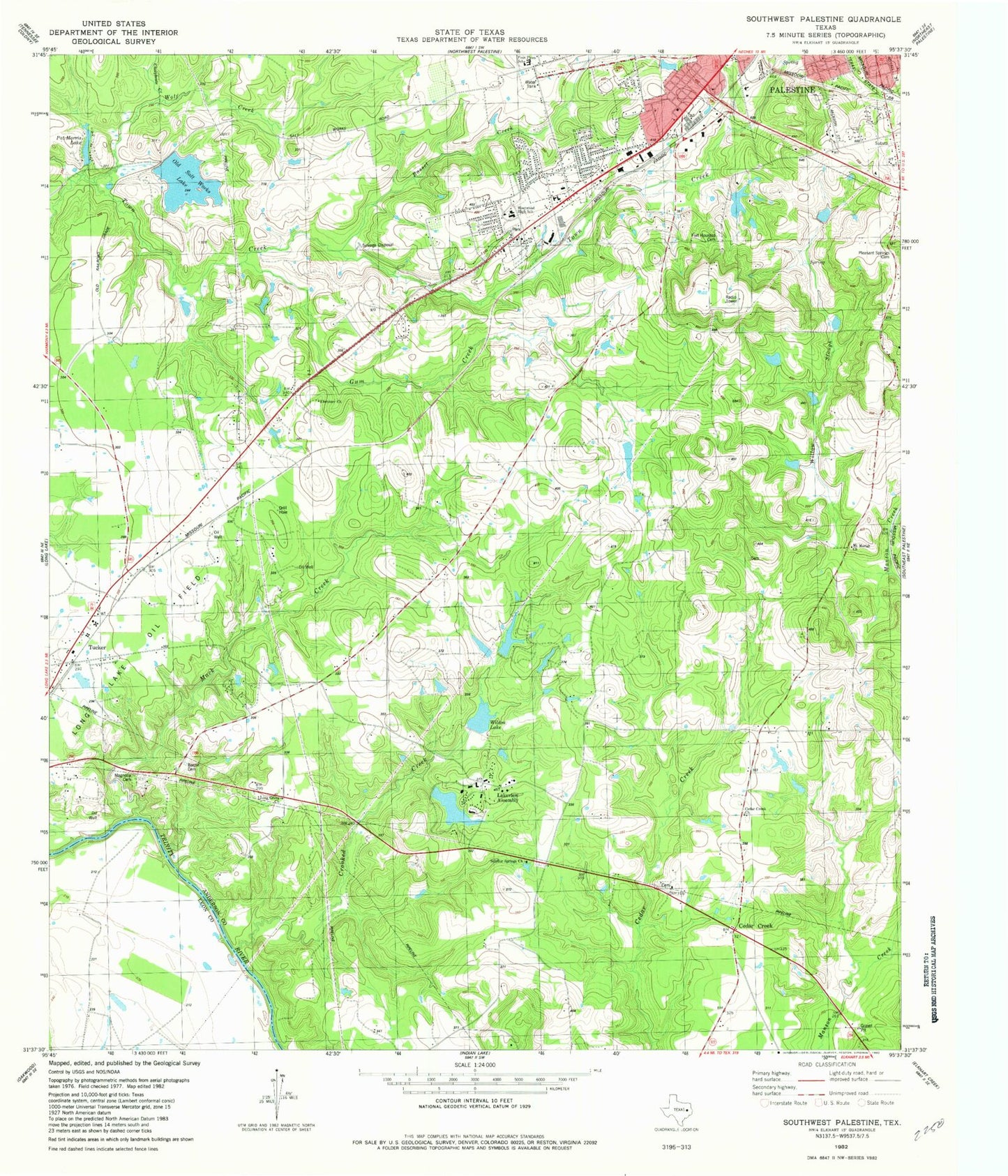
Classic USGS Southwest Palestine Texas 7.5'x7.5' Topo Map
Couldn't load pickup availability
Historical USGS topographic quad map of Southwest Palestine in the state of Texas. Map scale may vary for some years, but is generally around 1:24,000. Print size is approximately 24" x 27"
This quadrangle is in the following counties: Anderson, Leon.
The map contains contour lines, roads, rivers, towns, and lakes. Printed on high-quality waterproof paper with UV fade-resistant inks, and shipped rolled.
Contains the following named places: Bacon Cemetery, Basset Creek, Bassett Road Baptist Church, Cedar Creek Cemetery, Cedar Creek Church, Chalybeate Creek, Church of Christ, Crooked Creek, Duggeys Lake Dam, Ebenezer Church, Fort Houston Cemetery, Four Pines School, Gooch Lake, Gooch Lake Dam, Gum Creek, Lakeview Assembly, Lakeview Methodist Lake, Lakeview Methodist Lake Dam, Lighthouse Pentecostal Church, Living Green Church, Long Lake Oil Field, Mack Creek, Magnolia Cemetery, Mount Moriah Church, New Salem Church, Old Salt Works Lake, Palestine / Southside Volunteer Fire Department, Palestine Fire Department Station 2, Palestine Regional Medical Center, Pat Morris Dam, Pat Morris Lake, Pilgrim Hill Church, Pleasant Springs Cemetery, Sheridan Terrace Baptist Church, Southside Primary School, Sulphur Springs Church, Tucker, Tucker Volunteer Fire Department, Westwood Elementary School, Westwood High School, Westwood Junior High School, Westwood Primary School, Westwood United Methodist Church, William and Caroline Broyles House, Willow Slough, Wilson Lake, Wilson Lake Dam, Wolf Creek