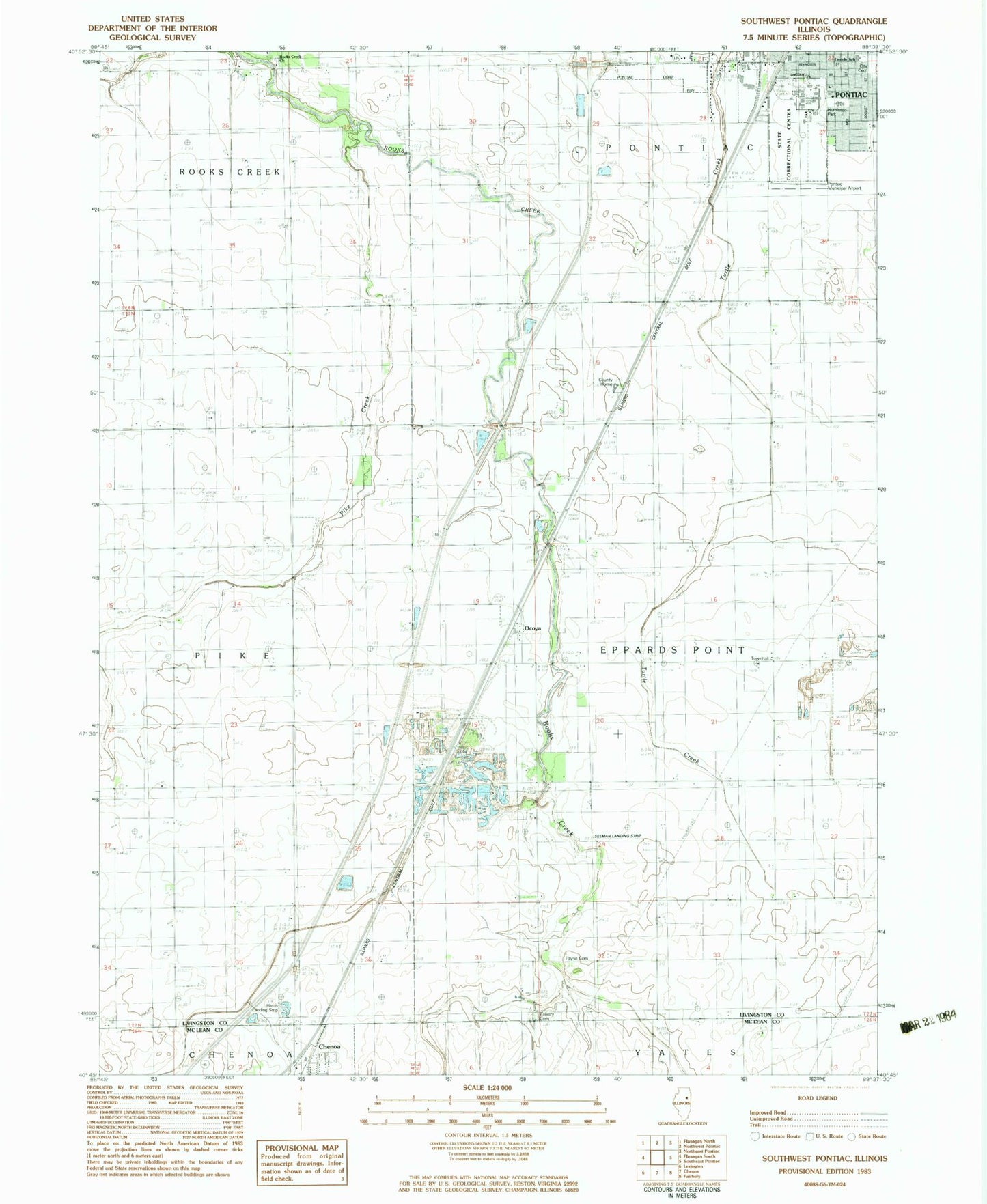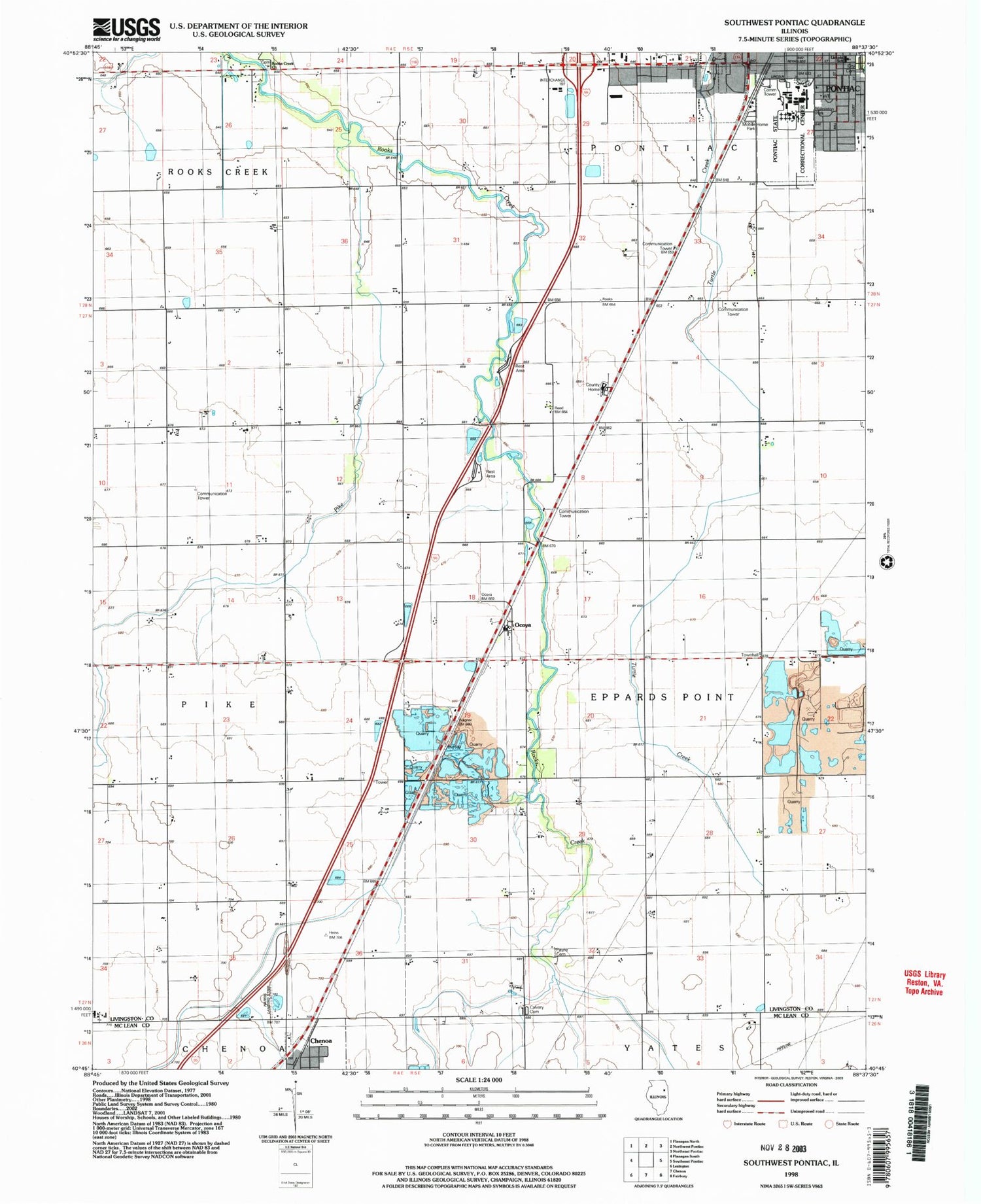
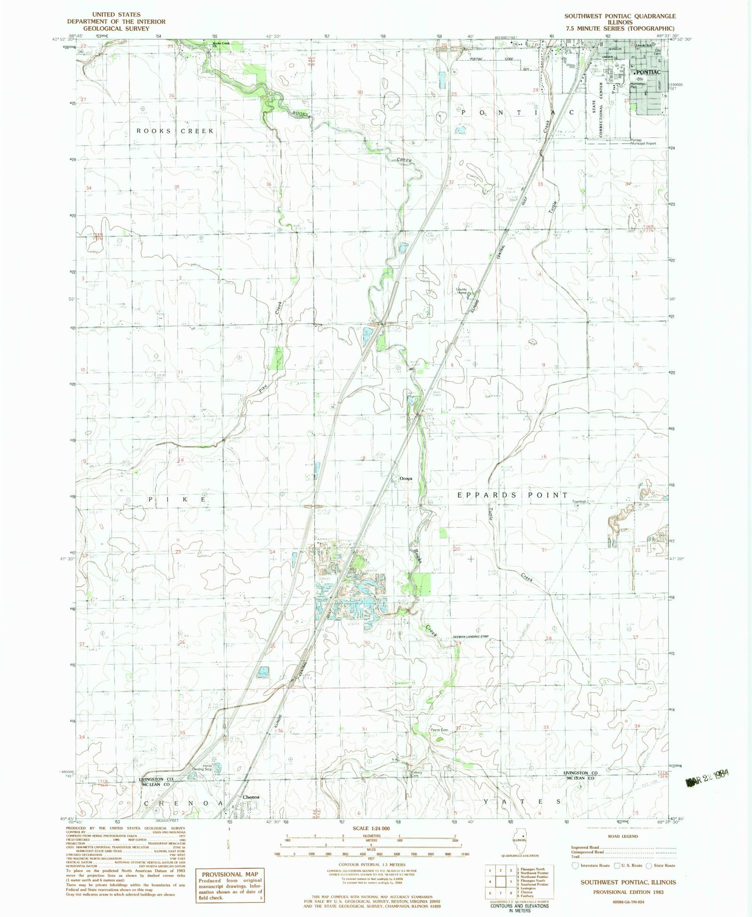
MyTopo
Classic USGS Southwest Pontiac Illinois 7.5'x7.5' Topo Map
Couldn't load pickup availability
Historical USGS topographic quad map of Southwest Pontiac in the state of Illinois. Map scale may vary for some years, but is generally around 1:24,000. Print size is approximately 24" x 27"
This quadrangle is in the following counties: Livingston, McLean.
The map contains contour lines, roads, rivers, towns, and lakes. Printed on high-quality waterproof paper with UV fade-resistant inks, and shipped rolled.
Contains the following named places: Calvary Catholic Cemetery, Center School, Dillon Quarry, East Quarry, Eppards Point Church, Eppards Point Townhall, Fairview School, Hancock School, Harris Landing Strip, Holmes School, Humiston Park, Illinois State Police Department District 6, Lammatch School, Laycock School, Lincoln Elementary School, Livingston County Home, Livingston County Jail, Livingston County Sheriff's Office, McDowell Quarry, Ocoya, Ocoya School, Order of Saint Francis Saint James Hospital - John Albrecht Medical Center, Payne Cemetery, Pike Creek, Pleasant View School, Pontiac Correctional Center, Pontiac Southside Cemetery, Raymond Schultz Round Barn, Reeds School, Rooks Creek Cemetery, Rooks Creek School, Rooks Creek United Methodist Church, Seeman Airport, Sunnydale School, Township of Eppards Point, Turtle Creek School