MyTopo
Classic USGS Southwest Pontotoc Mississippi 7.5'x7.5' Topo Map
Couldn't load pickup availability
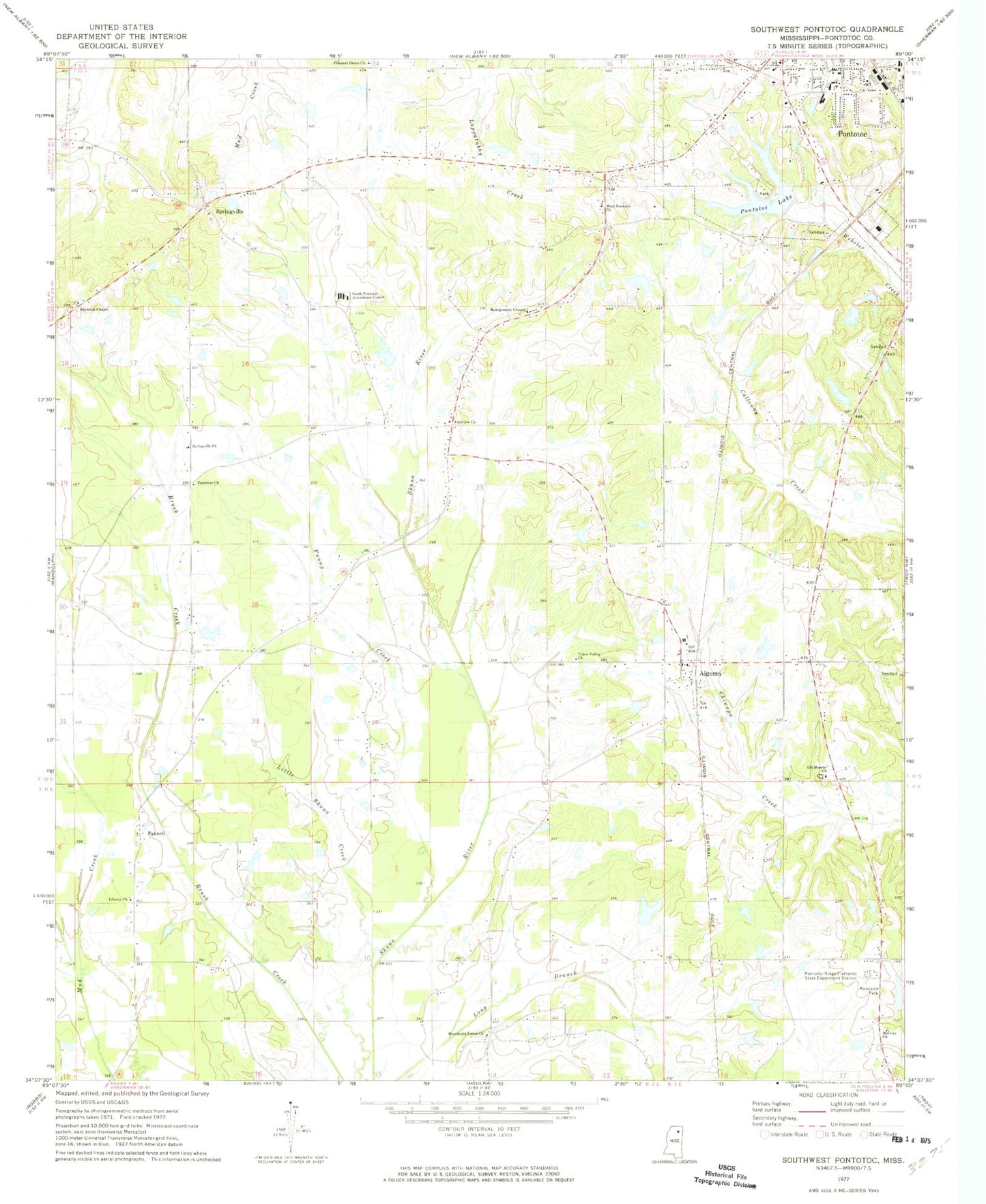
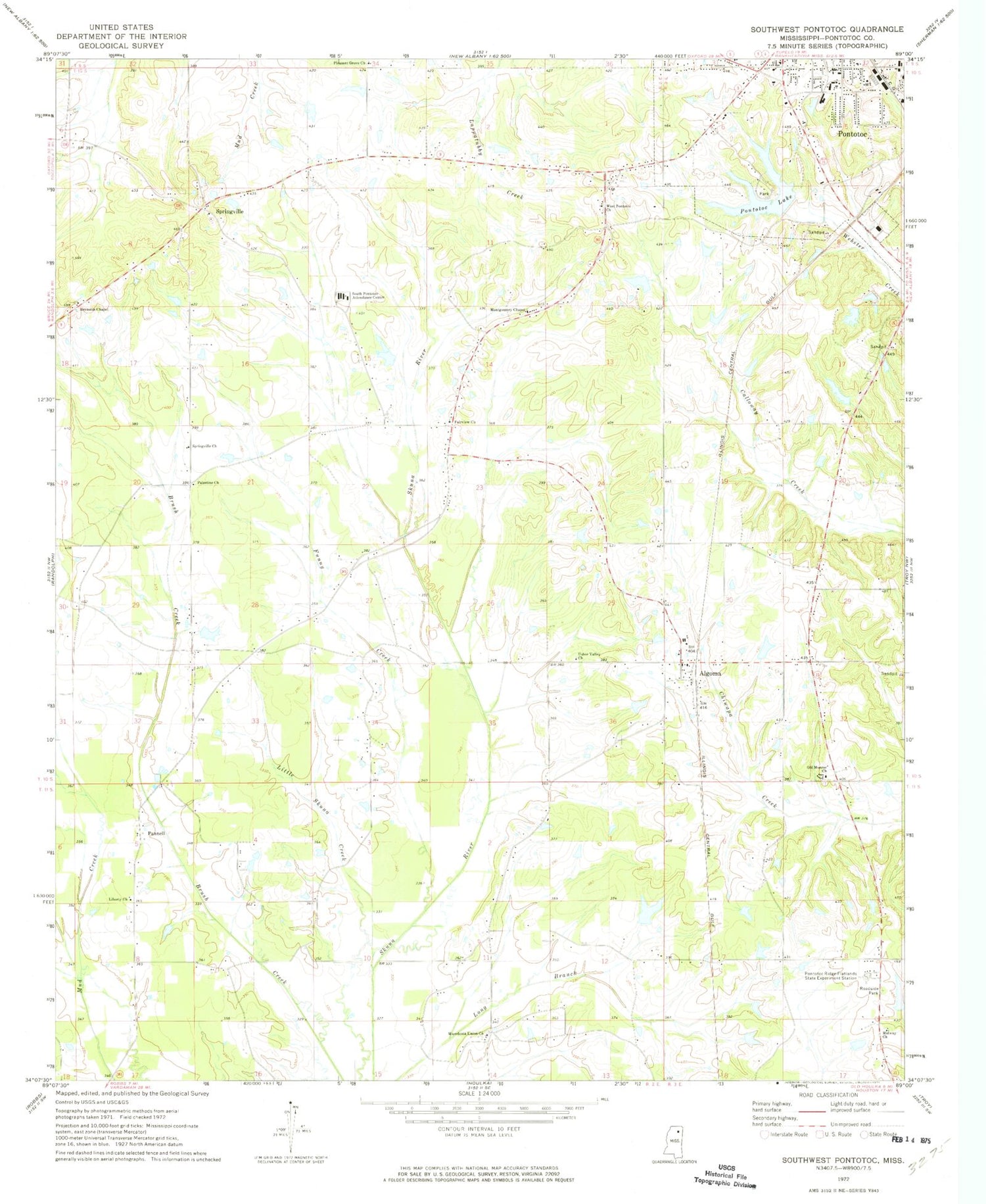
Historical USGS topographic quad map of Southwest Pontotoc in the state of Mississippi. Map scale may vary for some years, but is generally around 1:24,000. Print size is approximately 24" x 27"
This quadrangle is in the following counties: Pontotoc.
The map contains contour lines, roads, rivers, towns, and lakes. Printed on high-quality waterproof paper with UV fade-resistant inks, and shipped rolled.
Contains the following named places: Algoma, Algoma Baptist Church, Algoma Post Office, Algoma United Methodist Church, Algoma Volunteer Fire Department, Chiwapa Structure 3 Dam, Fairview Church, Funny Creek, G R Patterson Lake Dam, Liberty Church, Little Skuna Creek, Lochinvar, Macedonia Union Church, Midway Church, Midway School, Monroe, Montgomery Chapel, Newells Lake Dam, Old Algoma, Old Monroe Church, Palestine Church, Palestine School, Pannell, Pleasant Grove, Pleasant Grove Church, Pleasant Grove School, Pontotoc County, Pontotoc Lake, Pontotoc Police Department, Pontotoc Ridge, Pontotoc Ridge Experiment Lake Dam, Pontotoc Ridge-flatlands State Experiment Station, Reynolds Chapel, Scott Lake Dam, Springville, Springville Chapel Missionary Baptist Church, Springville Church, Town of Algoma, Usher Valley Church, Walls Lake Dam, West Pontotoc Church, ZIP Code: 38863