MyTopo
Classic USGS Spafford New York 7.5'x7.5' Topo Map
Couldn't load pickup availability
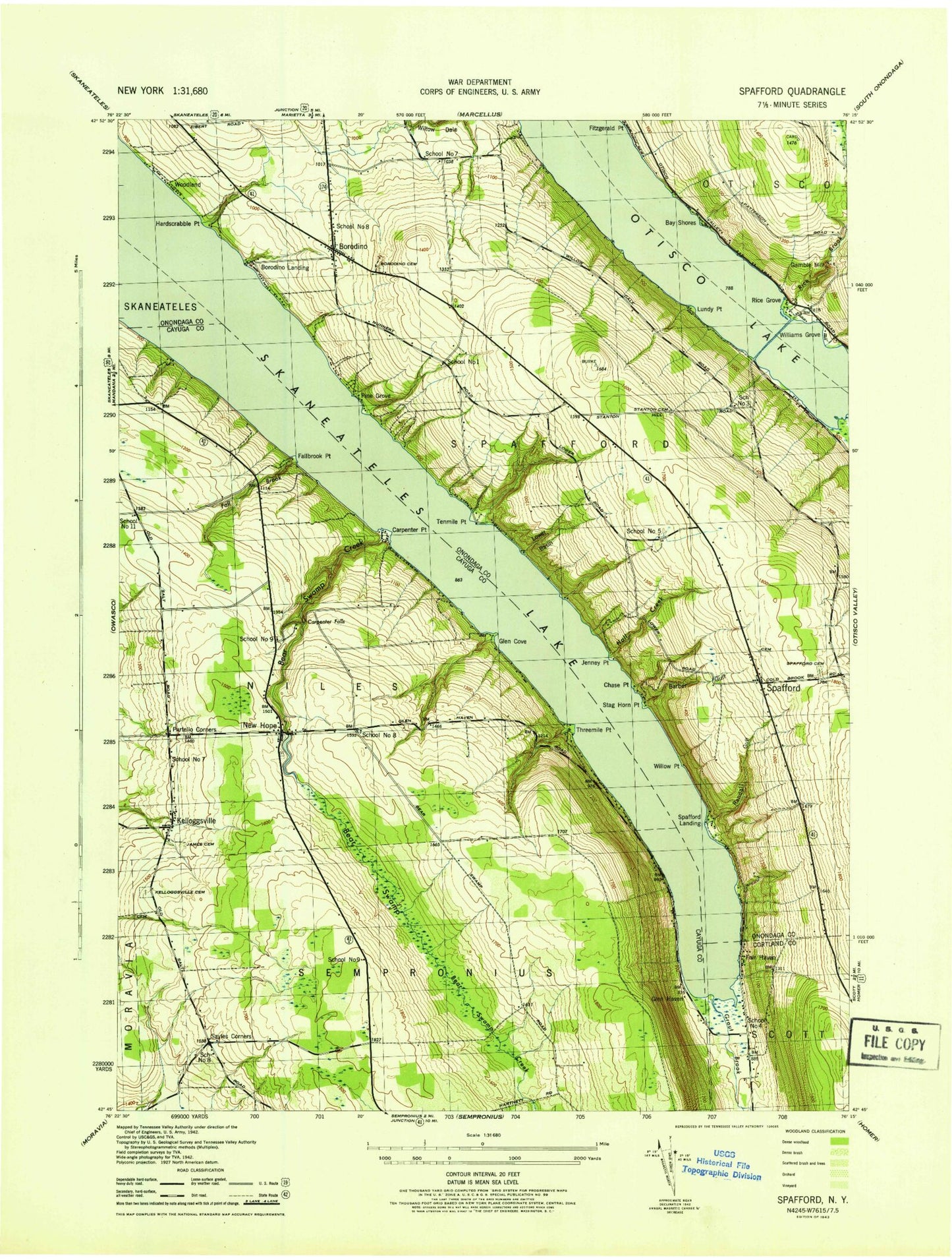
Historical USGS topographic quad map of Spafford in the state of New York. Typical map scale is 1:24,000, but may vary for certain years, if available. Print size: 24" x 27"
This quadrangle is in the following counties: Cayuga, Cortland, Onondaga.
The map contains contour lines, roads, rivers, towns, and lakes. Printed on high-quality waterproof paper with UV fade-resistant inks, and shipped rolled.
Contains the following named places: Barber Gulf, Bay Shores, Borodino, Borodino Cemetery, Borodino Landing, Carpenter Falls, Chase Point, Fair Haven, Fall Brook, Fallbrook Point, Glen Cove, Grout Brook, Hall Creek, Hardscrabble Point, James Cemetery, Jenney Point, Kelloggsville, Kelloggsville Cemetery, Lower Basin, New Hope, North New Hope School, Partello Corners, Pine Grove, Randall Gulf, Rice Brook, Rice Grove, Sayles Corners, Spafford, Spafford Cemetery, Spafford Landing, Stag Horn Point, Stanton Family Cemetery, Tenmile Point, Threemile Point, Bear Swamp Creek, Otisco Lake, Skaneateles Lake, Williams Grove, Willow Point, Woodland, Gamble Mill, Glen Haven, Gregory Landing, School Number 3 (historical), School Number 4 (historical), School Number 8 (historical), Maus Marineland Seaplane Base, Town of Spafford, School Number 7 (historical), School Number 8 (historical), School Number 8 (historical), School Number 9 (historical), School Number 11 (historical), School Number 1 (historical), School Number 5 (historical), School Number 7 (historical), Borodino Methodist Church, New Hope Cemetery, Lewis Family Cemetery, Mid - Lakes United Methodist Church, The Midlakes Club, Borodino Fire Department, New Hope Fire Department, Spafford Volunteer Fire Department, Carpenter Point