MyTopo
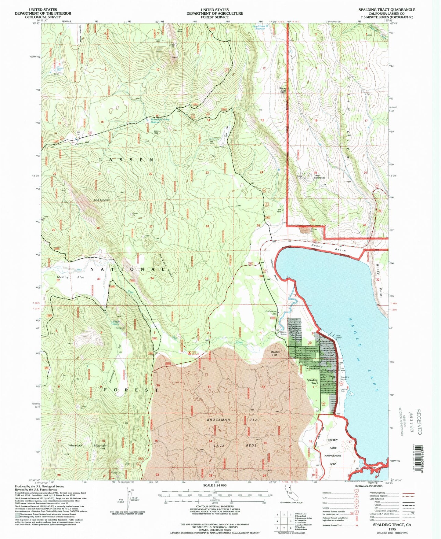
Classic USGS Spalding Tract California 7.5'x7.5' Topo Map
Couldn't load pickup availability
Historical USGS topographic quad map of Spalding Tract in the state of California. Map scale may vary for some years, but is generally around 1:24,000. Print size is approximately 24" x 27"
This quadrangle is in the following counties: Lassen.
The map contains contour lines, roads, rivers, towns, and lakes. Printed on high-quality waterproof paper with UV fade-resistant inks, and shipped rolled.
Contains the following named places: Bald Hills, Brockman Flat Lava Beds, Cave Mountain, Coyote Flat, Dow Butte, Dow Flat, Dow Wells, Dow Wells Recreation Site, Fish Cabin, Gordon Valley, Gordon Well, Halfmoon Beach, Houseman Camp Reservoir, Ice Cave Ridge, Lower Signal Butte, McCoy Flat, Old Spalding Cabin, Penitentiary Flat, Pine Creek, Pine Ridge Campground, Prison Spring, Prison Spring Campground, Rankin Flat, Sandy Beach, Signal Butte, Signal Butte Reservoir, Spalding Tract, Spalding Volunteer Fire Department, Spaulding Airport, Spaulding Census Designated Place, Whaleback Mountain